
In August of 2026, a glacier collapsed in Nepal, triggering catastrophic flooding and a debris avalanche that mercilessly roared down the slope, devastating vulnerable communities. U.S. Geological Survey experts used geographic information science to compare before-and-after satellite imagery, map the affected landscape, and document the extent of the inundation.
Over a year earlier, on July 4, 2025, in Central Texas, catastrophic flash floods overwhelmed the Guadalupe River in Kerr County. Very heavy rain fell on the night of July 3 and before dawn the next day, which caused the Guadalupe River to rise rapidly. Quickly, the river overflowed its banks, drowning communities, roads, campgrounds, and cabins. With a death toll of 131, this was one of the most recent deadliest recent flood events in the United States.
NASA responded with high-resolution imagery, radar-based flood maps, vegetation-change products, and inundation maps. Some radar detected flooding beneath tree canopy, providing emergency managers with information that ordinary aerial imagery might miss.
Previously, March 28, 2025 brought a seismic event to Miramar. The 7.7 earthquake was caused by a major rupture along the Saigang Fault, one of the most active in Southeast Asia.
What made this 7.7 quake so formidable was the length of its rupture. Sentinel satellite imagery, InSAR, optical imagery, GPS data, and geospatial analysis were coupled with ground observations. Together, they mapped the fault rupture and measured how far the ground had moved. Researchers discovered that the fault was roughly 465 km long, with as much as six meters of horizontal displacement in places.
Meet the Growing Need for Geospatial Insight.
As these examples demonstrate, GIS cannot stop a glacier from collapsing, a river from overflowing its banks, or the earth from splitting wide open.
However, GIS can help identify vulnerable terrain, assess damage, guide emergency response, and support recovery and smarter rebuilding. It can help humanitarian organizations understand conditions in places that are difficult to see, let alone reach, while also helping communities map future hazards, such as avalanches, floods, landslides, and areas of high seismic risk. By showing what has changed, who and what are exposed, and where future threats are most likely to occur, GIS supports better decisions before, during, and after a disaster.
These recent natural disasters and others reveal also reveal that geospatial challenges are definitely data challenges.
Satellites, drones, GPS devices, sensors, field observations, and other technologies can provide remarkable amounts of information about the world around us. But more data does not automatically translate into better decisions. One ongoing challenge in GI Science, then, is collating different kinds of data. For instance, a researcher or analyst might need to combine satellite imagery with drone data. They might need to add on GPS observations, field measurements, historical maps, infrastructure records, or public data. Unfortunately, these sources can differ in resolution, format, accuracy, projection, age, and quality.
Then, there comes the challenge of scale. Spatial datasets are growing larger and more complex whereas organizations increasingly expect faster answers. GIS professionals may need to automate repetitive workflows, manage large geodatabases, work with remote-sensing imagery, and use programming tools such as Python to make analysis more efficient.
Move From Making Maps to Solving Problems.
But perhaps most important skill is turning those results into something actionable. A technically accurate analysis still has to answer a real-world question, whether that involves disaster response, forest health, conservation, watershed planning, wildfire risk, infrastructure, land use, or environmental change.
Michigan Tech’s online Master of Geographic Information Science (MGIS) can help with these challenges. This program is designed for professionals who want to move beyond simply using GIS tools to solving increasingly complex spatial problems .
In this MGIS degree, students develop skills in spatial analysis, cartography, GPS, geodatabase management, Python, project design, remote sensing, digital image processing. They also get experience in analyzing satellite, drone, and sensor-based imagery.
The curriculum emphasizes natural resource and environmental applications, which include forestry, conservation, environmental monitoring, watershed planning, land management, and resource decision-making.
That applied focus matters because GI Science rarely exists in isolation. The technology is most valuable when someone understands both the data and the system it represents.
Earn Credentials Along the Way to Your Master’s Degree.
One of the most distinctive features of Michigan Tech’s Online Master of Geographic Information Science is its structure. Not only is the program online but also stackable.
That is, instead of completing an entire master’s degree before earning a credential, students progress through three stackable graduate certificates. This structure lets students acquire credentials as they work toward their graduate degree. No need to wait until the end to demonstrate new expertise.
The MGIS consists of three certificates that provide competencies and knowledge you can use right away on the job.
- Foundations in Geographic Information Science for Natural Resources: build core skills in GIS, spatial analysis, cartography, GPS field techniques, and spatial-data management.
- Advanced Geographic Information Science for Natural Resources: move into more sophisticated workflows, including Python, automation, geodatabases, advanced spatial analysis, and GIS project management.
- Remote Sensing for Natural Resources: focus on satellite, aircraft, drone, and sensor data; digital image processing; classification; and the use of imagery to monitor environmental change.
For working professionals, the structure provides useful milestones. Someone may begin by strengthening foundational GIS skills, move into programming and advanced analysis, and then add remote sensing – all while continuing toward the larger graduate degree.
Learn From an Enthusiastic, Seasoned GIS Professional.
Heading the online MGIS program is Dr. Parth Bhatt, Associate Teaching Professor and Researcher in Michigan Tech’s College of Forest Resources and Environmental Science, Program Director for the Online Master of GIS, and Lead GIS and Remote Sensing Educator for MichiganView.
Bhatt’s work reflects the interdisciplinary, rigorous nature of modern GI Science. His expertise spans GIS, remote sensing, GPS, spatial-data analysis, machine learning, artificial intelligence, Python, R, digital image processing, forest health, invasive-species mapping, and natural resource management.
He also brings a wealth of field experience into the classroom.
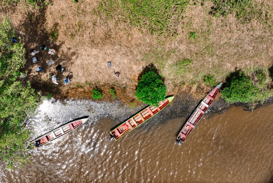
For instance, in 2025, and again in 2026, Bhatt traveled with a Michigan Tech team to Suriname for Michigan Tech’s Mapping Sustainability in Suriname study-away program. While there, he guided students in using satellite imagery, GPS, and GIS to investigate mangrove health, coastal change, and the impacts of gold mining near Brownsberg Nature Park.
Attend a info session on studying abroad on Monday, Oct. 19, at 5:00 PM.
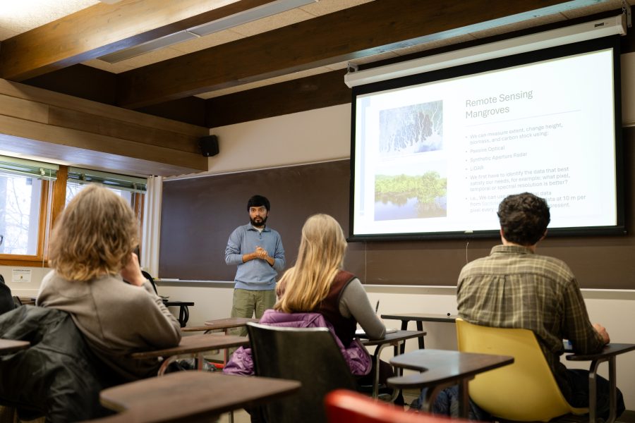
Bhatt also co-led a U.S. Embassy-supported initiative connecting Michigan Tech educators with Surinamese students and institutions through hands-on training in drone mapping, field data collection, and environmental analysis. These efforts are part of a growing, long-term partnership focused on geospatial education, environmental conservation, and international collaboration. He will once again lead Michigan Tech’s Suriname study-away program during Spring Break 2027, providing students with opportunities to apply classroom knowledge to real-world environmental challenges while learning alongside local experts and communities.
Prepare at MTU for a More Spatially Connected World.
Bhatt’s experiences and the previous examples both demonstrate the possibilities and limitations of modern spatial technology. For instance, drones and remote sensing can collect valuable information across difficult terrain. But effective natural-resource management still highly depends on trained, on-the-ground people who know how to gather, evaluate, interpret, and apply that information. It also depends on community participation. That philosophy remains central to the new master’s program: the goal is not simply to collect more data, but to turn spatial information into smart, meaningful decisions used across several fields.
GI Science now supports work across natural-resource management, government, conservation, planning, insurance, energy, forestry, environmental consulting, property management, emergency response, and other fields that depend on location-based information.
Possible careers for graduates range from GIS analyst and GIS project manager to remote sensing specialist, spatial ecologist, wildfire analyst, forest inventory analyst, conservation GIS specialist, environmental consultant, and watershed or land-use planner.
Whatever the role, the common thread is the ability to turn spatial information into better decisions.
Michigan Tech’s Online MGIS gives working professionals a flexible way to build those skills – from foundational GIS and field data collection through Python, advanced spatial analysis, and remote sensing – while earning three graduate certificates along the way.
In a world producing more spatial information than ever before, the real challenge is no longer simply obtaining data. It is about knowing what to do with it.