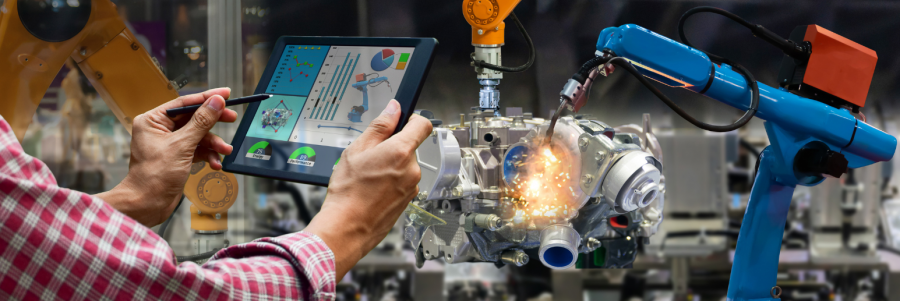
Electric often gets all the excitement–and the headlines. But internal combustion engines (ICEs) remain indispensable where power density, fast refueling, and rugged duty cycles rule.
Even in 2026, IC Engines still remain essential in heavy-duty trucking, construction and agriculture equipment, mining, rail, marine vessels, aviation (piston and turboprop), defense platforms, backup/prime power generation, and small off-road engines.
Why? These sectors face tough duty cycles, long ranges, and harsh conditions that make ICE (or hybridized ICE) the practical choice, especially as low-carbon fuels and aftertreatment tech improve.
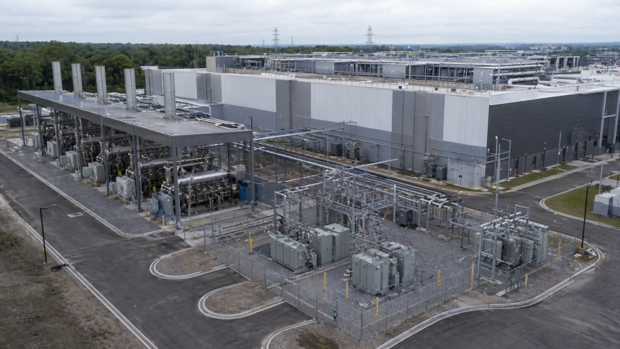
More recently, though, another user of internal combustion engines has emerged: huge data centers.

Big Data Needs Big Engines.
Data centers, sprouting up everywhere, are sprawling buildings full of specialized power, cooling, networking, and security systems. They house servers and storage so organizations can run applications, process data, and deliver online services. And they need a lot of energy to run these systems.
Big internal-combustion engines—usually large diesel or natural-gas generators—keep data centers alive, especially when grid power fails. Batteries or flywheels hold the load for seconds or minutes while the engines start, synchronize, and take over. With enough on-site fuel, these behemoth engines can run the whole facility for days. Sites often install multiple generators, so one can fail or be serviced without downtime. The engines stay warm for fast starts and connect through automatic switchgear that transfers power and shares load safely.
Recent industry reports, in fact, describe gigawatt-scale campuses planning onsite engine-based generation, including installing reciprocating engines as core infrastructure. In mid-March, for instance, Caterpillar emerged as a key player in the latest AI infrastructure surge. Developer Nscale said it would deploy Caterpillar’s natural gas generator sets at a major new West Virginia data center campus linked to Microsoft and NVIDIA. That decision places the company’s G3500 series reciprocating engine platform at the center of what Nscale says may become one of the nation’s largest purpose-built AI compute developments.
Data centers obviously use a lot of power, putting immense strain on the local grid. So, beyond emergencies, some data centers also run these engines to cut peak electricity costs, support the local grid, or operate as part of a microgrid with batteries and solar. Many of these data centers, though, are shifting to cleaner IC engines, such as those that run on renewable diesel (HVO), natural-gas (like Caterpillar’s), or even fuel cells for steady power—while still keeping the big engines as their backbones.
What “Cleaner” ICE Looks Like Now.
Cleaner fuels, advanced combustion, and smarter engine controls let today’s internal combustion engine platforms deliver lower emissions and higher efficiency while meeting harsh real-world demands.
Engine Research and Development is moving fast on several fronts:
- Low- and zero-carbon fuels: Hydrogen ICE (H2ICE), ammonia, and synthetic “e-fuels” compatible with existing engine architectures are advancing. The goal is near-zero tailpipe CO₂ (or CO₂-neutral lifecycle) and scaling via current manufacturing and service networks. IDTechEx+1
- Drop-in liquids for legacy fleets: Renewable diesel (HVO100) is also piloted in large fleets. It acts as a bridge decarbonization tool for the hundreds of millions of ICE vehicles already on the road.
- Smaller, more efficient engines designed for net-zero fuels: Leading OEMs are developing next-gen engines specifically optimized for carbon-neutral fuels and hybridization.
- Advanced combustion and controls: Continued progress in ignition systems, turbocharging, direct injection, and model-based controls is pushing higher efficiency with lower criteria pollutants. At the same time, research is exploring both combustion challenges (e.g., NOx with ammonia blends) and mitigation strategies.
Introducing the Online IC Engine Systems Graduate Certificate
To meet the demand for using and improving IC engines, Michigan Tech’s Department of Mechanical and Aerospace Engineering is offering an online graduate certificate that focuses on IC Engine Systems.
You can take individual courses to fill specific skill gaps or complete the three courses to earn the credential.
This credential can also be stacked with other online certificates and create a customizable MS in Mechanical Engineering.
Why Michigan Tech? MTU has long, hands-on tradition in combustion, fuels, and powertrains. It has a rich history of industry partnerships and applied research that translate to immediately useful skills. The new ICE certificate extends that legacy to busy professionals—wherever you’re based.
An Internal Combustion Engine Certificate Built by and for Industry
This certificate was developed with substantive input from USCAR (the United States Council for Automotive Research) and Dr. Andrea Strzelec (FSAE), a combustion and fuels expert whose work spans exhaust aftertreatment, fuels, and particulate matter. Recently affiliated with UW’s Engine Research Center, Strzelec has directed professional master’s programs in Engine Systems, Polymer Engineering, and Power Engineering. She is also a 2022 SAE International Fellow.
Dr, Jeffrey D. Naber brings additional real-world depth to the certificate. With experience in automotive engine development, combustion research at a national laboratory, and leadership in advanced power systems at Michigan Tech, he gives students insight into both the fundamentals and future of engine technology. His expertise includes engines, fuels, emissions, diagnostics, and control.
Previously with Argonne National Laboratory’s Engines and Emissions Research group, Dr. Scott A. Miers contributes expertise in combustion, engine efficiency, emissions, and alternative fuels. Further supporting the program is Rick Davis, MSME, who spent more than two decades at General Motors as a combustion specialist. His background in combustion research and engine development adds strong practical, industry-relevant perspective to the certificate’s focus on engine systems and performance.
All in all, students will benefit from an expert instructional team with decades of development knowledge, research, and innovation in internal combustion engines; a wealth of diverse industry experience; and deep roots in the Mechanical and Aerospace Engineering Department. In short, this certificate’s focused curriculum maps to current powertrain challenges and employer expectations.
Who Should Apply.
Through this certificate, students will learn to evaluate engine thermodynamics and cycle performance to uncover opportunities for greater efficiency. They’ll study the balancing act behind power, fuel economy, emissions, durability, and cost, and apply key principles in air handling, fueling, combustion, and heat transfer to real engine systems.
The program also helps students make sense of engine test data for calibration, diagnostics, and optimization, while exploring how internal combustion engine technology continues to evolve within hybrid systems and lower-carbon energy strategies. Below are some professionals who could benefit from this program.
- Working engineers in automotive, heavy-duty, off-highway, rail, marine, aviation, energy, or defense
- Controls, calibration, and test engineers upskilling for fuel-agnostic platforms
- EV/HEV professionals who integrate engines in hybrids and range-extenders
- R&D staff exploring e-fuels, hydrogen, or ammonia pathways
- Those looking to develop a focus area and dip into graduate school
In other words, if your day-to-day engineering work includes power density, duty cycles, emissions maps, and durability margins, this program speaks your language.
Ready to Help Lead In Combustion Engines?
Questions about fit, curriculum, or anything else? Contact Contact Dr. Jeff Naber (ME-EM) at jnaber@mtu.edu or Dr. Andrea Strzelec at strzelec@uscar.org.
Want to dive deeper into this online certificate? Speak to subject matter and admissions experts, get your questions answered in real-time, and learn how to get started for Fall 2026?
Then join us on Thursday, May 21, at 11:30 a.m. (ET) for a live webinar.