by James D. Spain (Written Spring 2012)
In 1968, the department began a study of Lake Superior and the Keweenaw Waterway, as it was felt that Michigan Tech had great potential in this area, being located very near to the geographical center of the big lake. Despite this fact, little significant research in either biology or chemistry of this great resource had been done at Michigan Tech. Otherwise, Lake Superior research was being carried on at the University of Minnesota-Duluth (UMD), and to a small extent by the Universities of Michigan and Wisconsin. So, it was obvious that great potential existed in a very interesting area for research.
To gain some knowledge about what was being done by our major competitor, Ken Kraft and Jim Spain made a trip to Duluth to meet with a couple of researchers at UMD, where Ken had previously served on the faculty. We found these men to be the most congenial of colleagues. After being treated to lunch and a tour of their lab, we left Duluth with a stack of reprints and other pertinent literature along with their encouragement to launch our studies in this exciting area.
One of the obvious requirements of lakes research is to have a platform for collecting samples, which generally means a boat. So, about the first thing we did was to put together a NSF Undergraduate Equipment proposal that involved a sampling craft and other essential equipment. In order to broaden our credibility and to justify the large budget proposed, we decided to make it an interdisciplinary grant involving the departments of Geology, Civil Engineering, and Forestry, in addition to Biological Sciences. The interdisciplinary concept was fairly new at the time and so NSF became quite interested, with the result that we received one of the largest undergraduate equipment grants funded that year. With this money we purchased a number of basic limnological research tools.
A major piece of equipment obtained with the grant funds was a 20-foot steel pontoon sampling raft. It was constructed by the MTU Physical Plant Department, based on our specifications. Since it consisted of a raft with an 8×8 foot pilot house/lab on its deck it was called the Monitor after the “cheese box on a raft” warship of Civil War fame. The name had a double meaning in that our initial investigations were to monitor the pollutants of the Portage Lake/Torch Lake system. Since the Physical Plant had constructed the Monitor, I had no trouble getting them to designate a docking site at the east end of the Michigan Tech Coal Dock. They also provided about 800 sq ft of storage space in the green metal building nearby and also provided some work space and running water. Thus, we had a Lakeside Lab that was used for about forty years until the recent (2012) completion of the Great Lakes Research Building. With the aid of the Physical Plant, we also set up an automatic water level recorder at the corner of the coal dock. This equipment was sufficiently sensitive to monitor the seiche activity in Keweenaw Bay and we got some interesting data over the years it was in place. When we went a significant distance in order to do the sampling work, such as to Ontonagon, Eagle Harbor, or Keweenaw Bay, we used the Evinrude Sweet 16, with 90 HP engine, owned by the Spain family.
Early on, we were able to interest one of the engineers on the National Parks Service shipRanger III to allow us to place a temperature recorder on the intake water supply during the voyage back and forth to Isle Royale. He became interested in the project and agreed to turn on the recorder when it left the dock, mark the time when the ship left the waterway, again when it entered Rock Harbor on the north side and turn the recorder off when it docked. He also added other tidbits of information when noticed. At the end of the summer I had some very interesting data that tied in nicely with the studies on the thermal bar that we did later and that other researchers have since elaborated.
During this same period, Spain was able to get two small grants for the support of MS graduate students. One of these grants was from the Ontonagon-Huff Paper Mill and the other was from Michigan DNR. With this money we were able to hire two graduate students who were ideal for the work that we were doing. They were both from Superior, Wisconsin, with fathers who had worked on the ore boats. Thus, they were able to provide a lot of common sense boating knowledge to support our initial forays into this field. We had two main projects. One dealt with the investigation of the Keweenaw Waterway system from Lake Superior on the north to Keweenaw Bay on the south, including Torch Lake. The other project covered about a mile of water in and around the mouth of the Ontonagon River (about 60 miles away). The objective of each was to find out anything unusual about the chemistry and biology of these two bodies of water that would have a bearing on future management strategies. Both students participated in both projects, but Dave Drown was responsible for the Ontonagon project and Jim Yanko was responsible for the Keweenaw Waterway project. I went on most trips, primarily directing the chemical aspects of the projects. Ken Kraft consulted on the biology of both projects, which consisted primarily of bottom invertebrates.
In the Keweenaw Waterway, the most interesting chemical feature was discovered more or less by accident. Not having much of a research plan, we began to measure most anything that was easy to measure. This included; phosphate, nitrate, oxygen and chloride. One constituent, we hit upon more or less by accident, as we were going to carry out a dye tracer experiment by dumping fluorescent-dye into the lake and measuring the dye in various down stream locations using a fluorometer. However, we discovered that the background concentration of fluorescence was so high that it obviated the tracer study and we became interested in the source of the fluorescence; was it natural or was it a pollutant? It turned out to be the result of the tea-colored tannin-like substances in most of the streams and thus natural. We discovered that the background research on natural fluorescence had been done at Yale University and so Spain borrowed the PhD thesis and copied pertinent portions as the work was largely unpublished. The Yale Library became extremely upset and demanded that the copies be destroyed immediately. Since we were not planning to publish any parts of the thesis, Spain ignored the demand.
In other studies, oxygen depletion and the nutrients, phosphate and nitrate, were only found in significant amounts in Dollar Bay, which suffered with runoff from the local milk processing factory. So it ended up that we routinely began to study the concentrations of chloride ion and natural fluorescence. Here we found that the chloride concentration varied from 300 ppm in Torch Lake to about 10 ppm in Portage Lake to about 1 ppm in Lake Superior. The high chloride (salt) content was later traced to the dewatering of a mine called Osceola #13, which drained into a creek, which fed Torch Lake. Other rivers had concentrations of only 1 or 2 ppm. We also found some interesting variations in the natural fluorescence of the water. It was high in rivers, relatively low in Torch Lake and almost zero in Lake Superior waters.
When we tried to study bottom invertebrates, we found that most of the waterway was covered with a fine clay-like material that was so dense and/or so toxic that it was largely devoid of invertebrates. This material was found to be the result of finely ground copper-ore waste that had been dumped into the system over a period of almost a hundred years. These results seemed to be sufficiently interesting that Jim Yanko used it for a thesis topic and I had at least something to report at the upcoming Great Lakes Research Conference.
Our Ontonagon study yielded somewhat less of a concrete nature. There were little significant changes in chemistry and the bottom was so dynamic because of the river flow that not much was found to be growing there. This latter fact led to the major invention of the project. Ken Kraft, had the idea of forming an artificial invertebrate environment to see what might be collected. The students decided to make their device by gathering up some small rocks from the shore of Lake Superior and wrapping them with hardware cloth to make a container with dimensions of about 12 x 8 x 2 inches. The result was what they called a “rock pasty” because of the similarity to the local Cornish meat pies that are a Copper Country specialty. When these rock pasties were placed at different sites, allowed to remain for approximately a week and then retrieved and sloshed up and down in a plastic baby bathtub (a common tool for invertebrate study), a measure of invertebrate populations was obtained. The question is; what does it exactly represent? Several studies were done exploring the applicability of the rock pasty for invertebrate analysis. This became one of the major topics of Dave Drown’s thesis.
Serendipity is often an important component of research. As Spain was working on the introduction to the pollution paper for Great Lakes Research Conference, he wanted some evidence to support his contention that the waterway could be considered an estuary of Lake Superior. So, he went to the library and began looking up the topic of estuaries. In the process of pulling books off of the shelf, and thumbing through pages, he ran across a book called Estuaries, edited by George Lauf. On flipping through the pages, looking for studies on freshwater estuaries, he discovered a very interesting paper that dealt with using two conserved chemical constituents to mathematically study water mass movements in the mouth of the Hudson River. All of a sudden he realized that all the data that we had been collecting for the past year concerning chloride and natural fluorescence concentrations would allow him to do exactly the same thing in the Keweenaw Waterway. He checked out the book from the library and rushed back to his office. Using the same mathematical equations, he was able to show that Keweenaw Waterway system contained three kinds of water: Lake Superior water, Torch Lake water and tributary water. To my knowledge, this important oceanographic technique had never been used with freshwater systems before. Our “research” had suddenly jumped from the high school science project level to something at the Ph.D. level or beyond. We even had winter data, collected through the ice, which showed layering of the three kinds of water similar to what is seen in the Atlantic Ocean. Over the next year or so, Spain was able to write several papers on this subject and have them accepted by major journals. It was satisfying to have contributed something of significance to the literature of chemical limnology, although it is unlikely that the technique is broadly applicable because of the special circumstances of our local system.
We had some interesting experiences with the Monitor during the years we were working on the Keweenaw Waterway that has some general value in the seamanship area. This resulted from the raft-like design of the vessel. It first occurred when we were headed out on one windy day to take some samples in Torch Lake. The wind was blowing out of the north and we were on a southerly bearing. As with other trips, we had the engines wide open to try to get there as quickly as possible. Even then it took the better part of an hour to get from the MTU coal dock to Torch Lake. Things were going along fine, Spain was in the pilothouse at the wheel and the two graduate students were sitting outside on the lab bench that went across in front of the wheelhouse. As we went down the lake the fetch increased and the height of the waves grew larger and larger. All of a sudden, we went down the front side of a wave and the bow of the flat deck vessel went under the surface of the water, making it behave like a submarine going into a dive This maneuver, which is similar to stubbing one’s toe, threw the two students off of the lab bench into a foot or so of water, which was now on the deck. Fortunately, they hung on to something and I pulled back hard on the throttles, so that the boat slowly backed out of this awkward position. Happily there had been no equipment sitting on the lab bench (just two unhappy grad students). Wow! Nothing like this had happened before. So, we stood around for a few minutes considering the situation. Eventually, we decided that it had been some kind of a fluke and began to proceed down the lake, with the two guys at my side in the wheelhouse. We were so convinced that it had been a fluke, that we put the speed right back to where it had been. It wasn’t more that five minutes and it happened again. There we were with the bow under the water standing at what seemed to be about 45 degrees. What we finally had to do was to maintain a speed of no more than that of the waves, which was very hard to do since we wanted so much to go faster. Eventually, we made it around the point and away from the waves. Some years later, we ran into much the same situation with our own family boat, so this seems to be a general response of boats in waves when headed in the downwind direction. I personally believe that this phenomenon was the cause of the demise of the Edmund Fitzgerald, although there is still a controversy about this.
In addition to research, we often had the opportunity to instruct classes in limnology, both on the undergraduate, graduate level and summer workshops. When it came to the laboratory portion of the class, the Monitor served as an ideal outdoor laboratory and we had two extreme examples of lakes to study. Only about a mile from the MTU coal dock was Dollar Bay, which had most of the characteristics of a nutrient-rich lake, with high concentrations of phosphate and nitrate and low concentrations of oxygen, while on the other hand, we had Lake Superior, having all the characteristics of a nutrient-poor lake. We also had interesting populations of organisms living in Dollar Bay, while the waters just outside the Bay were almost devoid of life. In addition there were nice examples of sediment layering almost anywhere in Portage Lake.
During this period, we had an opportunity to participate in a somewhat larger limnological investigation, as we received an invitation to join with the University of Michigan’s work on theInland Seas research vessel, when it entered Lake Superior at Sault Ste. Marie. Since the ship was supported by an annual grant from NSF, we were able to participate without cost. So, Dave Leddy from Chemistry, my two graduate students and I drove over to the Soo to board the ship for a two-week cruise. We made two trips like that. It was a great experience for us all, but particularly for the graduate students Dave Drown and Jim Yanko. My justification was to study the chloride content and natural fluorescence at various locations around the Lake Superior, to provide background data for the conserved constituent research described above. The two trips sort of run together in my mind, so I will just describe it as one trip.
First let me describe the ship. The Inland Seas was a 114′ wooden-hulled minesweeper that was constructed during WWII. After the war, it was used by the National Park Service to ferry people to Isle Royale for several years under the name Ranger II. It was obtained as surplus by the University of Michigan after being replaced by the steel-hulled Ranger III. The University outfitted it with oceanographic gear and had a full professional crew. The research people, except for a few chief staff, were housed in the forecastle.
In a typical trip (greatly abbreviated), we sailed out of the Soo about noon and ran headlong into a fairly heavy sea coming out of the northwest. Since it was due to continue for most of the day, the captain decided to head into Batchawana Bay, where there was a sturdy T-shaped dock built by the Canadian government. The following day, Lake Superior was fairly calm as we headed north for Michipicoten Harbor, near Wawa, Ontario and so we reached it sometime before dark. Our destination the following day was Michipicoten Island, where some of the people studying algae wanted to make a collection at a mostly undisturbed site. The following morning we headed for a spot called the Lake Superior Shoals, a shallow spot in the middle of the lake between Michipicoten and Isle Royale. Again, we were looking for algae. The rest of us were sampling other features of the lake. From here we headed for Rock Harbor on Isle Royale. We were late arriving in Rock Harbor, so I remember little until the following morning. It was a beautiful day and we left for the north point, as we were planning to go around to the northwest side to sample in Five Finger Bay, one of the most pristine parts of the island. Isle Royale is a 45-mile long island that runs in a southwest to northeasterly direction. It consists of a series of ridges, some of which run the length of the island. These ridges extend out into the lake to become shallow reefs, which on the north side of the island form five finger-like projections called Five-Finger Bay. We arrived there at about 11 am with clear blue sky and gin-clear water. Most of us had never been there, so we were all on deck soaking up the scenery, as the captain slowly guided the ship into the complex of reefs. After some difficulty getting tangled up with the reefs, we spent the night at Windigo, the park service station at the southwest end of Isle Royale. The following morning we headed for Houghton into about a 10-15 foot sea. I spent most of the morning standing on the lee deck of the ship trying to keep my digestive tract going in the right direction. I don’t believe there was a soul on board who wasn’t wondering a little bit about the impact of our recent visit to Five Finger Bay on the ship’s hull. After spending the night in Houghton, we headed along the south shore if Superior, visiting Marquette, Whitefish Bay and returning to Sault Ste Marie.
From the above comments, you might wonder if any serious research was done during these trips. The answer, of course, is yes, there were several stops at research stations. Each time, the ship would come into the wind, ship’s bell would clang and everybody would move to his or her work station. The graduate students would help out where they were needed as they had a powerful work ethic and picked up the ship’s routine before the end of the first station. I helped with water sampling and took my samples to the small portion of the lab that had been assigned to me. Actual analysis was carried on later; usually when we were tied up at a dock somewhere. The data obtained from these trips contributed some to conserved constituent research, but the experience we gained was immeasurable.
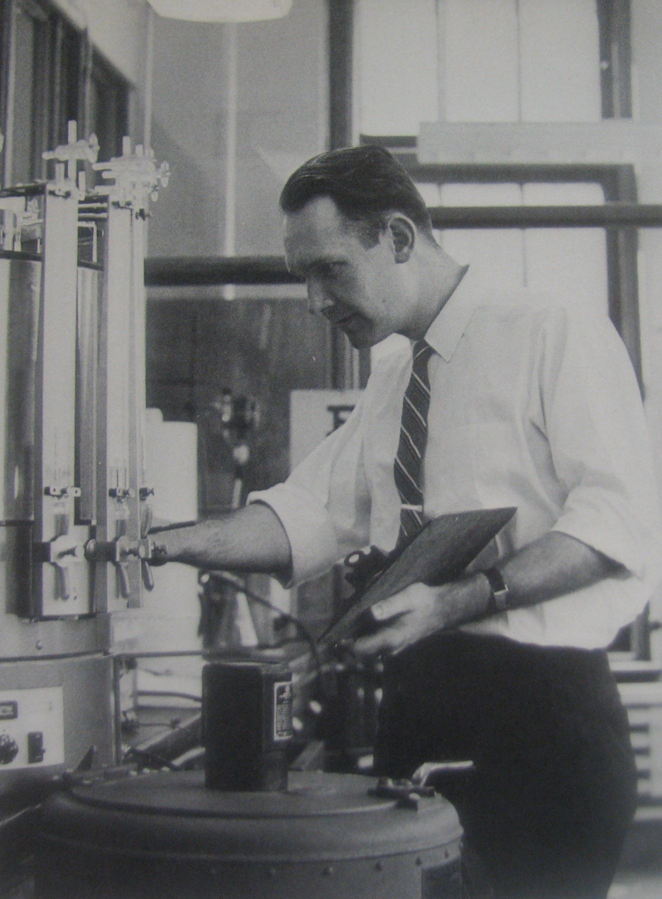
For the low chloride ion concentrations found in the Lake Superior waters in this study and later studies of Keweenaw Bay, Spain developed a spectrophotometric procedure that involved the indicator used for chloride titrations in the Hach Kit (commonly employed for simple limnological studies). In this procedure, a certain amount of indicator is mixed with a given volume of water sample and read in the spectrophotometer, previously standardized with known concentrations of chloride ion in the range of 0.00 to 5.00 ppm. This simple procedure was found to be surprisingly effective for chloride ion concentrations below that which may be obtained with the standard chloride ion titration, using an indicator.
A year or so after this, MTU was fortunate to receive a gift of a 30-foot tugboat that had been used by a retired faculty member who ran the small marina at the lower entry of the waterway. This was a lovely little tugboat called the Lake Breeze. Shortly, we had it outfitted for research, using some new equipment and a few things off of the Monitor, which was subsequently used primarily for teaching limnology class and summer institutes. My two grad students were much happier with the Lake Breeze, as this was a real boat, with a real engine and a great boat smell. We had it outfitted very quickly and used it for all the Keweenaw Waterway research from that point on. It was a significant step up in morale as we now felt that we were doing real limnological research not unlike what we had experienced on the Inland Seas. We installed a wench driven by a small gasoline engine for retrieving sampling gear from greater depths. This was especially useful for hauling up some of the larger bottom dredges that we were using then.
As I indicated above, some of our water sampling was done through the ice. To accomplish this, we needed a means of getting to the primary stations on Portage Lake that were several miles from our Lakeside Lab. My initial effort in this direction was a six-wheeled amphibious vehicle that was purchased with the initial NSF grant. This proved to be almost worthless for everything. It barely moved in the water; it had no traction on ice or snow; and it was so low-slung that it could get hung up even driving on dry land. So, we managed to get rid of it somehow and do our work with an Evinrude Snowmobile that the university had obtained through one of its testing programs. This was a heavy machine and thus was able to carry Jim Yanko and me, as well as pull a sled full of equipment. Everything went fine until one day we went out on the ice-covered lake after a reasonably heavy snowfall. We moved along well on open ice, but about half way to the key station we were headed for, we hit some heavy snow and the Evinrude bogged down. When we got off the machine, we discovered that under the snow was a good four or five inches of slush. This commonly occurs when the ice is weighed down with snow causing it to crack, so that water comes up over the ice. Our weight and that of the snowmobile were not helping. To make things worse, slush had gotten in under the snowmobile tracks. Before we could do anything, all this slush had to be cleaned out. Then, dry snow had to be piled up to provide a base to get the snowmobile on so that the engine could be started. This operation took fifteen minutes, or more. Our objective was to get the equipment out of the slush field back to the solid ice. So, we got the machine revved up and Yanko jumped on it to drive it away. It only went a few yards and it was bogged down again. It became obvious that it was not going to hold anybody’s weight, much less pull a sled. So, I hauled the sled to the safety of the clear ice, while Jim worked on cleaning out the slush. We piled up the snow again and lifted the snowmobile into place. After revving it up, Yanko tried running along beside it for as long as he could go. This time it went perhaps ten yards before it bogged down again. This process was repeated about five times, until we finally got it out of the slush field onto firm ice. By that time, we were both about dead, so the sampling trip was canceled. We just could not face the possibility of getting into another slush field. That was my last experience with snowmobiles. It was enough to last a lifetime.
After the initial projects were done and the graduate students had departed, Spain became involved in the development of the Lake Superior Basin Bibliography, which made use of a mainframe program developed at the University of Wisconsin. This was done in conjunction with a consortium of universities in the Lake Superior region and supported by a large grant from the Federal Government. The controlling board for the consortium, of which Spain was a member, defined a group of tasks that should be done to make the region more effective in protecting Lake Superior from potential problems in the future. One of the tasks was to develop a computerized bibliography to assist any researcher who wished to work on the lake. Presumably because of the availability of computers at Michigan Tech, we were given this assignment and Spain was selected as the leader of the project. Since the computer program was already available from the University of Wisconsin, all that was needed was to define the keywords to be used and assign them to each of the individual publications that dealt with the Lake Superior Basin. Despite our relative inexperience with the bibliographical science, our group forged ahead by hiring some part-time students and getting the MTU Library to assign us a room not far from the main stacks. They were also kind enough to have library personnel gather all the books and journals that they thought dealt with Lake Superior in one way or another. These publications were brought to our evaluation room.
The first weeks were spent in setting up the procedures that we would be using and getting to understand how the U.W. Bibliography Computer Program worked. All the data were to go on IBM punch cards for entry into the program. All we had to do was to define the data; someone else was being paid to punch it into the cards, using an IBM Key Punch. The objective of the work is perhaps more comprehensible if it is thought of as a crude and primitive version of current web search engines, like Google. Our responsibility was to anticipate the keywords that users of the system might enter to search for sources of information. Our funding was for two summers; the first summer was spent largely in defining better and better keywords to cover the available publications. The second summer was spent trying to apply these to all the publications having any relevance to the Lake Superior region that were available in the MTU library, plus those that were in other bibliographic listings. This work was carried out on the large conference table with all of us sitting around. We would write down the bibliographic information on the card that we had developed and check off the appropriate keywords from the list on the card, based on a quick perusal of the publication. If the students had any questions, they would pass the book to me for arbitration. As a consequence, I reviewed a lot of material during the summer, of course spending quite a bit of time on those things that caught my interest. The final product worked quite effectively and was used for many years at Michigan Tech and the other schools that had the necessary technology to make use of it. Whether it really was as effective as originally intended or not, I don’t really know. Of course it was not too many years before it was supplanted by bigger and more effective computer systems, but it is hoped that our bibliography played some role in laying the groundwork for the later systems.
During the work the Lake Superior Basin Bibliography, aquatic research and limnology instruction was taken over by Dr. Thomas Wright, a fisheries biologist from the Univ of Wisconsin-Madison. He led two graduate students, Bill Deephouse and Tom Rozich, in the study of two species of fish that ran in the Sturgeon River, the major tributary of the Keweenaw Waterway.
After the work on the Lake Superior Basin Bibliography, I got together with Davis Hubbard of the Chemical Engineering Department. Dave was a specialist in hydrology and the peculiar aspects of fluid flow. I had been able to interest him in a special feature of large lakes called the “thermal bar”. The thermal bar is a feature that occurs during the warming of the water of large lakes in the spring. Inshore water warmer that 4°C comes in contact with offshore water that is colder than 4°C. Because water is most dense at 4°C, it tends to sink to the bottom to be replaced by both inshore and offshore water, which mixes to make still more 4°-water. The result is a curtain of descending water that separates warmer inshore water from the mass of cool offshore water, acting as a dynamic barrier, and so it is called a thermal barrier or thermal bar. As far as we could find, no one had studied the fine structure of thermal bars, and nobody had studied the thermal bar in Lake Superior.
Dave and I ran some crude transects of water temperature at the north entry of the Keweenaw Waterway and off of Eagle Harbor to verify that the thermal bar did exist in those areas, which of course it did. The thermal bar near Eagle Harbor was especially exciting to observe, as one could place the boat right at the 4° line and observe that there was a distinct line of flotsam on the bar and that the color of the water was significantly different on one side from the other, being clear blue on the offshore side and greenish on the inshore side. This line of demarcation was not nearly as evident at the upper entry. The following year, Dave had a graduate student who was interested in studying the fine structure of the thermal bar with a special computer analysis program. First we needed some data on the fine structure of the TB. So we obtained 150 meters of polypropylene line, marked it off in 10-meter units and put floats and anchors at each end. We also set up two pieces of plywood to serve as a range marker on shore. Then, when the weather was appropriate we took a series of 10 vertical water samples and temperature readings every 10 meters across the thermal bar. We believed that this might have been the most intensive set of transect samples ever taken in lakes research. Since each location took about 20-30 minutes, it took hours to complete and was done at least two times during the spring. The water was analyzed for natural fluorescence, which was higher in the inshore water because of the runoff.
All the data was subjected to the computer analysis. Despite the general pattern that confirmed the thermal bar concept, there was no distinct line of demarcation. We were very disappointed in the results, because we had hoped to answer the question of whether the line leans inward toward the shore or vise versa. In retrospect, it became clear that undulations in the long-shore current that is assumed to flow inside the thermal bar had caused fluctuations in the pattern during the time that we were taking the data. We had seen a similar phenomenon occur when we examined the thermal bar near Eagle Harbor, where it appeared to undulate as we watched it, so it was foolish to believe it would not have occurred in the Upper Entry study as well. It was evident that we had to find a faster way to take samples!
The following spring, Dave and I carried out a new high-speed technique, this time by taking a transect of Keweenaw Bay. In preliminary studies, we started at one shore near a big old barn that served as our initial range marker, and driving the Evinrude at about 20 mph, trailing a temperature probe about 10 meters behind the boat. I piloted the boat while calling temperature readings into a tape recorder, and making sightings of special features as we passed (“we are now in line with the entry light”, etc.). At the same time, Dave was taking surface water samples and calling sample numbers into the tape recorder. Again, we felt that we must be making limnological history of some sort, with our high-speed sampling procedure.
The results of these kinds of studies were very striking. We found a very clearly demarcated thermal bar on each side of the bay that was mirrored by both fluorescence and chloride concentration. But, it was evident that to see the fine structure, we needed a vertical array of thermal sensors and a more sophisticated recording device. However, we were operating with no financial support and no platform that could carry it. So, the next step was to use the data obtained to get that sort of support. Unfortunately, the following year, Dave went on sabbatical leave in Venice to work on the water problems in the Venice Lagoon and I became involved in working on the computer. Because of these distractions, our exploratory study was never published. After Dave returned, we never got back to the project, as he was working on some research that was more appropriate to chemical engineers.
At about this time, Spain was invited by a member of the Wisconsin DNR to carry out an analysis of oscilloxanthin in portions of sediment cores taken from Lake Winnebago. This involved development of quantitative analysis for the mercurochrome-colored oscilloxanthin produced byOscillotoria rubescens, a species of cyanobacteria (blue-green algae) normally associated with human pollution. The final technique involved an extraction of the sediment sample, followed by adsorption on micro columns, elution by isopropanol and spectrophotometric analysis at three wavelengths. The results showed significant quantities of oscilloxanthin in what appeared to be pre-Columbian times.
Tom Wright’s studies were concluded when he took a leave of absence to work with the Corps of Engineers at Vicksburg, MS. He returned for a short period of time and then left for a full-time position in Vicksburg.