Bringing GI Science to Suriname
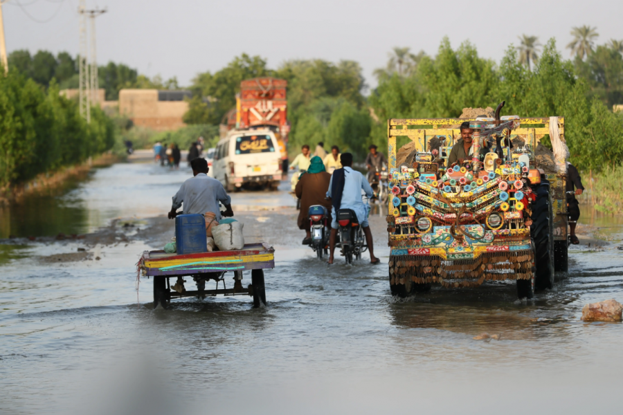
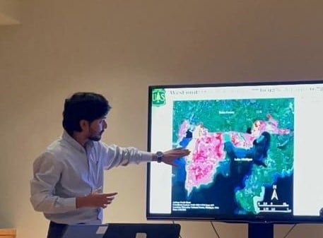
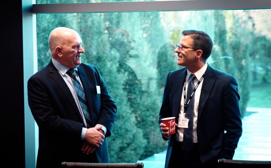
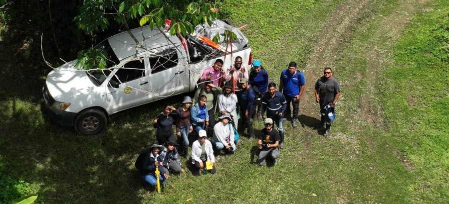
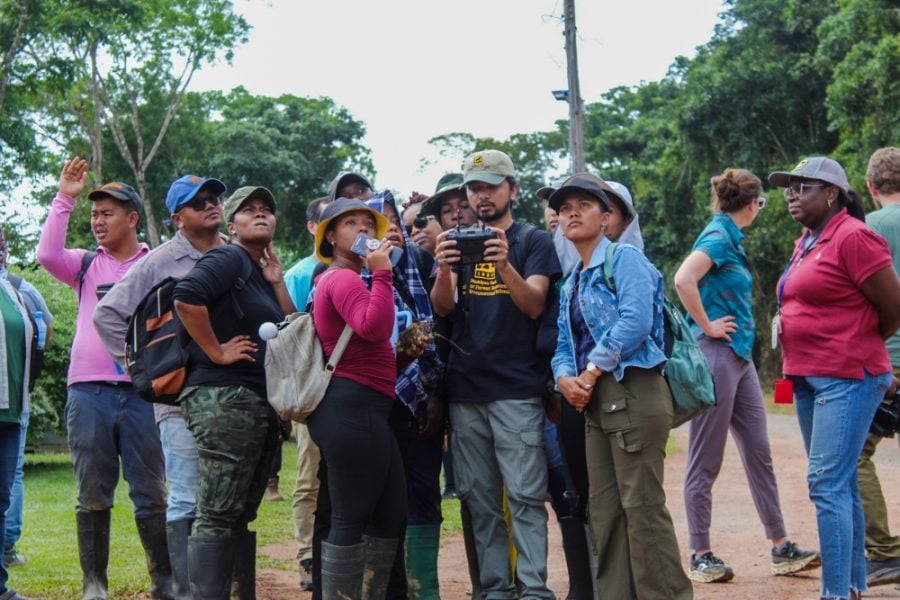
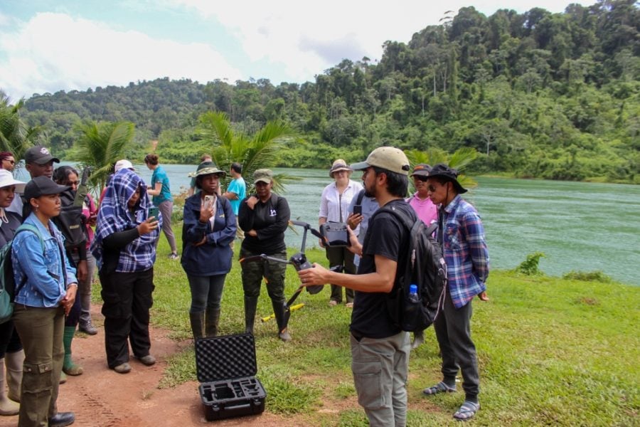
Dr. Parth Bhatt, Assistant Teaching Professor/Researcher from the College of Forest Resources and Environmental Sciences (CFRES) breathes and lives Geographic Information Science. In fact, Bhatt, a team of researchers, and other MTU representatives recently returned from Suriname, South America. There, they led an immersive, 3-day workshop in Forest Field Research Methods at Anton de Kom Agricultural University’s Centre for Agricultural Research (CELOS).
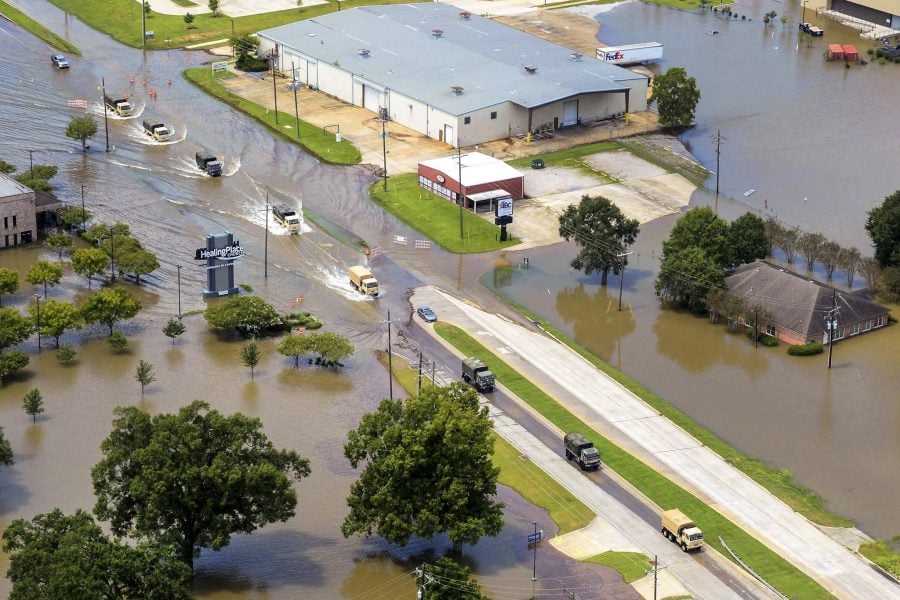
Suriname, endowed with vast tropical rainforests and rich biodiversity, faces several pressing technological, environmental, and socio-political challenges. And the country’s geographical features also make it vulnerable to the effects of climate change, such as those of severe flooding and storms.
There are also the more obvious human-made damages to Suriname’s delicate ecosystem. Between 2019 and 2022, in fact, artisanal and small-scale gold mining (ASGM) increased by 47%. This growth led to significant deforestation and environmental degradation. As a result, the region lost approximately 25 square kilometers of rainforest. Suriname’s remoteness further complicates regular data collection, hindering effective policy development and environmental protection efforts.
Exacerbating these issues is a serious skills gap. That is, Bhatt acknowledges that “a major challenge [Suriname] faces is a shortage of highly trained professionals to help manage and preserve these resources effectively. Strengthening educational and research collaborations can help bridge this gap by providing expertise in conservation, remote sensing, and sustainable resource management.”
In Suriname, Parth Bhatt and the rest of the team tried to bridge this gap. For instance, while he was there, Bhatt led workshops on the use of drones for collecting geospatial data in the country’s rainforests. This hands-on experience with UAVs (Unmanned Aerial Vehicles) exemplifies the benefits of applying emerging technologies in natural resource management.
Ongoing Challenges in Geographical Information Science
Most obviously, these workshops demonstrated how Geographic Information Science provides approaches for managing natural resources. To Bhatt, though, “remote sensing are more than just tools—they’re gateways to understanding our world in ways that truly matter.”
Bhatt’s online certificates, through CFRES, certainly help with this understanding. In fact, their coursework addresses the complexities of applying GI Science to natural resource management in the US, Suriname, and beyond.
As an example, let’s take Dr. Bhatt’s inaugural online certificate from Michigan Tech Global Campus: Foundations in Geographic Information Science for Natural Resources.
GI Science Challenge #1: Working with Variable Data Sets
Data sets often vary in resolution, format, projection, and accuracy. This point is especially true when researchers combine historical data with newer sources (e.g., satellite vs. drone). Because of variations in data, it is often difficult to model ecosystems reliably. Or to make consistent decisions across jurisdictions or even time spans.
Furthermore, when it comes to geospatial information, there are additional difficulties with handling the volume, variety, and velocity of data. GI Scientists must contend with a stream of heterogenous data from sensors, satellites, smartphones, and social media. And they must collect and streamline this data while also creating real-time data analytics and visualizations.
GI Science Challenge #2: Contending with Uneven Data Quality and Uncertainty
To complicate things further, geographic data often come from multiple sources. Researchers must juggle information from satellites, GPS, surveys, user-generated content (e.g., OpenStreetMap), and government records. And each source may differ in accuracy, resolution, update frequency, and metadata standards, leading to uneven quality and results. For instance, combining high-resolution satellite imagery with outdated census data might produce misleading results in land-use change analysis.
There is also the problem of uncertainty and inconsistency in spatial data. This problem is especially tricky when boundaries or attributes are interpreted subjectively (e.g., informal settlement boundaries). And inconsistency in quality can result from human error, different measurement techniques, and varying classification systems.
Classification, for instance, is variable. Organizations, datasets, and researchers might categorize geographic features differently, even when referring to the same types of objects or areas. For instance, one land-cover dataset might classify land according to “forest,” “urban,” “agriculture,” and water. Another might use these categories: “deciduous forest,” “coniferous forest,” “low-density urban,” “high-density urban,” and “irrigated cropland.”
FW5550 (Geographic Information Science and Spatial Analysis)
Some of the course’s key topics address these challenges.
- Metadata Standards and Quality Assessment. FW5550 emphasizes understanding metadata, particularly their provenance, processing, and reliability.
- Spatial Data Models and Structures: Students learn how different types of spatial data (raster vs. vector, continuous vs. discrete) are structured, so that they can recognize the limitations and strengths of each. This skill is crucial when merging data from multiple sources that have inconsistent formats or resolutions.
- Data Integration and Overlay Analysis: Combining datasets from multiple origins is stressed. The course addresses inconsistencies in classification systems, temporal mismatches, and spatial resolution. It also covers practical techniques of reclassification, resampling, and transformation.
GI Science Challenge #3: Collecting Data in the Field
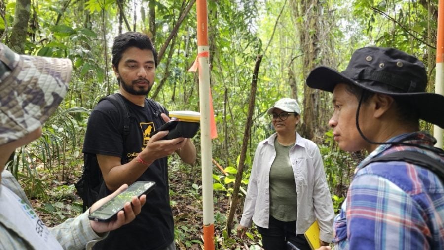
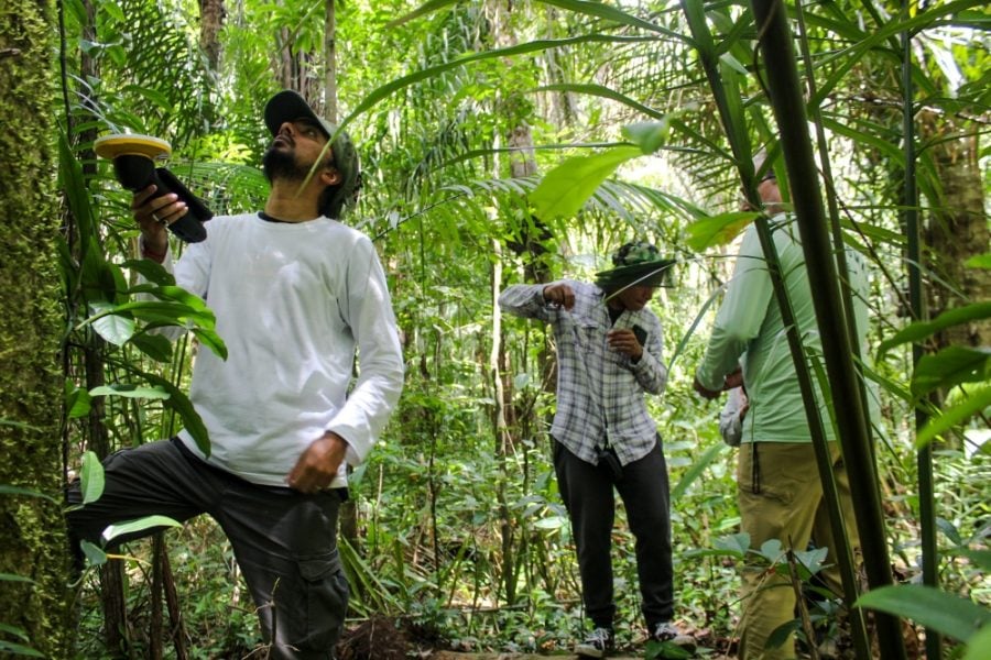
Gathering data in the real world is definitely messy. Thus, another challenge is ensuring the collection of accurate, up-to-date, and context-sensitive data collection while in varied environments. Researchers must contend with several obstacles, such as poor signal in forests, variable terrain, or multipath interference.
Multipath interference is a common and important source of error in Geographic Information Science, particularly in GPS/GNSS data collection. This problem occurs when a GPS signal bounces off surfaces (buildings, water, terrain, dense forest canopies) before reaching the GPS receiver. This interference then causes delays and inaccuracies in position calculation. (If you’ve ever run in a dense forest with a Garmin watch that beeps out an impossibly fast 6-minute mile followed by an annoying slow, 13-minute one, you’ve experienced this phenomenon.)
In other words, collecting data in the real world means recognizing environmental context, positional accuracy, and uncertainty. Therefore, researchers must understand how to quantify and mitigate locational error in spatial datasets. This need is especially true of data in high-precision applications, such as autonomous navigation. Drones used in forest-fire management, for instance, must quickly get to where they need to be. Furthermore, field-collected data must also be integrated with other geospatial datasets: aerial/satellite imagery, census records, or remote sensing products
How FW5554 (GPS Field Techniques) Helps Students Address the Complexities of Data Collection
This hands-on course, which focuses on GPS technology and its applications, emphasizes data collection, processing, and management. Students gain practical experience with various GPS units, learning to ensure data accuracy and quality. They also get experience integrating GPS data with GIS systems–vital for working with UAVs and IoT devices.
Some of the course’s key features include the following:
- Data Collection in the Real World: Students work with state-of-the-art handheld Trimble GPS unit and industry-standard mobile applications, such as FieldMaps, Survey123 and QuickCapture which are crucial for their portfolios (as part of the Modern GeoApps). Thus, they gain hands-on experience using GPS devices and collecting precise spatial data in challenging, obstacle-filled settings.
- Positional Accuracy and Uncertainty: The course covers differential correction techniques and the use of real-time kinematic (RTK) positioning, which are both essential for high-accuracy mapping.
- Integration of Field Data with Other Geospatial Data: Students learn how to format, import, and manage GPS data in GIS platforms, such as ArcGIS. The course also prepares students to handle data transformation, projection alignment, and temporal matching, which are increasingly important for multi-source data fusion in GI Science. The emphasis on using GPS and mobile mapping technologies gives learners a strong base for adapting to newer geospatial tools (drones, IoT, GIS apps).
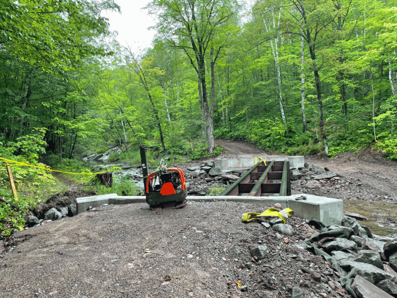
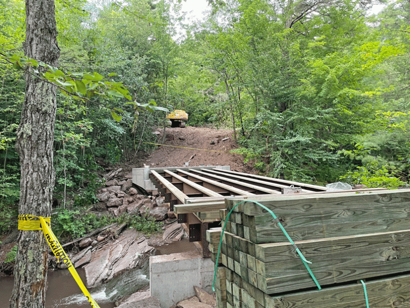
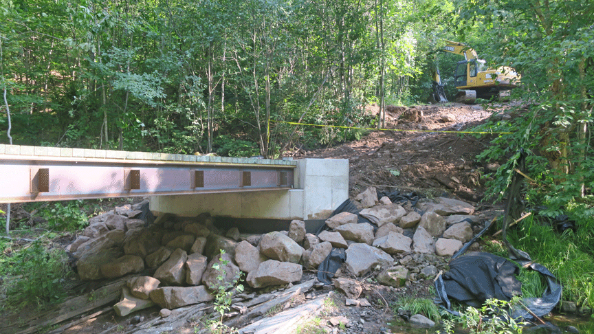
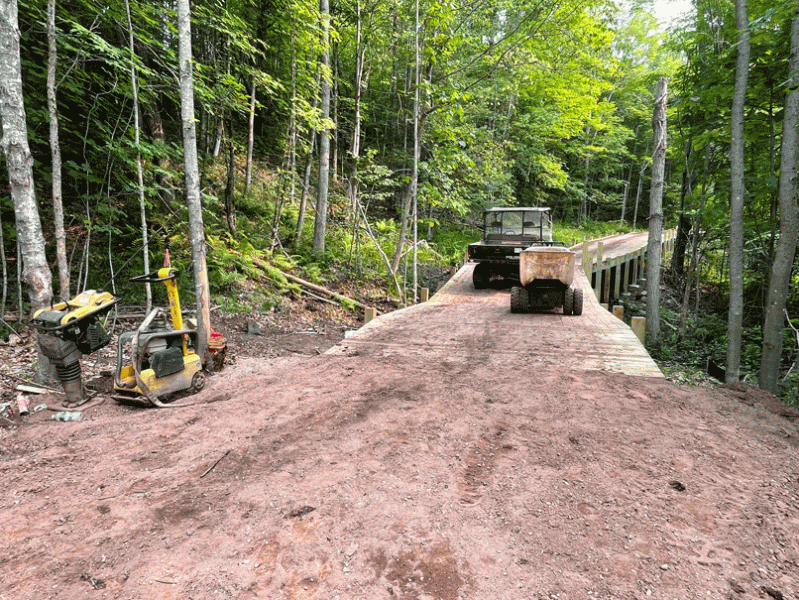
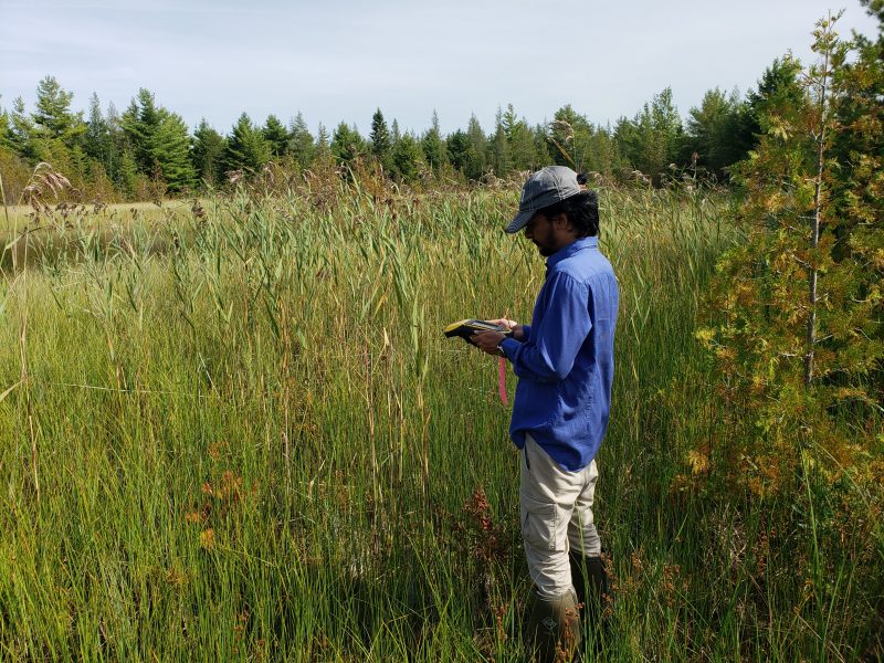
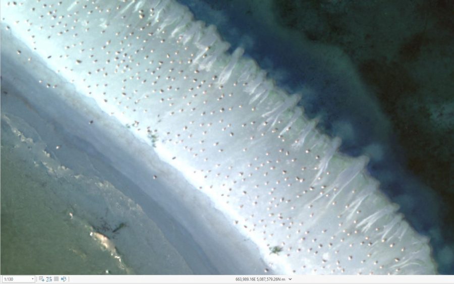
The pictures below, taken from Dr. Bhatt’s trip to Suriname, represent the challenges of collecting data in the field while respecting the input of local knowledge.
GIS Challenge #4: Ensuring Human-Centered and Participatory GI Science
Data of any kind is not neutral. It is not without bias. Therefore, one ongoing challenge to GI Science is ensuring that data collection is more inclusive, especially to underrepresented communities. For inclusive GI Science to happen, though, GIS interfaces and tools must be user-friendly. If they are, participatory mapping, community engagement, and indigenous mapping can deepen both the collection and analysis of spatial data.
HOW FW 4545 (Map Design with GIS) Helps Make GI Science More Inclusive
This course teaches the principles of effective map-making. It also focuses on clear communication for decision-making and inclusive natural resource management. That is, students learn advanced visualization techniques to create accessible, informative maps for diverse audiences, supporting participatory approaches.
Ethical issues in GI Science, such as geoprivacy, data anonymization, equity, and bias in spatial algorithms, are another important topic. On the responsible use of spatial data, the course highlights opportunities to empower local and Indigenous communities by integrating traditional knowledge.
GI Science Challenge #5: Addressing the Effects of Climate Change
Overall, the curriculum of Dr. Bhatt’s first online certificate–Foundations in GI Science for Natural Resources–emphasizes applying GI Science to monitor and analyze changing natural systems. By engaging with real-world datasets and case studies, students develop the skills to update and interpret GIS models. They become adept at analyzing environmental conditions, ongoing trends, and the impacts of climate change.
They also learn to integrate ecological and climatic data. In doing so, they develop comprehensive analyses and predictive models so that they can make informed decisions in natural resource management.
Integrating remote sensing techniques with GIS is also stressed. This skill is pivotal to monitoring deforestation, tracking wildlife movements, and assessing fire risks. Also, through the program’s emphasis on the societal applications of GI Science, students learn how to engage with communities, incorporate local knowledge, and support collaborative natural resource management.
GI Science at MTU: Looking Forward.
All in all, Michigan Technological University’s Online Graduate Certificate in Foundations in Geographic Information Science for Natural Resources is structured to build foundational GIS skills while addressing common technical barriers.
This certificate is just the first of the stackable three that will constitute Michigan Tech’s forthcoming Online Master of Geographic Information Science (MGIS) program. The subsequent certificates will delve deeper into advanced GI Science and remote sensing topics. Their content will further equip students to navigate and utilize modern GIS tools and technologies as they apply natural resource management.
Currently, Dr. Bhatt is running these courses from the first certificate in the Summer: FW5550 (Geographic Information Science) and FW5554 (GPS Field Techniques). And in Fall 2025, these three courses will be available: FW5550, FW5554, as well as FW5553 (Python Programming for GIS). This last course is from the second very-soon-to-be-released certificate: Advanced Geographic Information Science for Natural Resources.
And he’s proud of these courses, too, and their graduates. He enjoys giving his students “hands-on experience with spatial technologies while exploring their real-world applications, from environmental monitoring in the forests and wetlands to solving local and global resource challenges.”
Through Michigan Tech’s global learning opportunities and hands-on programs, I’ve been able to offer a valuable education to students, which helps them not only transform curiosity into capability, but also data into meaningful change.
Learn More About Michigan Tech’s Online GI Science Program.
If you’re interested in diving deeper into this online program and discovering how it can align with your specific career goals or research interests, please contact Dr. Parth Bhatt at ppbhatt@mtu.edu.