The Department of Geological and Mining Engineering and Sciences (GMES) at Michigan Technological University is always looking for opportunities to expand our education and research into new, forward-looking areas. Drone-based geophysics is one such area—an emerging field that is rapidly transforming how we investigate and understand the subsurface.
Drone-based geophysics offers remarkable potential for geoscience and engineering practice. By
combining unmanned aerial systems with advanced geophysical sensors, we can safely and efficiently
collect high-resolution data in challenging or previously inaccessible environments. These capabilities
are reshaping mineral exploration, environmental assessment, hazard mapping, and infrastructure
monitoring.
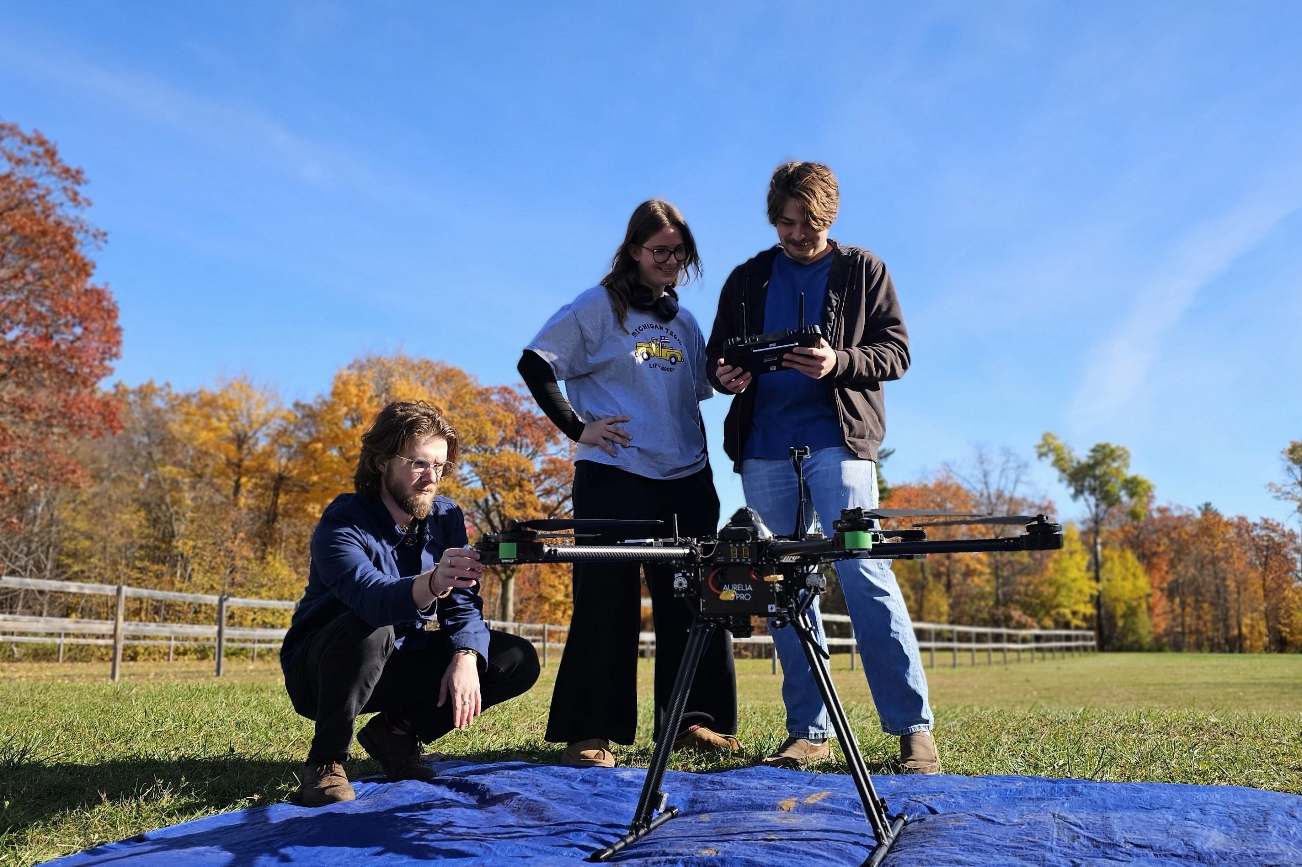
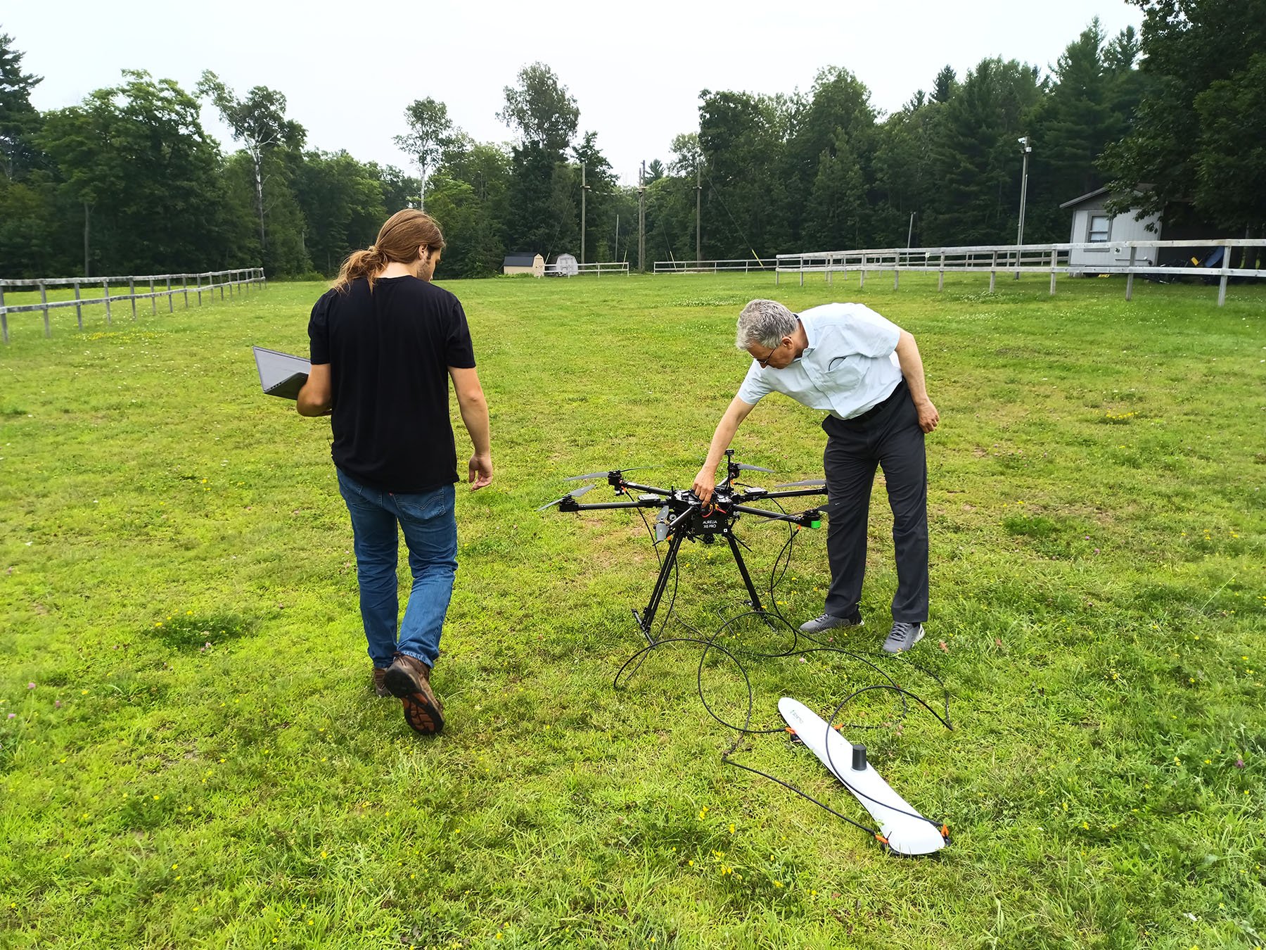
To provide our students with this increasingly sought-after skill set — valued across industry, government agencies, and research organizations — we have launched the development of a new drone-based geophysics curriculum. To support this initiative, the department has acquired a high-capacity Aurelia X6 Pro V2 drone paired with a Geometrics MagArrow II magnetometer, one of the most advanced airborne magnetic systems available. This effort is currently led by Professor Aleksey Smirnov, chair of GMES, together with MS student Samuel Jensen. Both have recently completed comprehensive training and earned professional unmanned aerial vehicle pilot licenses, ensuring safe and compliant deployment of these systems in research and instructional settings.
Our vision is to develop a suite of drone-based geophysics courses covering not only airborne data acquisition but also advanced data processing and visualization. Students will use the state-of-the-art Seequent Oasis Montaj geophysical software — recently acquired to support the Applied Geophysics program — to work with real flight datasets, learn industry-standard workflows, and build strong practical expertise.
Our future research directions include a wide range of potential applications, such as high-resolution magnetic mapping of Precambrian rocks in the Upper Peninsula of Michigan, critical minerals and geological hydrogen exploration, surveys of mine tailings and legacy mining landscapes for environmental and safety assessments, geologic mapping of fault zones and structural features, and magnetic mapping for archaeological investigations.
We are also actively seeking collaborations with other departments and research centers at Michigan Tech, as well as partners outside the university, to broaden the impact and interdisciplinary reach of this developing program.
Looking ahead, we plan to expand our toolkit with additional drone-compatible geophysical methods, including electromagnetics and ground-penetrating radar, further enhancing opportunities for education and research.
We are excited about the hands-on learning and research possibilities that drone-based geophysics will offer, and we hope that this work will inspire more students to join GMES and contribute to the continued success of the department. Stay tuned for updates…