GMES Seminar April 6: Tropical glaciers

Geological & Mining Engineering & Sciences Seminar April 6:
Kyung In Huh, Visiting Scholar, Department of Geological & Mining Engineering & Sciences, Michigan Technological University
and PhD Candidate, Department of Geography and Byrd Polar Research Center, The Ohio State University
Friday, April 6, 2012 3:00pm Dow 610

Title: Assessing the volume and hypsometric changes of the glaciers
in the Tropical Peruvian Andes: Some case studies over Cordillera Blanca

Tropical glaciers are very sensitive to changes in climate due to the low latitude radiation regime and steep vertical mass balance gradients. These mountain glaciers have rapidly retreated over the 20th century, raising concerns about downstream regional water supplies under continued global climate change. Monitoring tropical glaciers using remotely sensed data has drawn a great attention in earth science communities for decades and time-lapse analysis of sensory data has
provided important variability information of tropical glacier recession. The motivation of this study is to refine a surface area to volume relationship for tropical glaciers to enable extrapolation of more detailed inventory of glacier volume and water resources. This study
focuses on the glaciers in the Cordillera Blanca in Peru, within the world’s largest concentration of tropical glaciers, to assess the volume and topographic changes over the late 20th century. A combination of LiDAR (Light Detection and Range) data achieved in 2008, DEMs (Digital Elevation Models) from vertical aerial photographs taken in 1962 by stereo-photogrammetry, and multispectral ASTER (Advanced Spaceborne Thermal Emission and Reflection Radiometer)
imagery taken during 2001 – 2008 with geospatial techniques are used for this research. These airborne and Spaceborne imagery can reveal both current glacial surface topography and glacial
profiles 46 years back, enabling calculation of the total volume loss trend over the last 46 years.

The resulting improved understanding of how tropical glacier mass changes in response to climate dynamics is critical for global climate modeling, which can reliably predict future glacier changes only after accurately simulating the past.

Alumni Jim Wark Awarded Aerial Photographer of the Year 2012

Jim Wark has been honored for the third time by Aerial Photographers Association. He is a Michigan Tech Geological and Mining Engineering and Sciences graduate with a BS in both geological engineering and mining engineering  in 1954 and is a member of the Academy (2006).
The Professional Aerial Photographers Association International (PAPA) is pleased to announce that Jim Wark of Pueblo, CO has been selected to receive the 2012 EPSON Aerial Photographer of the Year award.
Each year, this award is presented to one PAPA member who has demonstrated an outstanding contribution to aerial photography, based on the following criteria:
•Continuous excellence in aerial photography
•In the public eye via books, exhibits, lectures, publications
•Long term service to PAPA and its members

“Jim was the outstanding candidate for the award,” said Chuck Boyle, president of PAPA. “In addition to his extraordinary body of aerial photography work in the public eye, he is also a generous contributor of guidance and inspiration to the membership of PAPA.”
“On behalf of the PAPA membership and the entire PAPA Board of Directors, we congratulate Jim on this award.”
This year Jim has published his 9th book of his aerial photography, Leave No Trace, The Vanishing North American Wilderness. Additionally, five of his aerial images were selected for the new United States Postal Service “forever” postage stamps scheduled to be released in October of this year.
“My life’s work has been in aviation and earth sciences,” said Jim. “Combining these interests with an inherited instinct for photography has fulfilled my deepest ambition.”
“I am forever grateful to my wife, Judy, who gave me the unconditional support to wander the sky at will and to PAPA for providing the inspiration, assistance and camaraderie to get the job done. This award and the EPSON award of 2006 are among my most cherished achievements.”
This is the second time Jim has been honored for his work by PAPA with this award having been named the Aerial Photographer of the year in 2006, the first year it was awarded. He was also honored with a Lifetime Achievement Award by PAPA in 2005.
Jim Wark owns Airphoto (www.airphotona.com) in Pueblo, CO. During his 59 years as an aviator and 24 years of aerial photography, Jim has amassed a collection of more than 100,000 stock aerial images from Alaska and Hawaii, across America and Canada and to as far south as Grenada in the Lesser Antilles. His website offers more than 15,000 images online meticulously key-worded for the serious photo buyer. In addition to his books, Jim’s aerials have been published in textbooks, calendars, posters and magazines worldwide.

The Epson Aerial Photographer of the Year award, a commemorative etched crystal eagle, was presented at the PAPA International Annual Conference on March 4, 2012 which took place near Miami, FL. The award is sponsored by Epson and Logix of Michigan, sellers of Epson and other professional printers & printing supplies.
PAPA is a professional trade organization, whose members are aerial photographers throughout the world. The association’s goal is that of an educational group, dedicated to the promotion of high business ethics and helping members to provide quality service and products through shared experience. www.PAPAinternational.org

Society of Exploration Geophysicists Challenge Bowl

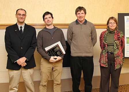
Two students from the geological and mining engineering and sciences department were runners-up at the Society of Exploration Geophysicists (SEG) Challenge Bowl recently. Josh Richards, a PhD candidate in geophysics, and Chad (Danford) Moore, a senior in applied geophysics, took second place at the Sixth Annual Sooner Challenge Bowl at the University of Oklahoma in Norman.
View a larger photo of the award

The SEG Challenge Bowl is an international contest testing students’ breadth and depth of knowledge about the field of geoscience. The quiz-show format features intense competition, as the contestants attempt to buzz in first with the answers to challenging geoscience questions.

Departmental Seminar

Title/Abstract

Beauty and the Beast: Using EarthScope, Sense of Place and the Landscapes of Our National Parks to Engage the Public on the Scenery and Geological Hazards of the United States

Presenter

Robert J. Lillie, PhD, Certified Interpretive Trainer, Emeritus Professor of Geosciences
Oregon State University
E-mail: lillier@geo.oregonstate.edu
Web: http://geo.oregonstate.edu/~lillier

Date

March 20, 2012 2 pm Dow 610

Pennington Gives Talk at Portland Museum on Earthquakes

Department Chair Dr. Wayne Pennington  gave a talk on the Haiti and Japan earthquakes at the Oregon Museum of Science and Industry (OMSI) Science Pub night at Portland Oregon recently. The entire talk. titled “Scientific and Humanitarian Lessons from the Haiti and Japan Earthquakes”  can be viewed from the Youtube link:   Link to Video 1 hr 16 min
Details about the talk in this OMSI web publication:

New Mineral Named for Seaman Museum Curator

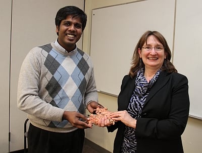
A new mineral discovered in the Mammoth-St. Anthony mine in Arizona has been named georgerobinsonite. The mineral is named after George W. Robinson, professor of mineralogy and curator of Michigan Tech’s A. E. Seaman Mineral Museum. It is a lead chromate—a salt of chromic acid—that occurs as minute, transparent, orange-red crystals on cerussite, another lead carbonate and secondary lead mineral.

MORE

Full Scale Coastal Experiments….from Flying Buoys to Caribou Hunters

Date and Location

Feb 8, 3-4pm, Dow 642

Presenter

Dr Guy Meadows, Univ of Michigan and adjunct professor, GMES

Abstract

Over the past several years, the Ocean Engineering Laboratory (OEL) of the University of Michigan has been involved in the design, fabrication and deployment of a wide variety of Great Lakes and coastal ocean environmental monitoring platforms. These platforms are all either, semi- or fully-autonomous in the execution of their respective missions and capable of producing real-time data.  The development of these platforms offers a glimpse into the possible future of advanced aquatic sensing and long term, open water, measurement persistence. Examples of the utilization of these and other environmental sensing platforms, many developed jointly with MTU, will be provided.  Applications to a variety of Great lakes and coastal ocean environments will be discussed including searching for evidence of Paleo-Indian occupation of what is now the submerged Alpena-Amberley, central ridge of Lake Huron.