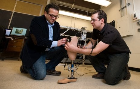
 Mo Rastgaar is poised to take a giant step forward in the development of a better prosthetic ankle.
The Michigan Technological University mechanical engineer and his team have already developed a prototype that can provide a range of motion that rivals a natural gait. Next, they aim to give their robotic ankle something different: eyes.
Read More
 Fluorescent bands of color outline the Great Lakes on a new, comprehensive map of the region’s coastal wetlands. This publicly available map is the first of its kind on such a broad scale — and the only one to trump political boundaries. Both Canadian and US wetlands are shown along more than 10,000 miles of shoreline.
The Great Lakes is an important focus of Michigan Technological University research. The coastal wetlands map is an extension of that focus, expanding on previous maps created through the Michigan Tech Research Institute (MTRI).