Category: Research

NSF Funding for Chad Deering on Magma Storage Assessment

Chad Deering
Chad Deering

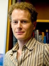
Chad Deering (GMES/EPSSI), is the principal investigator on a project that has received a $250,718 research and develop grant from the National Science Foundation.

The project is titled “Assessing Changes in the State of a Magma Storage System Over Caldera-Forming Eruption Cycles, a Case Study at Taupo Volcanic Zone, New Zealand.”

This is the first year of a potential three-year project which could total $349,665.

By Sponsored Programs.

ABSTRACT

The largest volcanic eruptions are rare events but can represent a global catastrophe. Smaller eruptions may still have significant (billions of dollars) economic impacts and may affect the lives and livelihoods of large numbers of people, even in places distant from the erupting volcano (e.g., the relatively small eruption in Iceland in 2010). This project focuses on the Taupo Volcanic Zone (TVZ) in New Zealand as a case study of a large and very active volcanic system, and will focus on developing a better understanding of how the temperature and mobility of a magma body below the surface changes before, during, and after a major eruption. This study will contribute to our understanding of the volcanoes that produce such large eruptions (for example, Yellowstone volcanic system in the US), and will provide critical context for interpretation of real-time hazard monitoring at these and other active volcanoes. In addition, the project will include research experience for a K-12 teacher and development of new standard-based physics, chemistry and mathematics curriculum that will be disseminated broadly.

Read more at NSF GeoPRISMS.

63rd Annual Institute on Lake Superior Geology

Institute on Lake Superior Geology

The Ontario Geological Survey, Ministry of Northern Development and Mines and the A. E. Seaman Mineral Museum teamed up to co-host the 63rd Annual Institute on Lake Superior Geology held in Wawa, Ontario May 8-12.

This professional meeting consisted of two days of technical sessions with 29 oral and 22 poster presentations. There were three geological field trips before the technical sessions and three after.

The meeting was attended by 137 geologists from the US and Canada. Academic institutions (58 members), government agencies (28 members), and mining and consulting companies (36 members) were well represented among attendees.

Margaret Hanson, museum assistant director, served as registrar for the meeting while Ted Bornhorst, museum executive director and professor, organized the meeting sessions, handled finances and decided on travel awards to students.

The Institute publishes technical volumes in hard copy for each meeting and offers them open-access online after the meeting is completed.

Bornhorst and Hanson co-edited the Institute on Lake Superior Geology, Proceedings Volume 63, Part 1: Program and Abstracts (97p.). They also compiled Part 2: Field Trip Guidebook (204p.).

The Institute is well regarded for its high quality field trips having recently won a national award from the Geoscience Information Society for the Outstanding Geologic Field Trip Guidebook Series.

The Institute initiated a new annual award for 2017, Pioneer of Lake Superior Geology, to recognize those individuals who made significant contributions to the understanding of the geology of the Lake Superior region primarily prior to the Institute’s awarding of the prestigious annual Goldich Medal in 1979.

The first Pioneer of Lake Superior Geology is Douglass Houghton (1809-1845). Bornhorst nominated Houghton for the award and wrote, along with Larry Molloy, President of the Keweenaw County Historical Society, the two-page biographical sketch published in the Proceedings Volume. As the first speaker for the technical sessions, Bornhorst provided the highlights of the important attributes that contributed to Houghton’s success.

By Ted Bornhorst, A. E. Seaman Mineral Museum.

ERUPT: Report Identifies Grand Challenges for Scientific Community to Better Prepare for Volcanic Eruptions

Despite broad understanding of volcanoes, our ability to predict the timing, duration, type, size, and consequences of volcanic eruptions is limited, says a new report by the National Academies of Sciences, Engineering, and Medicine. Meanwhile, millions of people live in volcanically active areas around the world.


ERUPT - NAP report
ERUPT: A National Academies report published in April 2017

Volcanic Eruptions and Their Repose, Unrest, Precursors, and Timing (ERUPT) identifies grand challenges for the scientific community to better prepare for volcanic eruptions. Michigan Tech volcanologist Simon Carn (GMES) was an author on the report, and served with 11 other volcanologists and scientists on the Committee on Improving Understanding of Volcanic Eruptions that prepared the report. Their goal: improving eruption forecasting and warnings to save lives.

According to the NAP media release on the report, “Volcano monitoring is critical for forecasting eruptions and mitigating risks of their hazards. However, few volcanoes are adequately observed, and many are not monitored at all. For example, fewer than half of the 169 potentially active volcanoes in the US have any seismometers–an instrument to detect small earthquakes that signal underground magma movement. And only three have continuous gas measurements, which are crucial because the composition and quantity of dissolved gases in magma drive eruptions. Enhanced monitoring combined with advances in experimental and mathematical models of volcanic processes can improve the understanding and forecasting of eruptions.”

“This report was requested by NASA, NSF and USGS, the three main sources of funding for volcano science in the US, to identify some of the grand challenges in the field,” says Carn. “It was a privilege to serve on this distinguished committee and help craft a document that we hope will guide and strengthen future research efforts in volcanology.”

“The National Academies convenes committees of experts to review the current understanding of pressing issues and identify priorities for future progress in addressing the issues,” adds Michigan Tech  Department Chair John Gierke (GMES). “Committee reports play important roles in formulating government policies and setting priorities for funding scientific research. Dr. Carn is a global leader in remote sensing for monitoring volcanic emissions and surely contributed a comprehensive assessment of the state of knowledge and recommend how different disciplinary fields could bring new perspectives and approaches to advance the understanding of volcanic hazards.”

Electronic (free) and hard copies ($40) of Volcanic Eruptions and Their Repose, Unrest, Precursors, and Timing are available online. More information is available in the NAP media release about the report.

The 2016– 2017 Eruption of Bogoslof Volcano, Aleutian Islands, United States

Bogoslof, a remote, mostly submarine volcano in the Aleutian Island arc began erupting in late December 2016 and activity continues as of February 2017. The Bogoslof eruption highlights several of the challenges facing volcano science. Over one month, the volcano produced numerous explosions with plumes rising 20,000–35,000 ft, posing a significant hazard to North Pacific aviation. There are no ground-based instruments (e.g., seismometers) on the volcano, and so the USGS Alaska Volcano Observatory (AVO) has been relying on distant seismometers, satellite data, infrasound, and lightning detection to monitor activity (Challenge 3). Bogoslof’s submerged vent obscures any preemptive thermal or gas signals, and infrasound and lightning are detectable only after eruptions have begun (Challenge 1). AVO has been unable to provide early warning of these hazardous events. The eruption also highlights our limited understanding of magma–water interactions and raises important questions regarding the controls on phreatomagmatic explosivity, column altitude, ash removal, and pauses (Challenge 2). In more than 20 discrete events, the emerging volcano has reshaped its coastlines repeatedly, providing snapshots of volcano–landscape interactions. The figure below shows the first evidence for an ash-rich (brown-grey) plume, almost one month into the eruptive activity.

Excerpted from Volcanic Eruptions and Their Repose, Unrest, Precursors, and Timing, National Academies of Sciences, Engineering, and Medicine, April 2017


Bogoslof Volcano
Image from the Moderate Resolution Imaging Spectroradiometer (MODIS) aboard NASA’s Terra satellite showing an eruption plume from Bogoslof volcano on January 18, 2017. The red dot at the base of the eruption cloud is a thermal anomaly on the volcanic edifice. Inset shows a high-resolution image of the volcano from January 11, 2017, with subsequent morphological changes indicated (image courtesy of USGS/AVO).

Simon Carn Comments on Kambalny Volcano Activity

The Daily Mail (London) published an article about the eruption of a large Russian volcano. The article quoted Tech volcano expert Simon Carn (GMES).

Stunning footage shows a giant Russian volcano violently erupting for the first time in 250 YEARS

  • The 7,103ft tall (2.2km high) Kambalny volcano is in the Kamchatka peninsula in the far east of Russia
  • The colossal volcano recently became active and spewed out a 60-mile long ash plume visible from space

Nasa scientists warned that the volcano may have spewed out large amounts of sulphur dioxide (SO2), which is harmful to human lungs.

The higher SO2 amounts downwind could be due to multiple factors, including variable emissions at the volcano (such as an initial burst), increasing altitude of the plume downwind or decreasing ash content downwind,

Simon Carn, an atmospheric scientist at Michigan Technological University, told the Earth Observatory.

Read more at the Daily Mail, by Will Stewart.

Kambalny Volcano Plume
Kambalny Volcano ash plume on March 25, 2017. Image from NASA Earth Observatory

Simon Carn (GMES) discusses sulfur dioxide emissions in an article accompanying a NASA Image of the Day showing the extent of the fires in Mosul, Iraq.

Sulfur Dioxide Spreads Over Iraq

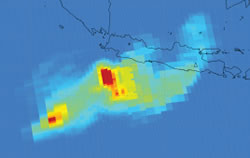
Sulfur PlumeIn June 2003, atmospheric scientists at NASA’s Goddard Space Flight Center and the University of Maryland, Baltimore County, used satellites to track how much sulfur dioxide streamed into the atmosphere from a fire at a sulfur mine and processing facility near Mosul, Iraq. They calculated that the fire at Al-Mishraq, which burned for nearly a month, released 21 kilotons of toxic sulfur dioxide per day. That is roughly four times as much as is emitted each day by the world’s largest single-source emitter of sulfur dioxide, a smelter in Noril’sk, Russia.

More recently, sulfur dioxide has been lofted to higher altitudes where it may undergo long-range transport. —Simon Carn

Read more at NASA Earth Observatory, by Joshua Stevens and Adam Voiland.

In the News

News outlets around the world covering the Mosul, Iraq fires quoted Simon Carn (GMES) for his work in sulfur dioxide emissions. The original story was posted by NASA’s Earth Observatory along with satellite images; news outlets include ABC News, Nature World News, Yahoo News and a number of science blogs.

By Allison Mills.

Volcanology Research by Simon Carn in Smithsonian Magazine

Earthquakes and Volcanoes

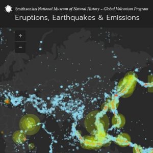
The Smithsonian Magazine referenced Simon Carn’s (GMES) volcanology research, which seeks to incorporate emissions data into the Smithsonian database, in a feature story along with an interactive map.

How Earthquakes and Volcanoes Reveal the Beating Heart of the Planet

Earthquakes and volcanoes can conjure up images of widespread destruction. But for those who study Earth’s deepest reaches, like Elizabeth Cottrell, a research geologist at the Smithsonian’s National Museum of Natural History and director of the Global Volcanism Program, volcanoes are also “windows to the interior.”

“Global satellite monitoring of volcanoes will transform our understanding of gas fluxes from Earth’s interior to exterior in the coming decade,” says Cottrell, who has been working along with Michigan Tech researcher Simon Carn and data manager Ed Venzke to incorporate volcanic emissions into the Smithsonian database since 2012.

Read more at Smithsonian Magazine, by Rachel E. Gross.

New Publications for Snehamoy Chatterjee

CERD 2016
CERD 2016

Snehamoy Chatterjee (GMES) recently published two new papers:

Open-pit coal mine production sequencing incorporating grade blending and stockpiling options: An application from an Indian mine” in the Journal of Engineering Optimization, DOI: 10.1080/0305215X.2016.1210312

Influence of surface tension gradient on liquid circulation time in a draft tube airlift reactor” in the journal of Chemical Engineering Research and Design, 113 (2016) 241-249

From Tech Today.

Engineering Optimization 2016

Tarshizi Nominated by the SME as a Henry Krumb Lecturer

Ebrahim Karimi Tarshizi

Ebrahim Tarshizi, an assistant professor of mining engineering, has been nominated by the Society of Mining, Metallurgy and Exploration (SME) as a Henry Krumb Lecturer for the 2016-2017 series.

Tarshizi presentation for this year’s series is “Simulation and Animation of Marigold Mine with Dynamic Pit Operation.” SME Henry Krumb Lectures will be scheduled from October 2016 to May 2017.

Read more at Tech Today, by Kelly McLean.