Category: Uncategorized

From High School Advanced Geology (HSAG) to GMES Student Spotlight

Meet Miah: A Passion for Geosciences and the Outdoors at Michigan Tech

Miah Mol

This fall, GMES welcomed a new member to the department: Miah Mol, an undergraduate student from Hudsonville, Michigan, pursuing a degree in geology and applied geophysics with plans to graduate in 2028. Discover how taking High School Advanced Geology (HSAG) in high school prepared Miah for success in geology at Michigan Tech. Her Q&A highlights the beauty of the campus, the GMES department’s excellence, and the opportunities available to proactive students.

Q: How did HSAG impact your decision to study geosciences or engineering?

A: Taking HSAG in high school solidified my want to study geosciences in college and made me 10 times more excited for my future in geology!

Q: Why did you choose Michigan Technological University?

A: The location is absolutely gorgeous, and there is so much to do outdoors, no matter the weather. The GMES department is also top-notch compared to most other universities.

Q: How did HSAG help you succeed at MTU?

A: Taking HSAG allowed me to advance into higher-level GMES classes during my first year, putting me a year ahead of most other GMES majors.

Q: What is the best advice to give a current HSAG student?

A: Work hard to succeed in your HSAG class and get college credit. It is 100% worth it!

Q: What do you like best about the Department of Geological and Mining Engineering and Sciences at Michigan Tech?

A: What I love most about the GMES department is the abundant research opportunities.

Q: What’s a standout story or lesson you’ve gained during your journey with GMES? 

A: In the GMES department, I have learned that if you know what you want, you can ask for it, and GMES can make it happen; you just need to take the first step!

Miah is enjoying her time in the Upper Peninsula of Michigan.
Miah takes in the Northern Lights.

Congratulations, Fall 2024 Graduates!

Completing a college degree requires tremendous effort, dedication, and sacrifice, and you’ve made it happen. Congratulations on your success!

The Department of Geological and Mining Engineering and Sciences is immensely proud of your well-deserved achievement. This is a momentous occasion and a testament to your dedication and perseverance. You should feel proud of your accomplishments and the bright future that awaits you.

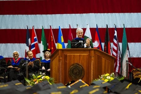
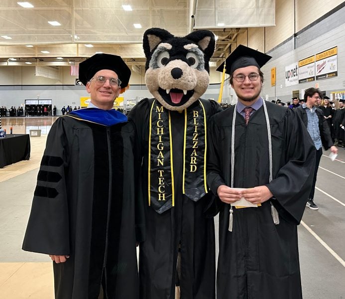
A moment from the MTU 2024 spring graduate commencement, captured by Kaden Staley.

Master of Science Degrees Awarded Fall 2024

  • Large, Conor  MS Geology, Advised by Luke Bowman
  • Sanchez Aguilar, Jhuleyssy  MS Geological Engineering, Advised by Snehamoy Chatterjee
  • Kunle, Bejide  MS Geology, Advised by Luke Bowman
  • Targbwe, Rapheka  MS Mining Engineering, Advised by Luke Bowman
  • Addai, Charles MS Mining Engineering, Advised by Snehamoy Chatterjee
  • Wiafe, Benitta MS Mining Engineering, Advised by Luke Bowman
  • Cocke, Ryan MS Geology, Advised by Luke Bowman
  • Donkoh, Isaac (M50484414) MS EMG, Advised by Luke Bowman
  • Yeboah, Maxwell Yeboah (M33730552) MS EMG, Advised by Luke Bowman

Bachelor of Science Degrees Awarded Fall 2024

  • Seth Farmer, B.S. Geology
  • Noah Hodson, B.S. Mining Engineering (Cum Laude)
  • Tanner McDonald, B.S. Geology
  • Anton Smirnov, B.S. Geology

Certificate Graduates

  • Locklear, Dakota Geoinformatics
  • Milanzi, Nyasha  Geoinformatics
  • Kavousi, Sara Natrl Hazds & Disaster Rsk Red
  • Yeboah, Maxwell Yeboah  Geoinformatics
  • Odoh, Izuu  Geoinformatics
  • Krier, Jacob  Natrl Hazds & Disaster Rsk Red
  • Krier, Jacob  Geoinformatics
  • Brodowski, Ella Natrl Hazds & Disaster Rsk Red (not in GMES)
  • Large, Conor Natrl Hazds & Disaster Rsk Red
  • Aghaei, Nelly Natrl Hazds & Disaster Rsk Red
  • Kunta, Rishitha Geoinformatics

Award & Scholarship Recipients

  • Outstanding GTA Award Sananda Ray
  • Outstanding Scholar Jhuleyssy Sanchez Aguilar
  • Avery Spalding Clarissa Gordon DeCleene 
  • Rapheka Targbwe WAAIME Scholarship
  • Oden Horne WAAIME Scholarship
  • Alice Schmaltz 2024 Copper Club Scholarship
  • Gustavo Bejar Lopez 3MT & Nat
  • Natalie Sorensen 2024 AIPG Undergraduate Scholarship
  • Konraad VanDyke AIPG Michigan Section Mozola Scholarship

Take a moment to reflect on all you have accomplished and the invaluable support you’ve received along the way. Your success is a testament to your hard work and the encouragement of those around you. Congratulations again to the graduates, and best wishes for a bright and prosperous future!

Kaden Staley documents the joy of MTU’s 2024 spring graduate commencement.
Spring 2024 undergraduate commencement ceremony.


Geoinformatics Graduate Certificate Ask and Answer with Nyasha Milanzi

Connect with Nyasha on LinkedIn: linkedin.com/in/nmilanzi/

Nyasha Milanzi, MS Sustainable Communities, 2025

Advisor: Chelsea Schelly
Home City: Harare, Zimbabwe

Nyasha pursued the Geoinformatics Graduate Certificate to enhance her spatial data analysis skills and address critical environmental challenges like climate change and wildfires. One highlight was analyzing the historic John Snow cholera data, which revolutionized public health research and paved the way for disease prevention and drug development advances. She also explored COVID-19 data, examining the varied impacts of state policies, a particularly relevant topic given that more than half of her undergraduate studies took place during the pandemic.   Equipped with GIS, Python, and statistical tools, she plans to continue researching and working on projects that improve health and economic well-being in underserved communities. She also plans to pursue a PhD in the future. Keep reading to learn how this program can elevate your career and empower you to solve global environmental issues!

Q: What GMES Graduate Certificate will you receive this December 2024?

A: Geoinformatics

Q: What motivated you to pursue this certificate?

A: I wanted to enhance my spatial environmental data analysis, management, and analysis skills. 

Q: What were the most valuable skills or knowledge you gained?  

A: I discovered the power of maps as tools to solve some wicked environmental challenges of our generation, such as climate change and its associated impacts, such as wildfires. 

Q: What part of the coursework did you enjoy the most?  A: I loved working with interesting datasets. One of the most memorable was the John Snow dataset from 19th-century England, which provided crucial evidence that cholera was a waterborne disease. This groundbreaking discovery revolutionized public health research and paved the way for disease prevention and drug development advances.

Connect with Nyasha @afroscicomm on Instagram: instagram.com/afroscicomm/

Q: After completing the certificate, do you feel more confident in a particular skill or area?  

A: Yes, I’m very confident in analyzing environmental data using a combination of Python Scripts, GIS, and Statistics. 

Q: What’s your next step after completing this program?  

A: I hope to continue to apply the skills in a role I will secure after my Master’s, as well as in individual and independent research I plan to do in Food, Energy, and Water Systems

Q: Do you plan to pursue any further education or certifications?  

A: Yes. I see myself pursuing a PhD and using some of the tools in my research.

Q: Would you recommend this program to others? If so, why?  A: Yes. If you like programming, GIS, and solving environmental challenges, this certificate is for you.

Building connections, one marshmallow, bracelet, and cup of cocoa at a time!

The Geological and Mining Engineering and Sciences Department (GMES) is home to a close-knit community of undergraduate and graduate students in mining engineering, geology, geological engineering, and geophysics. While we may be a smaller department, we pride ourselves on fostering meaningful connections among our students. Whether through game nights, campfire marshmallow roasting, tea times, or movie nights, we repeatedly prove that GMES truly rocks!

On Tuesday, December 3rd, GMES welcomed all Huskies to our Atrium for a day of creativity and connection. We created a warm and inviting atmosphere with hot cocoa, brownies, and friendship bracelet supplies. The event had a fantastic turnout, and we hope the memories made will remind everyone of their cherished time at MTU for years to come.

A woman, Angela, stands in front of large windows with a view of the outdoors, holding a steaming cup of hot cocoa in both hands. She is gazing contentedly, with soft natural light highlighting her face and casting gentle shadows behind her.
Angela Amoh, who expects to graduate with her MS in mining engineering next fall (2025), tastes the hot cocoa.
Jhuleyssy Liesseth Sánchez Aguilar, who completed her MS in geological engineering this month, stands next to MTU Senate President Robert Hutchinson from the College of Business.
Audrey Fall (left) and Sarah Woodworth (right) are majoring in geology. Are you following @mineral_rescue on Instagram?
Jhuleyssy and Sarah chat while they create bracelets.
Pictured left to right: Sara Kavousi, Benjamen Udota, and Angela Amoh.
MTU beaded bracelets.
December 3rd, 2024.

Michigan Tech’s GMES Department Receives State-of-the-Art Software from PE Limited

MOVE, a geologic modeling software, provides a full digital environment for best-practice structural modeling to reduce risk and uncertainty in geological models.

Michigan Technological University’s Department of Geological and Mining Engineering and Sciences (GMES) has received a generous donation from PE Limited, a global leader in petroleum engineering software. The $2,764,444.11 contribution consists of ten licenses for the state-of-the-art MOVE suite. This innovative software will be critical in advancing education and academic research by enabling cutting-edge structural modeling and minimizing risk in geological models.

GMES will install the MOVE software in a computer lab and integrate it into the curriculum, transforming structural geology education for undergraduate and graduate students. Courses like GE3050 Structural Geology, a requirement for GMES undergraduates, and graduate-level classes will leverage this powerful tool to enhance learning outcomes. Furthermore, MOVE will play a vital role in academic, non-commercial research on tectonics and structural geology, including mapping Michigan’s iconic Keweenaw Fault and other complex systems in the Upper Peninsula.

Dr. Aleksey Smirnov, Chair of the GMES Department, believes in the donation’s transformative impact. “This generous donation from PE Limited is a game-changer for our department,” said Dr. Aleksey Smirnov. It empowers our students and researchers to work with industry-leading tools, elevating their education and research to the next level.”

Since its founding in 1990, PE Limited has been developing software solutions for the oil and gas industry. PE Limited supports accredited universities offering advanced geology and petroleum engineering programs through its educational licensing program, fostering the next generation of industry innovators.

Learn more about the MOVE suite and its role in shaping geologic modeling excellence.

Do you know why MTU stands today?

Today (12.6.2024) is National Miners Day to honor the miners who provide the raw materials and minerals essential to our nation’s needs. Without mining, we wouldn’t have the critical materials that build our homes, infrastructure, electronics, or the resources that fuel our economy. From the roads we drive on to the technology we depend on, mining is the foundation of modern life. They are the reason MTU stands today!

Michigan Tech campus as captured using a drone.

Michigan Technological University (MTU) was founded in 1885 as the Michigan Mining School (MSM). In the mid-19th century, the discovery of copper in Michigan’s Upper Peninsula led to a surge of prospecting and speculation in the Houghton area. However, early mining attempts often failed due to a lack of technical knowledge. Recognizing this gap, the State of Michigan established a school dedicated to training professionals to develop the state’s copper and iron mining industries.

An early sketch of the Cliff Mine shows mine buildings in the background and stumps and logs in the foreground. The illustration is attributed to “Lossing-Barritt,” probably referring to Benson John Lossing and William Barritt, active illustrators of the late Nineteenth Century—photo courtesy of Michigan Tech Archives.

Although Governor Blair signed a bill to create the Michigan Mining School in 1861, the Civil War delayed funding and implementation. The state did not allocate the necessary funds until 1885, and in 1886, the school officially began operations. With a faculty of four and an initial enrollment of 23 students (9 to start, but increased to 23 by mid-year), the first classes were held in the basement of the Houghton Fire Hall (now known as the Continental Fire Co). By 1891, the school had more students than any such school in the country! GMES faculty and students now utilize state-of-the-art labs and equipment to drive their studies forward.

The first School Principal and Department Head, Albert Williams, Jr., was born in California. He is said to have graduated from Princeton. He worked for the United States Geological Survey (USGS) from its conception in 1879 until he moved to Houghton in 1886. After only working one year at MSM (he returned to USGS, where he worked for approximately 12 more years. Williams had three USGS publications on mineral statistics and two papers about precious metal ore deposits. He co-authored four others on mineral mining statistics with John Wesley Powell.

Oh, how photography has evolved over the years! Thanks to the Michigan Tech Archives, Albert Williams, Jr.’s portrait is preserved and made available.
This is a photo of Houghton’s original town hall and first home of Michigan Mining School, courtesy of Michigan Tech Archives. The rent was $25 per month, covering equipment costs and staff payroll.

What classes did the first students here take compared to today’s curriculum? We know they learned the following, but we can’t help but imagine what they would have thought about our Drilling & Blasting class:

  • Mining Engineering – Covering the principles and practices of mining, including mine design, operations, and safeguarding.  (Knowing the safety protocols have been refined is comforting.)
  • Geology and Mineralogy – Essential for understanding the ore deposits of the Keweenaw Peninsula.
  • Chemistry – Focused on chemical analysis for mining applications.
  • Mathematics and Physics – Providing the foundational knowledge needed for engineering calculations.
  • Surveying – Vital for mapping and planning mining operations.

These courses were designed to meet the practical needs of the mining industry, aligning with the school’s mission to support the region’s economic development. Over time, the curriculum evolved to include broader engineering and scientific disciplines, eventually leading to the university’s modern, diversified offerings.

Surveying equipment, Michigan Mining School. Photo courtesy of Michigan Tech Archives.

The Mining Club, a branch of the American Institute of Mining Engineers, was organized in the winter of 1930 so that mining students might hear men of experience in mining work and might discuss and demonstrate modern methods. Membership was limited to the current mining and geological students of twenty-four. It met every other week in the clubhouse if conditions permitted. Every other meeting was a business meeting, which included a discussion by the student members of some interesting topic. At the different sessions, an outside speaker discussed with the club members some engineering subjects of interest to both the guest speaker and the club. As demonstrated through our engaged AIPG student chapter, clubs are as crucial to students now as they were a century ago.

The group photo of the 1934 Mining Club (courtesy of Michigan Tech Archives) captures the timeless elegance of student attire from nearly a century ago.

With its historical roots in mining, MTU has built a strong reputation in geology. Its geological engineering program is highly esteemed for its focus on applied fieldwork and resource exploration, while the field geology and field geophysics courses are particularly outstanding.

Field geology with engineering applications during the summer of 2024.
Ryan Cocke provided images from the geology field class Dr. Chad Deering taught in 2024. After this wrapped up, Dr. Jeremy Shannon instructed field geophysics.

The school’s first official seal, which utilizes a rock hammer as a background for the letters MSM, highlights the mining and geology disciplines that comprised its main course of study. The university’s original mission was to educate engineers and professionals to support the mining industry, vital to the local economy. We pay tribute to this heritage through solid programs in mining engineering, geological engineering, and related fields. Nearly 100 percent of MTU mining engineering grads find employment within their field of study, enlist in the military, or enroll in graduate school within six months of graduation.

MSM logo

MTU’s legacy in mining has helped shape its identity as a leader in engineering, technology, environmental science, and beyond. While the university’s offerings have diversified to include disciplines like AI, business, cyber security, and nursing, its connection to mining continues to define its academic and cultural heritage. Preserving historic copper mining records is at the heart of an exciting new project at MTU led by James DeGraff.

In the A.E. Seaman Mineral Museum, we see the essence of our department. Founded initially within our department, this remarkable museum is one of the rare mineralogical museums still situated at a U.S. university. Now, just up the road, it remains a favorite destination for appreciating nature’s remarkable wonders. Its ongoing presence reflects the university’s dedication to minerals and plays a key role in our legacy.

Mining has evolved from humans finding minerals on the surface to looking deep underground. Tasks once accomplished with hand tools are now being transformed by autonomous vehicles and human-machine interfaces. Automation allows safer and more efficient operations. AI and intelligent mining systems allow more accurate mineral mapping for increased profits. Environmental considerations are central to this approach, which includes using low-emission vehicles, low-carbon binders, and repurposing mine tailings as substitutes for virgin materials.

So, today, National Miners Day, we honor MTU’s deep-rooted legacy and profound contributions to mining and geological sciences. We stand on the shoulders of those who came before us—thank you to past and present faculty whose passion, dedication, and expertise continue to inspire and shape the next generation of scientists and engineers. We also celebrate our remarkable alumni and friends, whose contributions to the field help propel the success of our current students and strengthen our community. Thank you!

https://drive.google.com/file/d/1o4EHX_3bFpeeWdhAm9sSd0-B1cwgHL55/view?usp=sharing

Aiden Harmon competed in a mining games competition this summer in Alaska, showcasing skill, innovation, and the spirit of hands-on learning. The event was Juneau Gold Rush Days, sponsored by Kensington Mine and Greens Creek Mine, Coeur Mining, and Hecla Mining, respectively. It was a great event that engaged the Juneau area’s mining community and the general population and preserved the history of traditional mining methods.

Sources:
https://www.mtu.edu
https://www.mtu.edu/library/archives/
https://www.msha.gov/about/about/history/national-miners-day
https://www.mtu.edu/library/archives/
https://www.nps.gov/places/a-e-seaman-mineral-museum.htm
https://aimehq.org/
https://museum.mtu.edu/
https://www.involvement.mtu.edu/
https://www.mtu.edu/physics/department/history/1885-1900/

Exciting the next generation of earth scientists and engineers—SYP middle school students visited Adventure Mine to try their hand at drilling this summer.

Geoinformatics Graduate Certificate Ask and Answer

Rishitha Kunta poses for a picture.

Rishitha Kunta, MS Mining Engineering, 2025
Advisor: Luke Bowman
Home City: Karimnagar, INDIA

Keep reading to discover Rishitha’s insights on the Geoinformatics Graduate Certificate. This program provides a unique opportunity to master GIS, remote sensing, and spatial data visualization, equipping you for meaningful roles in mining and resource management through hands-on experience.

Q: What certificate(s) will you receive this December 2024

A: Geoinformatics

Q: What motivated you to pursue this certificate?

A: I am motivated to pursue this certificate because I want to integrate geospatial analysis with the mining industry, leveraging spatial data for resource location, operational planning, and environmental assessment. I am also interested in mastering GIS and remote sensing to promote responsible mining, site analysis, and land reclamation.

Q: What were the most valuable skills or knowledge you gained?  

A: The most valuable skills gained include advanced proficiency in GIS software for mapping ore deposits, terrain assessment, and environmental impact analysis. Additionally, expertise in remote sensing techniques supports mineral exploration and monitoring changes over time. A strong understanding of spatial databases and data visualization is also essential for tracking, analyzing, and presenting mining site data effectively.

Q: What part of the coursework did you enjoy the most?  

A: Learning how to apply geoinformatics to real-world challenges and all the lab sessions, where I learned many new techniques.

Captured in the heart of Downtown Houghton, Rishitha stands against the wintery night scene with the iconic bridge and water glowing behind her.

Q: After completing the certificate, do you feel more confident in a particular skill or area?  

A: I feel more confident in a particular skill or area after completing the certificate. I have Improved my ability to interpret spatial data related to terrain, ore quality, and environmental factors and enhanced my skills in creating accurate, detailed maps that communicate critical information for decision-making in mining.

Q: What’s your next step after completing this program?  

A: The next step involves pursuing roles like GIS Analyst, Mining Geospatial Technician, or Environmental Consultant in the mining sector. I plan to work on projects involving geospatial data for mineral exploration, resource management, and environmental impact assessments while building expertise through field projects or internships.

Q: Do you plan to pursue any further education or certifications?  

A: Yes. I plan to do additional certifications in mining GIS, remote sensing for mineral exploration, or environmental assessments in resource extraction.

Q: Would you recommend this program to others? If so, why?  A: Yes, I recommend this program to anyone interested in this kind of stuff. This geoinformatics program offers hands-on training directly applicable to mining and many other fields, providing tools for spatial analysis essential to the field. The practical focus equips you with software and data interpretation skills that are highly demanded for responsible and efficient practices. It is also highly recommended for anyone interested in integrating spatial data with mining, as it covers technical skills and industry-relevant applications.

Photo of a view from Cliff Drive on Michigan Tech’s campus provided by Rishitha Kunta.

Recognizing Excellence: A Tribute to Fall 2024 GMES Outstanding Awardees

Sananda Ray received the Outstanding Graduate Teaching Award, recognizing her teaching performance for Computational Geosciences (GE3250) in the spring 2024 semester. Sananda is a Ph.D. candidate in geophysics with plans to graduate next year under the guidance of her advisor, Radwin Askari. She joined us in the summer of 2021 from Cooch Behar, India. She shares some of her insights on MTU in this Q&A. View her publications at this link.

Jhuleyssy Liesseth Sánchez Aguilar has been awarded the Dean’s Award for Outstanding Scholarship, which recognizes her exceptional academic performance. Jhuleyssy expects to complete her MS in geological engineering this month, December 2024, under the guidance of her advisor, Snehamoy Chatterjee. She is firmly committed to inspiring the next generation of geologists and engineers. She joined us in the spring of 2023 from Cajamarca, Peru, as part of the Fulbright Perú and Newmont ALAC programs.

Sananda and Jhuleyssy pose for a photo in celebration of their accomplishments.

The GMES Department is honored to recognize such outstanding students! A certificate of recognition for these awards will be presented at the Graduate Research Colloquium Banquet held this spring. While these awards are not monetary, the recipients should feel honored by the recognition of their accomplishments. Way to rock, ladies!

Sananda Ray is pictured presenting her research poster at the American Geophysical Union (AGU) Fall Meeting in 2023.
Jhuleyssy Liesseth Sánchez Aguily defended her geological engineering master’s research on December 2nd, 2024.

Leading the Charge in Climate Science: Join Dr. Xin Xi at Michigan Tech

Dr. Xin Xi is excited to mentor and collaborate with the next generation of scholars.

Dr. Xin Xi is at the forefront of climate science, and Michigan Tech offers the chance to be part of his transformative work. Focusing on the life cycle of atmospheric aerosols and their far-reaching impacts on ecosystems, air quality, and climate, Dr. Xi tackles critical global challenges such as desertification and air pollution through remote sensing, in situ measurements, and advanced modeling techniques.

Dr. Xi and his team address pressing environmental and human health issues by combining cutting-edge research with innovative approaches. Supported by prestigious grants, including NASA’s LCLUC program, Dr. Xi’s work is shaping the future of climate science and inspiring the next generation of problem-solvers.

Going back to the vault, in this MTU research blog, Dr. Xi explains how airborne dust aerosols impact the Earth in various ways and shares how he believes the surface synoptic observations have not yet been used to their full potential, leading him to develop a unified dust-climate data record.

Since joining Michigan Tech, Dr. Xin Xi has significantly contributed to geoscience education, teaching advanced geoinformatics courses, introduction to GIS, and Python programming for geosciences. His Geoinformatics Graduate Certificate is widely recognized for its excellence and relevance in preparing students for the demands of modern geospatial research and industry applications.

Join Michigan Tech, where Professor Xi leads, and you excel.

MTU campus viewed from across the frozen snow-covered canal.
Michigan Technological University campus as viewed from across the frozen Portage canal.

GMES Student Internship Q&A: Rapheka Yah Targbwe

GMES Student Internship Q&A: Rapheka Yah Targbwe

Rapheka Yah Targbwe, MS Mining Engineering 2024
Home City: Harbel LIBERIA


Rapheka Targbwe spent her summer as an intern at Freeport McMoRan, diving into the world of Short-Range Planning. Her main responsibility? Developing a monthly production schedule—a key component of keeping operations running smoothly! Beyond the technical skills, Rapheka was inspired by the incredible teamwork she saw throughout the industry. And here’s the cherry on top: she’s earning her MS degree after just one impressive year as a Husky! Read on to see how her experience could inspire you.

Q: Where did you intern?
A: Freeport McMoRan, Safford Operations in Arizona

Q: When did you intern?
A: Summer 2024.


Q: What were your key responsibilities during your internship?
A: As the short-range planning intern, my primary responsibility was to
develop a monthly production schedule from April to December 2025. This entails forecasting and resource (shovel) allocation, which was part of my project.


Q: What surprised you most about working in the industry?
A: I was surprised by how interdependent the industry is. Every department relies on each other to ensure that production goals are met. Mine planning engineers relied on information from the geologists before making a plan, and drill and blast engineers needed information from mine engineers, the slopes stability department, or mine operations. It was really amazing to see and understand the amount of teamwork that goes into mine production.

Q: Did your internship give you a better understanding of any specific processes or technology?
A: I knew little about short-range planning or leach pad stacking before my internship. Now, I understand how these processes work and can be implemented in the mining industry.

Q: What kind of hands-on experience did you gain in the field, labs, or sites?
A: My project enabled me to perform proper data visualization and analysis.


Q: What aspect of the internship did you find most rewarding or valuable?
A: The most valuable part of my internship was the people I met and worked with. From my fellow interns, mentors, and supervisors to the entire mine engineering team, they were just amazing people to work with. They respected my ideas and opinions and didn’t make me feel like “I was just an intern.” The entire work environment was phenomenal. I loved it!


Q: Did your experience change your perspective on the industry or your future career goals?
A: I’ve always wanted to be a mining engineer who’s well-versed in every or most aspects of the industry. My internship gave me a clearer picture of where I want to be – mine planning and design.