Tag: geology

Murchek Successfully Defends Geophysics Ph.D. Research Proposal

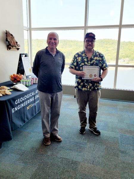
Jacob T. Murchek presented his doctoral research proposal defense on Friday, December 1, 2023. Advised by Dr. James DeGraff, with Dr. Benjamin Drenth, Dr. Jeremy Shannon, and Dr. Aleksey Smirnov serving as committee members. 

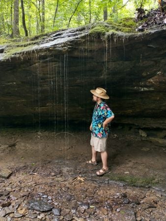
Murchek pictured collecting geophysical data across the Keweenaw Fault using the Lacoste Romberg Model G Gravity Meter and the Trimble differential GPS unit to create better constrained models of the subsurface geology crucial to refine the history of the Midcontinent Rift System and copper mineralization.

Title: Integration of Geophysical Data with Geologic Constraints to Infer Tectonomagmatic Controls on Mineral Systems in the Yukon-Tanana Uplands, Alaska, and Keweenaw Peninsula, Michigan

Abstract: Critical minerals are necessary for the everyday needs of modern human society and are paramount for the advancement of technology. Lithium, cobalt, nickel, and graphite are some examples of critical minerals used in cell phones, military equipment, vehicles, batteries, and other essential products. To increase domestic production of critical minerals, the U.S. Geological Survey (USGS) seeks to identify areas favorable to host deposits of such minerals through the Earth Mapping Resources Initiative. In collaboration with the USGS, the proposed research aims to identify tectonomagmatic controls of mineral systems in the Yukon-Tanana Uplands (YTU), Alaska, and along the Keweenaw Peninsula (KP), Michigan, using geophysical and geologic data to better understand the distribution and origin of such systems and to judge critical mineral potential in the two areas.

Both the YTU and KP have the potential to host critical mineral deposits, however, mineral systems in these areas are not completely understood. Critical minerals in the YTU are most likely to occur as secondary minerals associated with precious metal mineral systems. Aeromagnetic data will be interpreted, modeled, and integrated with regional geology, magnetic susceptibility measurements, and geochemical data to aid in delineating the boundary between the parautochthonous North American Basement (NAb) and allochthonous Yukon-Tanana Terrane (YTT) that underlie the YTU. Establishing a firm boundary for these terranes has major implications for understanding the origin and distribution of mineral systems across the YTU (e.g., porphyry Cu-Au, orogenic Au) and, consequently, the potential for such systems to host critical minerals. The research will emphasize developing geophysically mappable criteria for these and other mineral systems and the plutonic suites that may be associated with their deposition and enrichment. Along the KP copper district and its southwest extension, gravity and magnetic data, and possibly seismic reflection data, will be acquired to model the structure of the Midcontinent Rift System (MRS), thereby testing published cross-sectional models for the rift and the Keweenaw fault system (KFS). Better definition of the KFS is relevant to understanding migration pathways of copper-bearing hydrothermal fluids that produced economic deposits of copper and silver in the region. Quantitative geophysical modeling in the region can be tightly constrained by bedrock outcrops and rock property measurements (e.g., density, magnetic susceptibility). A better constrained subsurface model across the southeast margin of the MRS will establish a stronger tie to offshore geophysical data previously collected across Lake Superior. Such models should also improve the definition of known faults in the KFS as well as identify new faults beneath Jacobsville Sandstone, thus helping to infer mineralization pathways for copper and other elements associated with the MRS.

Isabella Metts Geophysics MS Defense

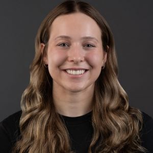
Isabella Metts achieved success in defending her geophysics MS research on November 11, 2023.

Metts pictured with her research poster at AGU.

Advised by Dr. Greg Waite, with Dr. Luke Bowman and Dr. Simon Carn serving as committee members.

Title: An Investigation of Microseismicity During the 2018 Kīlauea Caldera Collapse

Abstract: The 2018 Kīlauea volcano eruption and incremental caldera collapse was accompanied by more than 60,000 seismic events cataloged by the Hawaiian Volcano Observatory as well as 62 caldera collapse events. The majority of seismicity occurred on the eastern side of the caldera between daily collapses. However, the majority of caldera subsidence occurred to the west. To understand the collapse mechanics behind this variance in subsidence and seismicity across the caldera region, repetitive waveforms and source properties can be studied.

Repeating seismic events suggests a common source that is not moving or destroyed. At Kīlauea, clusters of repeating events can indicate source processes throughout collapse cycles. REDPy, a repeating earthquake detector tool for Python, cross-correlates seismic events to determine repetition. Events are separated into families or listed as orphans if no matches are found. We used data from HVO network stations surrounding Kīlauea’s summit. Possible events were identified using an STA/LTA trigger algorithm with a long-time average trigger of 8 seconds, a short-time average trigger of 1 second, and a trigger on/off range of 1-2.5. A minimum correlation coefficient of 0.7 was used to group over 167,000 recognized events from April 29th to August 2nd into nearly 6,000 families. Of these families, 697 were chosen as ‘clusters of interest’ for including >100 events or persisting for 7 days or more. P wave first motions were manually picked for waveforms associated with clusters of interest. These clusters were then located using P wave arrival times, and focal mechanisms were modeled for viable events to learn more about their source processes and relationship to collapse mechanics.

Dilatational first motions dominate our catalog and indicate crack-closing sources with possible relationships to conduit collapse after magma withdrawal and crack closure due to fault motion. Focal mechanism models produced mismatched station polarities indicative of non-double-couple sources, further aiding the hypothesis that dominant events involve a negative volumetric component. Focal spheres show evidence of ring faulting that is likely responsible for these non-double-couple events through the motion of concave fault structures presenting as repetitive crack closure along caldera margins.

Brendan Harville Presents at the Michigan Space Grant Consortium Annual Conference in Kalamazoo, MI

From his first weeks in the GMES Department, Brendan Harville was interested in getting involved in research. Through a handful of well-timed events in Brendan’s first semester, he seized an opportunity to submit a research proposal with Dr. Greg Waite to the Michigan Space Grant Consortium (MSGC) undergraduate fellowship to conduct research regarding “Seismic Amplitude-based Lahar Tracking for Hazard Risk Mitigation at Fuego Volcano in Guatemala.” Brendan’s proposal was selected, leading him to plan fieldwork in Guatemala with fellow PhD student Gustavo Béjar-López. Brendan and Dr. Waite used seismic data to create a model that
can locate and track how lahars propagate down drainages from Fuego’s flanks. The work took many twists and turns (as research often does!) and resulted in an improved understanding of how the morphology of Fuego and its many drainages influence lahars and their impacts. Brendan’s work was accepted by MSGC for an oral presentation at the MSGC Annual Conference on October 21, 2023. GMES student Conor Large accompanied Brendan for his presentation over MTU’s Fall Break.

Reflecting on the entire MSGC experience, Brendan says, “My experience with undergraduate research through MSGC was invaluable. I met, connected, and collaborated with many admirable and inspiring peers and mentors for which I am truly grateful for. Special experiences like these are what invigorate and propel students like me toward future goals and aspirations. I would never have enjoyed this opportunity if I hadn’t pushed through my initial fears and feelings of self-doubt.”

GMES celebrates Brendan’s accomplishment and is proud to have submitted four new MSGC proposals this week for the Consortium’s annual call.

Check out Brendan’s day-to-day field campaign journey in Guatemala through his personally made slideshow: Field Campaign Slideshow (bit.ly/Harville_Guatemala_FieldCampaign)

Pictured L to R: Brendan Harville, Conor Large

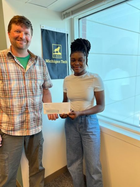
Dakota Locklear Receives the Outstanding Graduate Teaching Assistant Award

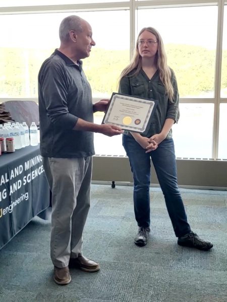
Dakota Locklear received recognition as an Outstanding Graduate Teaching Assistant for exceptional work during the spring 2022 semester in GE2000 Understanding the Earth. Dr. Snehamoy Chatterjee advises Dakota as he pursues a Ph.D. in geology.

Locklear’s dedication and hard work, which did not go unnoticed, led to his nomination by the GMES Department. To be eligible for recognition as an Outstanding GTA, the candidate must have had sole responsibility for instruction in a lecture or laboratory course or section at any level within the past academic year. His praise as an Outstanding Graduate Teaching Assistant is a testament to his passion for geology and commitment to helping students learn.

Congratulations, Dakota, on this well-deserved recognition!

Ian Gannon Receives the Dean’s Award for Outstanding Scholarship

Ian Gannon (GMES) recently received the Dean’s Award for Outstanding Scholarship. The Dean’s Award for Outstanding Scholarship is given to students who excel academically and have demonstrated originality in their research, leadership skills, and professionalism.


Advised by Dr. James DeGraff, Ian successfully defended his MS thesis titled “Integrating LiDAR, Aeromagnetic, and Geological Field Data to Identify Structural-Lithologic Elements Within the Archean Carney Lake Gneiss Complex” on August 3, 2023.


Ian contributed significantly to the U.S. Geological Survey under the Earth Mapping Resources Initiative (Earth MRI) project. He helped the survey to understand the complex geological makeup of a section of the Minnesota River Valley subprovidence.


Gannon’s achievement is an inspiration for all the students who are passionate about research and innovation. Congratulations, Ian!

Ian Gannon

Luke Bowman and Erika Vye Represent Michigan Tech at the GSA Annual Meeting

Assistant Teaching Professor Luke Bowman (GMES, PhD ‘15) and Research Scientist Erika Vye (GLRC/GMES, PhD ‘16) represented Michigan Tech at the Geological Society of America’s annual meeting in Pittsburgh, PA, October 14-18, 2023. They participated in a session titled “Field-Based Geoscience Education: Advances in Research, Program Evaluation, Pedagogy, and Curriculum”.

Bowman shared an oral presentation titled “Community Involvement in Building and Testing A Flash-Flood Model for Simulating Flood Frequency” (with co-authors Natalea Cohen (GMES, MS ‘23), John Gierke, Vanessa Bailey, Hannah Lukasik, Shannon McAvoy, Mario Hugo Mendez, Susan Toivonen, and David Yates).

This research, which involves several MTU researchers and students, is part of a multi-year project that addresses climate change-induced, water-related challenges in the Central American Dry Corridor, focusing on agricultural community adaptations to extreme hydrometeorological events in El Salvador. This project is a collaboration of Michigan Technological University (MTU), CUAHSI, and Lutheran World Relief (LWR) in El Salvador, funded as a National Science Foundation International Research Experience for Students (IRES).

Geological Society of America Abstracts with Programs. Vol. 55, No. 6, 2023
doi: 10.1130/abs/2023AM-394917

Bowman also participated in a workshop on Positive Mental Health in the Geosciences sponsored by GSA and the Science Education Resource Center (SERC). The workshop shed light on the challenges experienced by many geoscientists, explored the common signs that indicate when geoscientists are struggling with their mental health, and showcased best practices to create a safe and supportive working environment.

Vye shared an oral presentation titled “The Keweenaw Geoheritage Summer Internship: Exploring Our Shared Relationships with Land and Water” (with co-author Amanda Gonczi).

Geological Society of America Abstracts with Programs. Vol. 55, No. 6, 2023
doi: 10.1130/abs/2023AM-395861

Vye also supported and co-authored two first-time student presentations in a session titled “The Stories of Geoheritage”: “Connecting Geology, Mining, & Fish Sovereignty in the Keweenaw” by Naomi Smith (Keweenaw Bay Ojibwa Community College),” and “Bridging Knowledges – Using Geospatial Technology to Support Place-Based Geoheritage Learning” by Steph Fones (University of Wisconsin-Milwaukee) with co-authors Daniel Lizzadro-McPherson and Naomi Smith. Fones and Smith participated in an 8-week Keweenaw Geoheritage internship at Michigan Tech in the summer of 2023. This work was supported by NSF Award # 2136139 – EAGER: Geoheritage and Two-Eyed Seeing – Advances in Interdisciplinary Earth Science Research, Learning, and Inclusion through Shared Ways of Knowing (PI Vye).

Geological Society of America Abstracts with Programs. Vol. 55, No. 6, 2023
doi: 10.1130/abs/2023AM-395218

Geological Society of America Abstracts with Programs. Vol. 55, No. 6, 2023
doi: 10.1130/abs/2023AM-395408

The Department of GMES also co-sponsored the Michigan Colleges/Universities Joint Alumni Reception at the GSA conference (together with Grand Valley State University, Western Michigan University, Hope College, Wayne State University, Eastern Michigan University, Albion College, and Central Michigan University). It was good to see and chat with our alumni, colleagues, and friends. This gathering was a testament to the enduring camaraderie within our geoscience community.


Pictured from R to L: Frederic Wilson (BS ’71), John Yellich, Luke Bowman (Ph.D. ’15), Erika Vye (Ph.D. ’16), Steph Fones, Naomi Smith, and J. Schneider


EPSSI Seminar: Role of Subsurface Engineering and Geology in the Energy Transition World

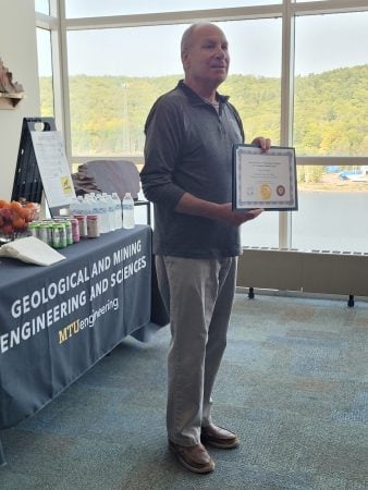
Mary Herrmann-Foley, MBA, returns to campus as the EPSSI Seminar guest speaker on Monday, October 23, 2023, from 4 – 5 p.m. in M&M room U113. Mary completed her Bachelor’s Degree in Geological Engineering at Michigan Tech in 1983. She continued her education at the University of Houston, earning her master’s in business administration in international finance in 1985. Currently, she serves as Manager of Central Support PetroSigns SSW application at Shell. Last fall, Mary was inducted into the Academy of Geological and Mining Engineering and Sciences. We are excited to welcome her back to campus once again!

In her talk, Role of Subsurface Engineering and Geology in the Energy Transition World, she will discuss the essential role of subsurface engineering and geology in the changing world of energy transition.

From the abstract: The world is in the midst of the first “truly global energy crisis,” the International Energy Agency (IEA) said in its World Energy Outlook in October 2022. It’s multidimensional and comes with the challenge of global warming and the need to reduce/eliminate CO2 emissions. We are all experiencing the impact of rising CO2 in the atmosphere: ocean levels rising, more intense storms, and increasing temperatures with corresponding implications on us and the environment around us. Conflicting pressures linked to continued high-energy demand, the need for energy security, and the imperative for reducing CO2 emissions are driving unprecedented renewable energy growth. This presentation will touch on the challenges related to these conflicting pressures and how existing and start-up energy companies are addressing some of these challenges through numerous renewable energy and carbon sequestration options, mainly focusing on the crucial role subsurface engineering and geology can play in this journey. Highlights of Michigan’s current situation and related business opportunities will also be discussed.

All are welcome to attend.

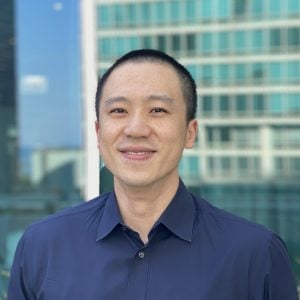
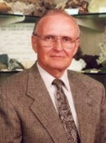
Mary Herrmann-Foley

GMES Students Wow Houghton Elementary

We are delighted to recount the recent visit of two Geological and Mining Engineering and Sciences (GMES) students to Houghton Elementary School, where the Rock Your School event sparked geologic wonder. Jhuleyssey Sanchez Aguila, an MS student in geological engineering, and applied geophysics undergrad student Brendan Harville took center stage as they masterfully conducted a captivating presentation on volcanic hazards, capturing the imaginations of the bright minds in the third, fourth, and fifth grades.

It was an immensely gratifying experience for all involved as the students exhibited an insatiable curiosity, inspiring questions that underscored their genuine interest in the particularities of geological science. The eagerness displayed by the young learners further reinforced the value of fostering scientific curiosity at an early age. This collaborative effort between our university and the elementary school enriched the children’s educational experience. It exemplified the profound impact that dedicated mentorship and knowledge-sharing can have on the budding scientists of tomorrow. TV6 gives a nod to Michigan Tech in the concluding comments of their news segment.

A special thank you to Jhuleyssey and Brendan!

Houghton Elementary School Principal Cole Klein introduces Jhuleyssy and Brendan to a group of 3rd, 4th, & 5th graders.
PC: Jennifer D’Luge

Ian Gannon MS in Geological Engineering Final Defense

On August 3, 2023, Ian Gannon successfully defended his geological engineering research for his MS degree.

Advised by James DeGraff, with Chad Deering and Aleksey Smirnov as committee members.

Title: Integrating LiDAR, Aeromagnetic, and Geological Field Data to Identify Structural-Lithologic Elements Within the Archean Carney Lake Gneiss Complex
Abstract: The Archean Carney Lake Gneiss Complex (CLGC) is a suite of rocks on the southern margin of the Superior Province and within the Minnesota River Valley subprovince. It is one of many gneissic domes in Michigan, Wisconsin, and Minnesota whose complex geology is poorly understood due to a previous lack of economic interest in gneissic terranes and significant challenges to their investigation. As a consequence, the CLGC and other gneissic domes in the region are represented on geologic maps as undifferentiated masses surrounded by better-defined and understood Paleoproterozoic supracrustal rocks and igneous intrusions. Within the last ten years, however, the United States has identified an urgent need to find new sources of critical minerals to sustain and grow the nation’s technology and defense industries, which has renewed interest in these very old and complex rocks. Under the Earth Mapping Resources Initiative (Earth MRI) of the U.S. Geological Survey, the CLGC and surrounding Paleoproterozoic rocks have been remapped to update geologic interpretations and to assist in identifying potential mineral systems in the region. Mapping of the CLGC was accomplished using traditional techniques combined with satellite-based phone applications and differential GPS devices to navigate in dense vegetative cover, to obtain accurate coordinates of field sites, and to collect geologic data at outcrops. As a further aid to ground mapping, high-resolution LiDAR and aeromagnetic data were analyzed to determine topographic and magnetic patterns and textures that potentially reflect structural-lithologic domains within the CLGC.

Integration of the new geologic field data with features and patterns identified on LiDAR and aeromagnetic maps allows definition of three domains within the CLGC: (1) a poly-deformed, mostly felsic gneiss with folded and sheared banding; (2) a meta-igneous, plagioclase-dominated gneiss with poorly expressed banding; and (3) a meta-sedimentary gneiss with thin well-developed banding and local relict sedimentary textures. Outcrop mapping also reveals the widespread occurrence and great variety of younger felsic and mafic intrusions that were not fully appreciated by earlier mappers. Data integration has allowed better definition of geologic unit contacts around the margins of the CLGC and within some Paleoproterozoic metasedimentary units, which updates knowledge about the Sturgeon Quartzite to the northeast and the Vulcan Iron Formation to the south. Although some analytical work is ongoing, such as radiometric age dating, the integrated mapping effort has identified between five to eight tectonomagmatic events that have affected the region, plus a number of sedimentary cycles. The abundance of processes that have affected the area provides multiple opportunities for concentration of mineral deposits that could be attractive for future exploration efforts. The data integration approach developed for this thesis project should be useful in identifying structural-lithologic domains within enigmatic Precambrian gneiss domes elsewhere in the region and globally.

Jordan Ewing Computational Science and Engineering Ph.D. Defense

On Friday, July 21, Jordan Ewing successfully defended the research for his doctoral degree in computational science and engineering.

Advised by Thomas Oommen, with Laura Brown, Stanley Vitton, and Paramsothy Jayakumar as committee members.

Title: Remote Sensing Approach for Terramechanics Applications Utilizing Machine and Deep Learning

Abstract: Terrain traversability is critical for developing Go/No Go maps, significantly impacting a mission’s success. To predict the mobility of a vehicle over a terrain, one must understand the soil characteristics. In situ measurements performed by soldiers in the field are the current method of collecting this information, which is time-consuming, are only point measurements, and can put soldiers in harm’s way. Therefore, this study investigates using remote sensing as an alternative approach to characterize terrain properties.

This approach will explore the relationships between electromagnetic radiation and soil types with varying properties. Optical, thermal, and hyperspectral sensors will be used to collect remote data and compare it against ground truth measurements for validation. Machine learning (linear, ridge, lasso, partial least squares, support vector machines, and k nearest neighbors) and deep learning (multi-layer perceptron and convolutional neural network) algorithms will be used to build prediction models.

Results showed that soil properties such as soil gradation, moisture content, and soil strength measured by a geogauge and averaged cone penetrometer for 0–6” and 0–12” (CP06 and CP12) can be estimated remotely. Deep learning provides the best models for estimating terrain characteristics compared to machine learning. It is shown that this method can produce much finer spatial resolution coverage than traditional geospatial point-based interpolation approaches and yield a higher prediction accuracy. Predictions maps can be used to generate threshold-based Go / No Go maps using a vehicle cone index or as a cost map for vehicle performance. A Polaris MRZR vehicle was used to test the application of these prediction maps for mobility purposes, and correlations were observed between the CP06 and rear wheel slip and CP12 and vehicle speed.

This study demonstrates the potential of using remote sensing data for more rapid and finer spatial resolution predictions of terrain properties with higher accuracies compared to traditional in situ mapping methods implementing machine and deep learning algorithms. The remote sensing approach allows the generation of Go/No Go and vehicle cost maps and, most importantly, provides a safe alternative to keep soldiers out of harm’s way.