 Understanding how French-speaking people migrated throughout North America from the 1600s to 1940 means tracking them at work, school and home spatially and archivally.
Michigan Technological University is a partner in the $2.4 million “Trois siècles de migrations francophones en Amérique du Nord (1640-1940) (Three centuries of migrations by French-speakers to North America)” funded by the Social Science and Humanities Research Council of Canada.
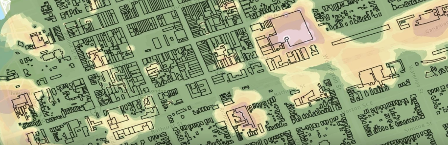
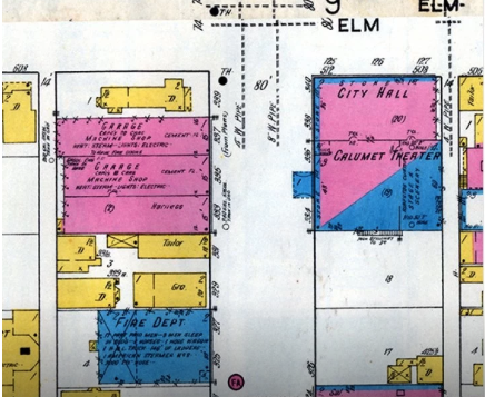
Sarah Scarlett, assistant professor of history, and Don Lafrenière, associate professor of geography, in the Social Sciences department, will use the Keweenaw Time Traveler and a combination of spatial and archival datasets to focus specifically on whether French-Canadians were socially mobile as they migrated from Canada to Michigan’s Upper Peninsula during the period of 1860 to 1940.
Read the full story on Unscripted.