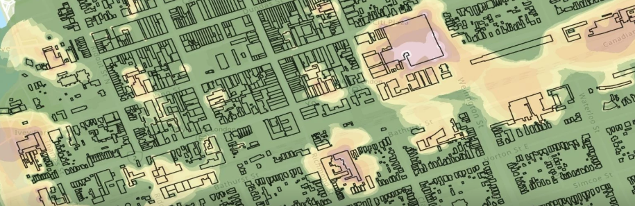
 Michigan Technological University researchers have developed a GIS-based model to identify the persistence of industrial hazards in postindustrial cities and their impacts on modern citizens. Dan Trepal, a postdoctoral researcher and Don Lafrenière, associate professor of geography and GIS, both in the Department of Social Sciences, use spatial-temporal models to demonstrate human risk of exposure to environmental hazards in postindustrial London, Ontario, but the model can be applied more widely.
“When you’re talking about human health or cumulative hazards, these places looked very different when these places are created. In the Keweenaw, the mines aren’t really gone They’re very much still here. It’s about giving presence to things that are not here anymore to the casual eye.” – Dan Trepal
Read the full story at mtu.edu/news.