Tag: research

Rumbling Recognition: Volcanology Professor Achieves Dual Honors

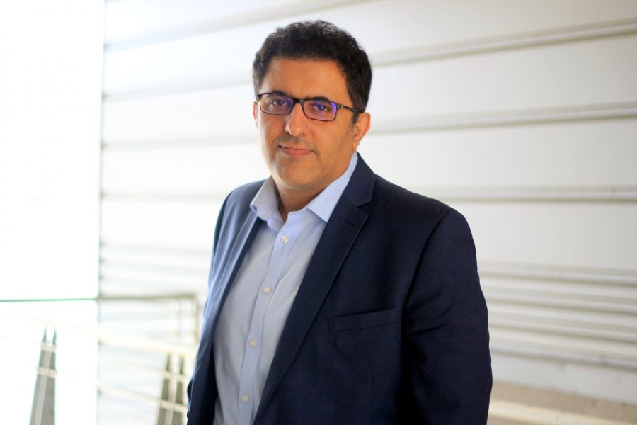
Dr. Simon Carn

In a stunning display of ‘when it rains, it pours,’ Dr. Simon Carn, a Professor at the Department of GMES, has bagged two prestigious awards within a month—a feat as rare as spotting a double rainbow. On April 5, Dr. Carn was honored with the Michigan Tech Research Award, recognizing his outstanding achievements in research. Just weeks later, on April 18, he was bestowed the title of Distinguished Professor, an accolade awarded to faculty members who have made substantial contributions to the University and their discipline.

Dr. Carn has made seminal contributions to both applied and fundamental aspects of volcanology, remote sensing, and meteorology. Recognized as a world authority on multi-sensor remote sensing of volcanic clouds, he uniquely blends advanced knowledge of remote sensing, volcanology, and atmospheric science. His research is noted for its innovation, collaborative spirit, and versatility, focusing on employing remote sensing data in studies of volcanic degassing, eruption clouds, and anthropogenic pollution. Dr. Carn excels in translating theoretical understanding into practical solutions, significantly impacting volcanic hazard prediction and mitigation and enhancing aviation safety. This blend of academic and practical prowess has earned him broad international recognition, including the American Meteorological Society Special Award and the NASA/US DOI William T. Pecora Award.

Dr. Carn has secured substantial external funding to support his research, with contributions from prestigious agencies such as NASA, NSF, and NOAA, underscoring the scientific community’s strong confidence in his work. His external expenditure ranks among the highest at MTU. His scholarly output is both prolific and collaborative, featuring 133 peer-reviewed publications and book chapters, many co-authored with his students. He is also among the most cited researchers at the university.

An inspiring mentor and instructor, Dr. Carn has guided four postdoctoral researchers, 22 PhD and 36 MS students. He led our successful dual International Master in Geology (INVOGE) program from 2009 to 2015 in collaboration with Université Blaise Pascal, the University of Buffalo, and the University of Milan Bicocca. His students have found employment in the public, government, and academia worldwide.

Dr. Carn has made significant contributions to his professional community, serving as an Associate Editor for the Journal of Geophysical Research and as Secretary of the Remote Sensing Commission of the International Association of Volcanology and Chemistry of the Earth’s Interior (IAVCEI) since 2008. Additionally, he has been a member of the National Academy of Sciences Committee on Improving Understanding of Volcanic Eruptions, the AAAS Review Committee for the U.S. Geological Survey Volcanic Hazards Program, and various scientific committees for international conferences and workshops.

Importantly, Dr. Carn has been very active and efficient in outreach and promotion of science. He is a frequent and long-term contributor to NASA’s Earth Observatory educational website and other outlets such as Scientific American and National Geographic. He conducted TV, radio, and newspaper interviews with BBC World Service, The Weather Channel, Wall Street Journal, Weather Underground, and others. Finally, he has actively promoted his research on X (formerly Twitter) with more than 7000 followers as of today.

Congratulations, Simon, on these well-deserved awards!

Elliz McClelland Interns for EarthScope and Presents at the American Geophysical Union Annual Meeting

This summer, Elliz McClelland interned in the URISE (Undergraduate Research Internships in Seismology) program, funded by EarthScope (formerly known as IRIS). This internship experience gave them professional research experience, guidance about graduate schools, and the opportunity to work with an institution they’d like to work at during their career. As part of their internship experience, they will also present at the annual national American Geophysical Union (AGU) meeting in December 2023, a completely new experience for them.

During Elliz’s internship, they conducted research into a volcanic caldera using geophysics in New Mexico. Elliz worked under the mentorship of the United States Geological Survey and spent part of their summer working in the USGS office in Denver, Colorado. This internship was a multi-faceted experience where they had the opportunity to do a lot of traveling. Elliz spent their first couple of weeks performing fieldwork in New Mexico in their study area, then moved into Denver to work at the USGS office. They were also lucky enough to work on a separate USGS project where they traveled to Hawaii to help their mentor conduct field research. Their summer was full of new experiences and cultures!

Elliz preparing to get on a helicopter for field work in Hawaii.

The URISE internship was highly targeted toward providing research experience and preparation for graduate school. While Elliz intends on taking a least one gap year before attending graduate school, the information the internship coordinators provided them about graduate school was instrumental in making their decisions about furthering their education. 

When reflecting on the value of the URISE internship, Elliz says, “For my needs, this internship was also immensely useful in determining my career path. I ‘put my boots on the ground’, so to speak, working directly with the USGS under a position I might like to hold myself in the future. My summer experience really confirmed for me that I love doing field work and I would enjoy working for an institution like the USGS.”

In December, Elliz presented their work at the AGU national conference in San Francisco, California. This conference is one of the biggest Earth Science conferences in the nation and is an excellent opportunity for students to meet potential employers, experience the professional research conference environment, and network with fellow geoscientists. For more details about Elliz’s internship experience and the research they conducted, you can visit their summer blog at URISE. Elliz would also like to highly recommend this internship to any geoscience students with an interest in research and geophysics. Anybody can apply and prior geophysics experience is not required! You can stay updated about internship applications at URISE.

Elliz and their USGS mentor Paul setting up a field station in New Mexico.

Murchek Successfully Defends Geophysics Ph.D. Research Proposal

Jacob T. Murchek presented his doctoral research proposal defense on Friday, December 1, 2023. Advised by Dr. James DeGraff, with Dr. Benjamin Drenth, Dr. Jeremy Shannon, and Dr. Aleksey Smirnov serving as committee members. 

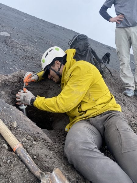
Murchek pictured collecting geophysical data across the Keweenaw Fault using the Lacoste Romberg Model G Gravity Meter and the Trimble differential GPS unit to create better constrained models of the subsurface geology crucial to refine the history of the Midcontinent Rift System and copper mineralization.

Title: Integration of Geophysical Data with Geologic Constraints to Infer Tectonomagmatic Controls on Mineral Systems in the Yukon-Tanana Uplands, Alaska, and Keweenaw Peninsula, Michigan

Abstract: Critical minerals are necessary for the everyday needs of modern human society and are paramount for the advancement of technology. Lithium, cobalt, nickel, and graphite are some examples of critical minerals used in cell phones, military equipment, vehicles, batteries, and other essential products. To increase domestic production of critical minerals, the U.S. Geological Survey (USGS) seeks to identify areas favorable to host deposits of such minerals through the Earth Mapping Resources Initiative. In collaboration with the USGS, the proposed research aims to identify tectonomagmatic controls of mineral systems in the Yukon-Tanana Uplands (YTU), Alaska, and along the Keweenaw Peninsula (KP), Michigan, using geophysical and geologic data to better understand the distribution and origin of such systems and to judge critical mineral potential in the two areas.

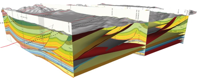
Both the YTU and KP have the potential to host critical mineral deposits, however, mineral systems in these areas are not completely understood. Critical minerals in the YTU are most likely to occur as secondary minerals associated with precious metal mineral systems. Aeromagnetic data will be interpreted, modeled, and integrated with regional geology, magnetic susceptibility measurements, and geochemical data to aid in delineating the boundary between the parautochthonous North American Basement (NAb) and allochthonous Yukon-Tanana Terrane (YTT) that underlie the YTU. Establishing a firm boundary for these terranes has major implications for understanding the origin and distribution of mineral systems across the YTU (e.g., porphyry Cu-Au, orogenic Au) and, consequently, the potential for such systems to host critical minerals. The research will emphasize developing geophysically mappable criteria for these and other mineral systems and the plutonic suites that may be associated with their deposition and enrichment. Along the KP copper district and its southwest extension, gravity and magnetic data, and possibly seismic reflection data, will be acquired to model the structure of the Midcontinent Rift System (MRS), thereby testing published cross-sectional models for the rift and the Keweenaw fault system (KFS). Better definition of the KFS is relevant to understanding migration pathways of copper-bearing hydrothermal fluids that produced economic deposits of copper and silver in the region. Quantitative geophysical modeling in the region can be tightly constrained by bedrock outcrops and rock property measurements (e.g., density, magnetic susceptibility). A better constrained subsurface model across the southeast margin of the MRS will establish a stronger tie to offshore geophysical data previously collected across Lake Superior. Such models should also improve the definition of known faults in the KFS as well as identify new faults beneath Jacobsville Sandstone, thus helping to infer mineralization pathways for copper and other elements associated with the MRS.

Summer 2023 Laboratory Updates at GMES: Transforming Learning and Collaboration

Two laboratories at the Department of GMES underwent significant renovations this past summer

1. Upgrading the Mine Design and System Simulation Laboratory 

Thanks to the generous support of our Mining Engineering alumni, we replaced all the computers in our Mine Design and System Simulation Laboratory (Dow 709) with new cutting-edge, powerful computers with advanced mine design, planning, and simulation software packages. At the same time, the laboratory capacity was increased to 15 seats. The MDSS Laboratory supports teaching, senior design, and research activities. The lab is fully equipped with the Sharp AQUOS BOARD Interactive Display System, and advanced audio-video equipment. This lab also includes a smart interactive center room for video conferences and online communications. The MDSS Lab is created to enhance and facilitate the potential of teaching and conducting modern mining projects at Michigan Tech. This upgrade will further enhance collaboration and foster innovation among our students and researchers.

 The Mine Design and System Simulation Lab (Photo by R. Askari)

2. Introducing the Earth Explorers Computer Laboratory: A Multifunctional Hub

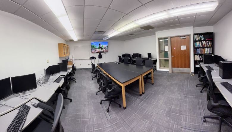
We converted the old seismic petrophysics laboratory into the dynamic Earth Explorers Computer Laboratory (EECL). It is a multifunctional space tailored for GMES students tailored for GMES students pursuing their research, coursework, and senior projects. Designed to foster creativity and collaboration, the laboratory is equipped with several high-performance workstations featuring AppsAnywhere technology and proprietary software. Students have access to many specialized applications, data processing tools, modeling software applications, and image processing. The computers in EECL also provide access to Michigan Tech’s high-performance computing cluster. This dynamic space now features a spacious TV screen,  a lectern, and video-conferencing equipment and serves as a geophysics reference library. Additionally, the lab serves as a multi-purpose space, doubling as a classroom for various GMES courses as well as a meeting space for research groups. The room’s ambiance was revitalized with brand-new carpeting and fresh paint, giving it an inviting vibe.

 Earth Explorers Computer Lab (Dow 619) (Photo by R. Askari)

These upgrades enhance the learning and collaboration experience within our department. They ensure more students can access our resources, and provide modern, adaptable spaces for educational and collaborative needs for everyone.

Our heartfelt thanks go to our alumni whose generous donations made these improvements possible. As we embrace the future of learning and research, we are excited about the possibilities these upgrades will bring.

Isabella Metts Geophysics MS Defense

Isabella Metts achieved success in defending her geophysics MS research on November 11, 2023.

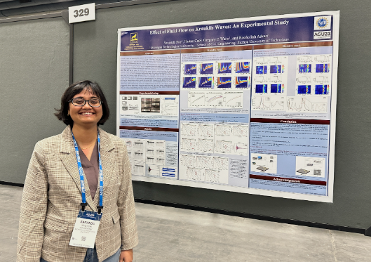
Metts pictured with her research poster at AGU.

Advised by Dr. Greg Waite, with Dr. Luke Bowman and Dr. Simon Carn serving as committee members.

Title: An Investigation of Microseismicity During the 2018 Kīlauea Caldera Collapse

Abstract: The 2018 Kīlauea volcano eruption and incremental caldera collapse was accompanied by more than 60,000 seismic events cataloged by the Hawaiian Volcano Observatory as well as 62 caldera collapse events. The majority of seismicity occurred on the eastern side of the caldera between daily collapses. However, the majority of caldera subsidence occurred to the west. To understand the collapse mechanics behind this variance in subsidence and seismicity across the caldera region, repetitive waveforms and source properties can be studied.

Repeating seismic events suggests a common source that is not moving or destroyed. At Kīlauea, clusters of repeating events can indicate source processes throughout collapse cycles. REDPy, a repeating earthquake detector tool for Python, cross-correlates seismic events to determine repetition. Events are separated into families or listed as orphans if no matches are found. We used data from HVO network stations surrounding Kīlauea’s summit. Possible events were identified using an STA/LTA trigger algorithm with a long-time average trigger of 8 seconds, a short-time average trigger of 1 second, and a trigger on/off range of 1-2.5. A minimum correlation coefficient of 0.7 was used to group over 167,000 recognized events from April 29th to August 2nd into nearly 6,000 families. Of these families, 697 were chosen as ‘clusters of interest’ for including >100 events or persisting for 7 days or more. P wave first motions were manually picked for waveforms associated with clusters of interest. These clusters were then located using P wave arrival times, and focal mechanisms were modeled for viable events to learn more about their source processes and relationship to collapse mechanics.

Dilatational first motions dominate our catalog and indicate crack-closing sources with possible relationships to conduit collapse after magma withdrawal and crack closure due to fault motion. Focal mechanism models produced mismatched station polarities indicative of non-double-couple sources, further aiding the hypothesis that dominant events involve a negative volumetric component. Focal spheres show evidence of ring faulting that is likely responsible for these non-double-couple events through the motion of concave fault structures presenting as repetitive crack closure along caldera margins.

Brendan Harville Presents at the Michigan Space Grant Consortium Annual Conference in Kalamazoo, MI

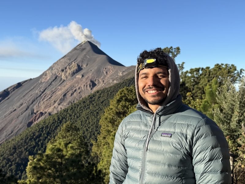
From his first weeks in the GMES Department, Brendan Harville was interested in getting involved in research. Through a handful of well-timed events in Brendan’s first semester, he seized an opportunity to submit a research proposal with Dr. Greg Waite to the Michigan Space Grant Consortium (MSGC) undergraduate fellowship to conduct research regarding “Seismic Amplitude-based Lahar Tracking for Hazard Risk Mitigation at Fuego Volcano in Guatemala.” Brendan’s proposal was selected, leading him to plan fieldwork in Guatemala with fellow PhD student Gustavo Béjar-López. Brendan and Dr. Waite used seismic data to create a model that
can locate and track how lahars propagate down drainages from Fuego’s flanks. The work took many twists and turns (as research often does!) and resulted in an improved understanding of how the morphology of Fuego and its many drainages influence lahars and their impacts. Brendan’s work was accepted by MSGC for an oral presentation at the MSGC Annual Conference on October 21, 2023. GMES student Conor Large accompanied Brendan for his presentation over MTU’s Fall Break.

Reflecting on the entire MSGC experience, Brendan says, “My experience with undergraduate research through MSGC was invaluable. I met, connected, and collaborated with many admirable and inspiring peers and mentors for which I am truly grateful for. Special experiences like these are what invigorate and propel students like me toward future goals and aspirations. I would never have enjoyed this opportunity if I hadn’t pushed through my initial fears and feelings of self-doubt.”

GMES celebrates Brendan’s accomplishment and is proud to have submitted four new MSGC proposals this week for the Consortium’s annual call.

Check out Brendan’s day-to-day field campaign journey in Guatemala through his personally made slideshow: Field Campaign Slideshow (bit.ly/Harville_Guatemala_FieldCampaign)

Pictured L to R: Brendan Harville, Conor Large

Ian Gannon Receives the Dean’s Award for Outstanding Scholarship

Ian Gannon (GMES) recently received the Dean’s Award for Outstanding Scholarship. The Dean’s Award for Outstanding Scholarship is given to students who excel academically and have demonstrated originality in their research, leadership skills, and professionalism.


Advised by Dr. James DeGraff, Ian successfully defended his MS thesis titled “Integrating LiDAR, Aeromagnetic, and Geological Field Data to Identify Structural-Lithologic Elements Within the Archean Carney Lake Gneiss Complex” on August 3, 2023.


Ian contributed significantly to the U.S. Geological Survey under the Earth Mapping Resources Initiative (Earth MRI) project. He helped the survey to understand the complex geological makeup of a section of the Minnesota River Valley subprovidence.


Gannon’s achievement is an inspiration for all the students who are passionate about research and innovation. Congratulations, Ian!

Ian Gannon

Luke Bowman and Erika Vye Represent Michigan Tech at the GSA Annual Meeting

Assistant Teaching Professor Luke Bowman (GMES, PhD ‘15) and Research Scientist Erika Vye (GLRC/GMES, PhD ‘16) represented Michigan Tech at the Geological Society of America’s annual meeting in Pittsburgh, PA, October 14-18, 2023. They participated in a session titled “Field-Based Geoscience Education: Advances in Research, Program Evaluation, Pedagogy, and Curriculum”.

Bowman shared an oral presentation titled “Community Involvement in Building and Testing A Flash-Flood Model for Simulating Flood Frequency” (with co-authors Natalea Cohen (GMES, MS ‘23), John Gierke, Vanessa Bailey, Hannah Lukasik, Shannon McAvoy, Mario Hugo Mendez, Susan Toivonen, and David Yates).

This research, which involves several MTU researchers and students, is part of a multi-year project that addresses climate change-induced, water-related challenges in the Central American Dry Corridor, focusing on agricultural community adaptations to extreme hydrometeorological events in El Salvador. This project is a collaboration of Michigan Technological University (MTU), CUAHSI, and Lutheran World Relief (LWR) in El Salvador, funded as a National Science Foundation International Research Experience for Students (IRES).

Geological Society of America Abstracts with Programs. Vol. 55, No. 6, 2023
doi: 10.1130/abs/2023AM-394917

Bowman also participated in a workshop on Positive Mental Health in the Geosciences sponsored by GSA and the Science Education Resource Center (SERC). The workshop shed light on the challenges experienced by many geoscientists, explored the common signs that indicate when geoscientists are struggling with their mental health, and showcased best practices to create a safe and supportive working environment.

Vye shared an oral presentation titled “The Keweenaw Geoheritage Summer Internship: Exploring Our Shared Relationships with Land and Water” (with co-author Amanda Gonczi).

Geological Society of America Abstracts with Programs. Vol. 55, No. 6, 2023
doi: 10.1130/abs/2023AM-395861

Vye also supported and co-authored two first-time student presentations in a session titled “The Stories of Geoheritage”: “Connecting Geology, Mining, & Fish Sovereignty in the Keweenaw” by Naomi Smith (Keweenaw Bay Ojibwa Community College),” and “Bridging Knowledges – Using Geospatial Technology to Support Place-Based Geoheritage Learning” by Steph Fones (University of Wisconsin-Milwaukee) with co-authors Daniel Lizzadro-McPherson and Naomi Smith. Fones and Smith participated in an 8-week Keweenaw Geoheritage internship at Michigan Tech in the summer of 2023. This work was supported by NSF Award # 2136139 – EAGER: Geoheritage and Two-Eyed Seeing – Advances in Interdisciplinary Earth Science Research, Learning, and Inclusion through Shared Ways of Knowing (PI Vye).

Geological Society of America Abstracts with Programs. Vol. 55, No. 6, 2023
doi: 10.1130/abs/2023AM-395218

Geological Society of America Abstracts with Programs. Vol. 55, No. 6, 2023
doi: 10.1130/abs/2023AM-395408

The Department of GMES also co-sponsored the Michigan Colleges/Universities Joint Alumni Reception at the GSA conference (together with Grand Valley State University, Western Michigan University, Hope College, Wayne State University, Eastern Michigan University, Albion College, and Central Michigan University). It was good to see and chat with our alumni, colleagues, and friends. This gathering was a testament to the enduring camaraderie within our geoscience community.


Pictured from R to L: Frederic Wilson (BS ’71), John Yellich, Luke Bowman (Ph.D. ’15), Erika Vye (Ph.D. ’16), Steph Fones, Naomi Smith, and J. Schneider


Ian Gannon MS in Geological Engineering Final Defense

On August 3, 2023, Ian Gannon successfully defended his geological engineering research for his MS degree.

Advised by James DeGraff, with Chad Deering and Aleksey Smirnov as committee members.

Title: Integrating LiDAR, Aeromagnetic, and Geological Field Data to Identify Structural-Lithologic Elements Within the Archean Carney Lake Gneiss Complex
Abstract: The Archean Carney Lake Gneiss Complex (CLGC) is a suite of rocks on the southern margin of the Superior Province and within the Minnesota River Valley subprovince. It is one of many gneissic domes in Michigan, Wisconsin, and Minnesota whose complex geology is poorly understood due to a previous lack of economic interest in gneissic terranes and significant challenges to their investigation. As a consequence, the CLGC and other gneissic domes in the region are represented on geologic maps as undifferentiated masses surrounded by better-defined and understood Paleoproterozoic supracrustal rocks and igneous intrusions. Within the last ten years, however, the United States has identified an urgent need to find new sources of critical minerals to sustain and grow the nation’s technology and defense industries, which has renewed interest in these very old and complex rocks. Under the Earth Mapping Resources Initiative (Earth MRI) of the U.S. Geological Survey, the CLGC and surrounding Paleoproterozoic rocks have been remapped to update geologic interpretations and to assist in identifying potential mineral systems in the region. Mapping of the CLGC was accomplished using traditional techniques combined with satellite-based phone applications and differential GPS devices to navigate in dense vegetative cover, to obtain accurate coordinates of field sites, and to collect geologic data at outcrops. As a further aid to ground mapping, high-resolution LiDAR and aeromagnetic data were analyzed to determine topographic and magnetic patterns and textures that potentially reflect structural-lithologic domains within the CLGC.

Integration of the new geologic field data with features and patterns identified on LiDAR and aeromagnetic maps allows definition of three domains within the CLGC: (1) a poly-deformed, mostly felsic gneiss with folded and sheared banding; (2) a meta-igneous, plagioclase-dominated gneiss with poorly expressed banding; and (3) a meta-sedimentary gneiss with thin well-developed banding and local relict sedimentary textures. Outcrop mapping also reveals the widespread occurrence and great variety of younger felsic and mafic intrusions that were not fully appreciated by earlier mappers. Data integration has allowed better definition of geologic unit contacts around the margins of the CLGC and within some Paleoproterozoic metasedimentary units, which updates knowledge about the Sturgeon Quartzite to the northeast and the Vulcan Iron Formation to the south. Although some analytical work is ongoing, such as radiometric age dating, the integrated mapping effort has identified between five to eight tectonomagmatic events that have affected the region, plus a number of sedimentary cycles. The abundance of processes that have affected the area provides multiple opportunities for concentration of mineral deposits that could be attractive for future exploration efforts. The data integration approach developed for this thesis project should be useful in identifying structural-lithologic domains within enigmatic Precambrian gneiss domes elsewhere in the region and globally.

Paola Rivera-González MS in Geology Final Defense

On April 5, 2023, Paola Rivera-González successfully defended her Geology Master of Science degree.

Title: Climate Changes in El Salvador: Impacts of ‘La Canícula’ (“Dog Days of Summer”) on Agricultural Practices and Decision-Making in Rural Communities

Abstract: The Central American Dry Corridor (CADC), a tropical dry forest region, is characterized by distinct rainy and dry seasons that influence the local agricultural calendar and decision-making in rural communities. ‘La canícula’ is a period of decreased precipitation during the rainy season, which typically occurs in July during the corn growing season in El Salvador. The ‘canícula’ is expected to change in intensity and duration in the next decades, which would impact small-scale farmers and their livelihoods. Climate variability and uncertainty has led to crop loss, water scarcity, and food insecurity in rural communities dependent on subsistence farming. Farmers’ experiences with a changing climate led to reformed decision-making and agricultural processes (eg. agricultural calendar, seed type usage, crop rotation) to optimize their harvest and adapt to a variable climate. Studying the local perceptions and adaptation practices of farmers showed how natural hazards related to global climate change impact society, community dynamics in how farmers identify their main challenges, and revealed the ways farmers improve resilience to a changing climate.

Advised by Luke Bowman with committee members Kari Henquinet, John Gierke

Paola Laguna Algeria