Category: Faculty

NASA Awards Funding to Simon Carn

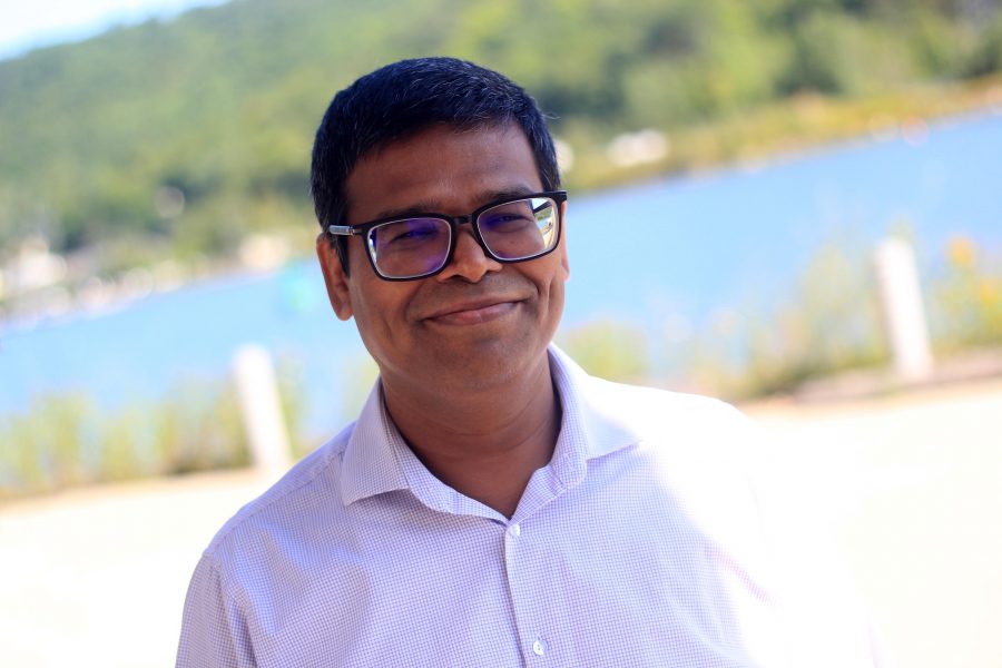
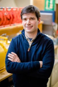
Simon Carn is the principal investigator on a project that has received a $325,000 research and development grant from the National Aeronautics and Space Administration.

The project is entitled, “Tracking Volcanic Gases from Magma Reservoir to the Atmosphere: Identifying Precursors, and Optimizing Models and Satellite Observations for Future Major Eruptions.”

This is a potential three-year project.

NASA Project Funding For Simon Carn

Simon Carn
Simon Carn

Simon Carn (GMES/EPSSI) is the principal investigator on a project that has received a $27,883 research and development grant from the University of Maryland-The National Aeronautics and Space Administration (NASA).

The project is titled “Extending NASA’s EOS SO2 and NO2 Data Records from Auro/OMI to Suomi NPP/OMPS.”

This is the first year of a potential three-year project totaling $96,614.

By Sponsored Programs

Dean’s Teaching Showcase: Chad Deering and Bob Barron

by Michael Meyer, Director, William G. Jackson Center for Teaching and LearningPrint

This week’s Dean’s Teaching Showcase selection, made by Dean Wayne Pennington of the College of Engineering, is a unique teaching partnership. Assistant Professor Chad Deering and Lab Manager Bob Barron were selected for “deftly leading our students for the past three summers” through the field course in the Department of Geological and Mining Engineering and Sciences.

GMES Chair John Gierke explains the unique demands and challenges of teaching the field geology course. “While most of us hold a fondness to participate in fieldwork, the glamour wears off when conditions get tough or if the work turns out tedious. Field geology starts a few days after Spring Semester. In addition to the rapidly changing and variable weather, UP fieldwork in May and June is accompanied by hordes of mosquitoes and black flies. The glamour evaporates by the second day. Moreover, field geology is fraught with uncertainty and figuring out the geological setting is tedious. Frustrations with the weather, bugs, and unknown are pervasive. It takes special people to lead students through the five week, all-day, every-day course.”
In addition, Michigan Tech’s field course has non-traditional timing which creates unique learning opportunities, but might make the teaching even more demanding. Pennington explains, “In most institutions, the ‘field course’ in geology is the final course, often following all other coursework. At Michigan Tech, it is usually taken after the second year. This enables students to have a better understanding of the basis for nearly all their subsequent courses … but only if the field course is taught in a way that encourages self-discovery and insight. For many years, Bob and Chad have taken the field course to new levels of integration with the concepts students are exposed to in their courses, helping the students to better master the concepts as well as the practices involved in the various disciplines that are based on these experiences. This approach to field experience is one of the things that makes Michigan Tech unique, and our students more successful upon graduation.”
Deering and Barron’s co-nomination for the Dean’s Showcase is based not on one particular innovation but their collective skills for success in developing students’ field skills in geology. Their complementary styles and knowledge have been an ideal pairing for leading the course, and student evaluations of instruction confirm their effectiveness. They approach each new site with a sequence that includes background literature, field observations, measurements and sampling, then further study in the microscopy lab.
They find ways to reinforce the mineralogy, petrology and structural geology skills developed in prerequisite courses, and insist on frequent individual and small-group interactions in the field to help the students persist, guiding them to an appropriate explanation for each site.
Intermingled through the learning experience are barbecues, brief periods of shooting the breeze in picturesque locales and other recreational activities. The fieldwork activities culminate with students creating geological maps and reports describing their findings. At this point in their studies, students span a spectrum of abilities for scientific writing and creating maps, which require artistic skills along with technical competence.
Gierke articulates the unique teaching challenges of the field course, saying “Achieving a balance of being critical of quality and yet maintaining morale is a knack that I have never mastered—I, unfortunately, excel at the being-critical part. Yet Bob and Chad have somehow figured out how to take students who are exhausted, sunburned and fly bitten and keep them sufficiently motivated to produce maps that could be framed (for some) and develop writing skills that help them through the rest of their curriculum.”
Deering and Barron will be recognized at an end-of-term luncheon with other showcase members, and the team is now eligible for one of three new teaching awards to be given by the William G. Jackson Center for Teaching and Learning this summer recognizing introductory or large-class teaching, innovative or outside-the-classroom teaching methods, or work in curriculum and assessment.

Black and White and Red All Over

sandstoneThe Keweenaw Peninsula shoreline tells a billion-year-old story forged in fire, sculpted by ice. Geoheritage tours teach visitors and residents how to read the variegated cliffs, long-tailed tombolos and shifting sands. To see where volcanoes, glaciers and humans irrevocably altered topography. Bill Rose, a Michigan Tech professor emeritus of geology who developed and leads the tours, calls it “geopoetry.” View full story here.

Aleksey Smirnov Elected a Fellow of the Geological Society of America

Aleksey Smirnov
Aleksey Smirnov

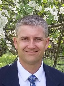
Aleksey Smirnov (GMES), has been elected a Fellow of the Geological Society of America (GSA), as elected by the GSA Council.

Established in 1888, the GSA is a global professional society with more than 26,000 members in 110 countries, all working to advance geoscience research and discovery. The society unites thousands of earth scientists, like Smirnov, to study the perplexity of our planet and share scientific findings.

Society Fellowship, the highest level of membership, is an honor bestowed on the best in the profession by election by the GSA council. GSA members are nominated by existing GSA Fellows in recognition of their distinguished contributions to the geosciences through such avenues as publications, applied research, teaching, administration of geological programs, contributing to the public awareness of geology, leadership of professional organizations, and taking on editorial, bibliographic, and library responsibilities.

In his nomination letter, John A. Tarduno, University of Rochester, wrote “Aleksey is recognized for his advances in fundamental rock magnetism and related innovative applications of paleomagnetism to solve geologic problems, especially concerning the nature of the early geodynamo and core.”

On being elected a Fellow, Smirnov says “I am truly honored to be joining others as a newly elected GSA Fellow”.

Smirnov has authored or coauthored 49 peer-reviewed journals and about 80 conference publications. He has been an associate editor for Journal of Geophysical Research since 2005.

ERUPT: Report Identifies Grand Challenges for Scientific Community to Better Prepare for Volcanic Eruptions

Despite broad understanding of volcanoes, our ability to predict the timing, duration, type, size, and consequences of volcanic eruptions is limited, says a new report by the National Academies of Sciences, Engineering, and Medicine. Meanwhile, millions of people live in volcanically active areas around the world.


ERUPT - NAP report
ERUPT: A National Academies report published in April 2017

Volcanic Eruptions and Their Repose, Unrest, Precursors, and Timing (ERUPT) identifies grand challenges for the scientific community to better prepare for volcanic eruptions. Michigan Tech volcanologist Simon Carn (GMES) was an author on the report, and served with 11 other volcanologists and scientists on the Committee on Improving Understanding of Volcanic Eruptions that prepared the report. Their goal: improving eruption forecasting and warnings to save lives.

According to the NAP media release on the report, “Volcano monitoring is critical for forecasting eruptions and mitigating risks of their hazards. However, few volcanoes are adequately observed, and many are not monitored at all. For example, fewer than half of the 169 potentially active volcanoes in the US have any seismometers–an instrument to detect small earthquakes that signal underground magma movement. And only three have continuous gas measurements, which are crucial because the composition and quantity of dissolved gases in magma drive eruptions. Enhanced monitoring combined with advances in experimental and mathematical models of volcanic processes can improve the understanding and forecasting of eruptions.”

“This report was requested by NASA, NSF and USGS, the three main sources of funding for volcano science in the US, to identify some of the grand challenges in the field,” says Carn. “It was a privilege to serve on this distinguished committee and help craft a document that we hope will guide and strengthen future research efforts in volcanology.”

“The National Academies convenes committees of experts to review the current understanding of pressing issues and identify priorities for future progress in addressing the issues,” adds Michigan Tech  Department Chair John Gierke (GMES). “Committee reports play important roles in formulating government policies and setting priorities for funding scientific research. Dr. Carn is a global leader in remote sensing for monitoring volcanic emissions and surely contributed a comprehensive assessment of the state of knowledge and recommend how different disciplinary fields could bring new perspectives and approaches to advance the understanding of volcanic hazards.”

Electronic (free) and hard copies ($40) of Volcanic Eruptions and Their Repose, Unrest, Precursors, and Timing are available online. More information is available in the NAP media release about the report.

The 2016– 2017 Eruption of Bogoslof Volcano, Aleutian Islands, United States

Bogoslof, a remote, mostly submarine volcano in the Aleutian Island arc began erupting in late December 2016 and activity continues as of February 2017. The Bogoslof eruption highlights several of the challenges facing volcano science. Over one month, the volcano produced numerous explosions with plumes rising 20,000–35,000 ft, posing a significant hazard to North Pacific aviation. There are no ground-based instruments (e.g., seismometers) on the volcano, and so the USGS Alaska Volcano Observatory (AVO) has been relying on distant seismometers, satellite data, infrasound, and lightning detection to monitor activity (Challenge 3). Bogoslof’s submerged vent obscures any preemptive thermal or gas signals, and infrasound and lightning are detectable only after eruptions have begun (Challenge 1). AVO has been unable to provide early warning of these hazardous events. The eruption also highlights our limited understanding of magma–water interactions and raises important questions regarding the controls on phreatomagmatic explosivity, column altitude, ash removal, and pauses (Challenge 2). In more than 20 discrete events, the emerging volcano has reshaped its coastlines repeatedly, providing snapshots of volcano–landscape interactions. The figure below shows the first evidence for an ash-rich (brown-grey) plume, almost one month into the eruptive activity.

Excerpted from Volcanic Eruptions and Their Repose, Unrest, Precursors, and Timing, National Academies of Sciences, Engineering, and Medicine, April 2017


Bogoslof Volcano
Image from the Moderate Resolution Imaging Spectroradiometer (MODIS) aboard NASA’s Terra satellite showing an eruption plume from Bogoslof volcano on January 18, 2017. The red dot at the base of the eruption cloud is a thermal anomaly on the volcanic edifice. Inset shows a high-resolution image of the volcano from January 11, 2017, with subsequent morphological changes indicated (image courtesy of USGS/AVO).