Category: News

My story: John Myaard, MTUengineer

John sits at a table with brochures and MTU Geo Mining banners
Geological Engineering student John Myaard ’23
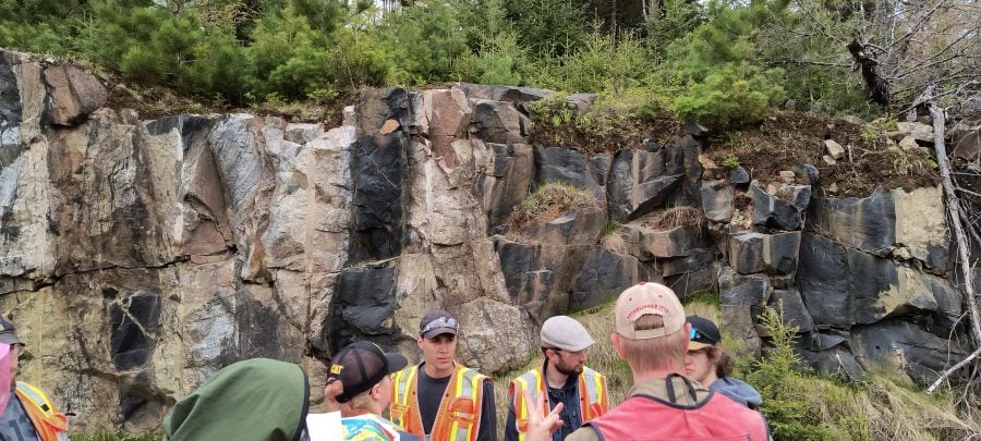
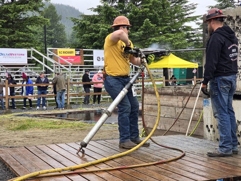
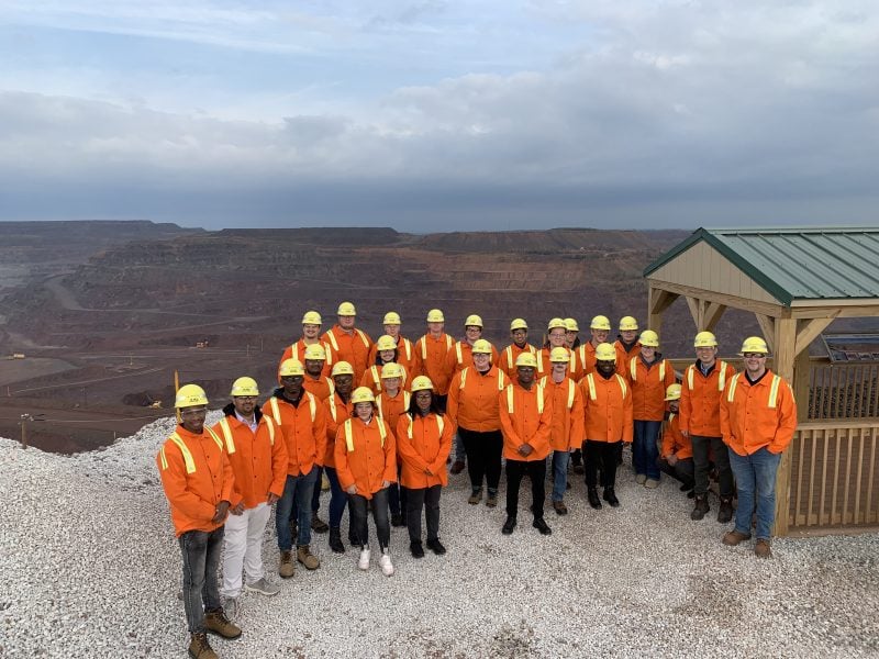
John and others wear hardhats and yellow shirts on a mining platfrom in an open air mine, surrounded by rock formations.
John Myaard (far right) in Roff, Oklahoma, during his summer internship with Covia.

Geological engineering student John Myaard interviewed for an internship with Covia Corporation during a Michigan Tech Career Fair, and landed the job.

“Covia develops mineral-based and material solutions for the materials and energy markets. I spent a summer with Covia’s operations team at their mine and plant in Roff, Oklahoma. During my time there I learned a lot about operations as I worked in a variety of positions—from slurrying sand to loading railcars and everything in between. I also completed new miners training: MSHA Part 46 Certification, required by the U.S. Department of Labor.

“My time at Tech has been influential. I’ve met many good peers with whom I’ve weathered both the classroom and the elements.”

John Myaard

“Michigan Tech was always on my radar. I am from Michigan and grew up in Hudsonville, home to Hudsonville ice cream. I had family in the UP, so I’d already had a chance to see the MTU campus. Originally I was going to major in computer science, but after being exposed to some geology courses in high school and then experiencing a favorable tour of the GMES Department, I decided geological engineering would be a better fit.”

“I’m passionate about the interdisciplinary problem solving required in the field of mining. I see a lot of value in geological engineers getting involved with operations and mineral processing. We bring a diverse set of skills to the table.”

“There are more opportunities within the geological disciplines than most people are aware of. Especially now, as I am looking to graduate, many diverse career options exist, and the future of the discipline looks good.”

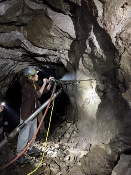
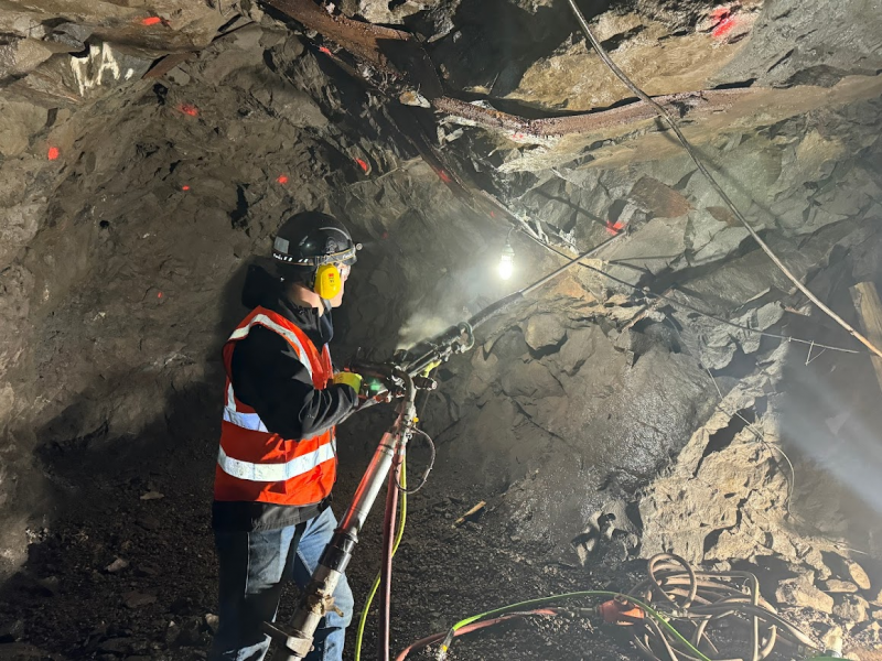
John is drilling in an underground mine.
John operates a drill in an underground mine. Hands-on learning is the norm for GMES students at Michigan Tech.

“The Career Fair is not only a great resource for students to find new opportunities, it’s a great place to receive professional development, as well. I took part in several callback interviews that helped me develop and improve my interview skills. The callbacks were instrumental in landing my internship, and hopefully in launching my future career.”

“There is no singular path for success. It is a journey, try your best.”

Advice for incoming students, from John Myaard

AIPG 2023 Outstanding Student Chapter Award

Historical photo of the Natural Wall geological feature on a hillside.
Natural Wall by J.T. Reeder. MS042 Reeder Photograph Collection, Michigan Tech University Archives and Copper Country Historical Collections.

AIPG, the American Institute of Professional Geologists, recognized the student chapter at Michigan Tech as one of the outstanding student chapters in the nation this past year. The chapter is highly deserving of this distinction and honor and was selected as the Second Place 2023 AIPG Student Chapter of the Year.

The award consists of a certificate to be presented to the student chapter, and a certificate to each of the standing chapter officers at the time of the student chapter report submittal.

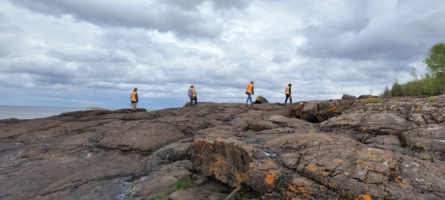
Some of the recent activities of the chapter involve field trips to mining foundations as well as to the Natural Wall, a geological structure formed of Jacobsville Sandstone.

The students are encouraged to attend the annual AIPG conference and meetings, which will be held next in Covington, Kentucky on September 16–19, 2023. During the conference, students will have the opportunity to observe the organization and functions of AIPG, participate in the Student Career Workshop, and attend a networking event with professional AIPG members.

The Chapter Sponsor is David Adler, CPG-11377, a Mannik & Smith Group Certified Professional Geologist (BS Geology ‘82). David Adler, inducted into the GMES Academy in October, has been awarded the AIPG Presidential Certificate of Merit for excellent contributions to the AIPG Michigan Section as chairman of the Michigan Section CPG application process.

The Chapter’s Faculty Sponsor is Chad Deering, associate professor in the Department of Geological and Mining Engineering and Sciences.

Related

Michigan Tech wins 2022 AIPG Student Chapter of the Year Award

The 2020 AIPG Student Chapter of the Year Award goes to Michigan Tech

Beth Bartel: Women’s Perspectives on Evacuation at Fuego Volcano

Fuego contour representation in a map of Guatemala.
Fuego in Guatemala. NASA Earth Observatory.

Beth Bartel ’23 (Ph.D. Geology) is a co-author of a paper published in Frontiers in Earth Science.

The article is titled “Children first: women’s perspectives on evacuation at Fuego volcano and implications for disaster risk reduction.”

Ailsa Naismith of Bristol University is also a co-author.

The article was included as a part of a special research topic on “Women in Science: Volcanology” and is the first publication from Bartel’s dissertation work. The research was supported by committee members from both the Department of Geological and Mining Engineering and Sciences (GMES) and the Department of Social Sciences (SS).

https://doi.org/10.3389/feart.2023.1172867

Ian Gannon MS in Geological Engineering Final Defense

On August 3, 2023, Ian Gannon successfully defended his geological engineering research for his MS degree.

Advised by James DeGraff, with Chad Deering and Aleksey Smirnov as committee members.

Title: Integrating LiDAR, Aeromagnetic, and Geological Field Data to Identify Structural-Lithologic Elements Within the Archean Carney Lake Gneiss Complex
Abstract: The Archean Carney Lake Gneiss Complex (CLGC) is a suite of rocks on the southern margin of the Superior Province and within the Minnesota River Valley subprovince. It is one of many gneissic domes in Michigan, Wisconsin, and Minnesota whose complex geology is poorly understood due to a previous lack of economic interest in gneissic terranes and significant challenges to their investigation. As a consequence, the CLGC and other gneissic domes in the region are represented on geologic maps as undifferentiated masses surrounded by better-defined and understood Paleoproterozoic supracrustal rocks and igneous intrusions. Within the last ten years, however, the United States has identified an urgent need to find new sources of critical minerals to sustain and grow the nation’s technology and defense industries, which has renewed interest in these very old and complex rocks. Under the Earth Mapping Resources Initiative (Earth MRI) of the U.S. Geological Survey, the CLGC and surrounding Paleoproterozoic rocks have been remapped to update geologic interpretations and to assist in identifying potential mineral systems in the region. Mapping of the CLGC was accomplished using traditional techniques combined with satellite-based phone applications and differential GPS devices to navigate in dense vegetative cover, to obtain accurate coordinates of field sites, and to collect geologic data at outcrops. As a further aid to ground mapping, high-resolution LiDAR and aeromagnetic data were analyzed to determine topographic and magnetic patterns and textures that potentially reflect structural-lithologic domains within the CLGC.

Integration of the new geologic field data with features and patterns identified on LiDAR and aeromagnetic maps allows definition of three domains within the CLGC: (1) a poly-deformed, mostly felsic gneiss with folded and sheared banding; (2) a meta-igneous, plagioclase-dominated gneiss with poorly expressed banding; and (3) a meta-sedimentary gneiss with thin well-developed banding and local relict sedimentary textures. Outcrop mapping also reveals the widespread occurrence and great variety of younger felsic and mafic intrusions that were not fully appreciated by earlier mappers. Data integration has allowed better definition of geologic unit contacts around the margins of the CLGC and within some Paleoproterozoic metasedimentary units, which updates knowledge about the Sturgeon Quartzite to the northeast and the Vulcan Iron Formation to the south. Although some analytical work is ongoing, such as radiometric age dating, the integrated mapping effort has identified between five to eight tectonomagmatic events that have affected the region, plus a number of sedimentary cycles. The abundance of processes that have affected the area provides multiple opportunities for concentration of mineral deposits that could be attractive for future exploration efforts. The data integration approach developed for this thesis project should be useful in identifying structural-lithologic domains within enigmatic Precambrian gneiss domes elsewhere in the region and globally.

Simon Carn on Sulfur Dioxide Emissions from Fagradalsfjall

False color image of part of Iceland showing a bright, orange flow on top of older lava flows.
The false-color image of fresh lava flowing south in Iceland was acquired on July 17, 2023, by the Operational Land Imager-2 (OLI-2) on Landsat 9.

On July 10, 2023, lava began to spill from the Fagradalsfjall volcanic system in southwestern Iceland, marking the third consecutive summer of activity at the volcano.

Simon Carn (GMES) was quoted by NASA’s Earth Observatory and eGreenews in stories about the continuing eruption of Fagradalsfjall.

“Based on satellite and ground-based data, emissions of sulfur dioxide from Fagradalsfjall are in the range of several thousands of tons per day—similar to the 2021 and 2022 eruption,” said Carn, a volcanologist at Michigan Tech and member of a NASA team that monitors sulfur dioxide emissions.

Read more at NASA Earth Observatory, by Adam Voiland.

Jordan Ewing Computational Science and Engineering Ph.D. Defense

On Friday, July 21, Jordan Ewing successfully defended the research for his doctoral degree in computational science and engineering.

Advised by Thomas Oommen, with Laura Brown, Stanley Vitton, and Paramsothy Jayakumar as committee members.

Title: Remote Sensing Approach for Terramechanics Applications Utilizing Machine and Deep Learning

Abstract: Terrain traversability is critical for developing Go/No Go maps, significantly impacting a mission’s success. To predict the mobility of a vehicle over a terrain, one must understand the soil characteristics. In situ measurements performed by soldiers in the field are the current method of collecting this information, which is time-consuming, are only point measurements, and can put soldiers in harm’s way. Therefore, this study investigates using remote sensing as an alternative approach to characterize terrain properties.

This approach will explore the relationships between electromagnetic radiation and soil types with varying properties. Optical, thermal, and hyperspectral sensors will be used to collect remote data and compare it against ground truth measurements for validation. Machine learning (linear, ridge, lasso, partial least squares, support vector machines, and k nearest neighbors) and deep learning (multi-layer perceptron and convolutional neural network) algorithms will be used to build prediction models.

Results showed that soil properties such as soil gradation, moisture content, and soil strength measured by a geogauge and averaged cone penetrometer for 0–6” and 0–12” (CP06 and CP12) can be estimated remotely. Deep learning provides the best models for estimating terrain characteristics compared to machine learning. It is shown that this method can produce much finer spatial resolution coverage than traditional geospatial point-based interpolation approaches and yield a higher prediction accuracy. Predictions maps can be used to generate threshold-based Go / No Go maps using a vehicle cone index or as a cost map for vehicle performance. A Polaris MRZR vehicle was used to test the application of these prediction maps for mobility purposes, and correlations were observed between the CP06 and rear wheel slip and CP12 and vehicle speed.

This study demonstrates the potential of using remote sensing data for more rapid and finer spatial resolution predictions of terrain properties with higher accuracies compared to traditional in situ mapping methods implementing machine and deep learning algorithms. The remote sensing approach allows the generation of Go/No Go and vehicle cost maps and, most importantly, provides a safe alternative to keep soldiers out of harm’s way.


Beth Bartel Geology Ph.D. Defense

On Friday, July 7, 2023, Beth Bartel achieved resounding success as she skillfully defended her research for her doctoral degree in geology.


Co-Advised by Greg Waite and Rüdiger Escobar Wolf, with Angie Carter, Kari Henquinet, and Luke Bowman as committee members.

Title: Information Use and Decision-Making for Evacuation at Fuego Volcano, Guatemala Information Use and Decision-Making for Evacuation at Fuego Volcano, Guatemala

Abstract: Active volcanoes are complex, multi-hazard systems. Early warning systems (EWS) may enable populations to live sustainably with volcanic hazards, but developing an effective EWS is far from straightforward, as is measuring its efficacy. At Fuego volcano, Guatemala, pyroclastic density currents (PDCs)—fast-moving flows and surges of hot volcanic gas, ash, and rock–killed more than 400 people during a paroxysmal eruption in June 2018 and continue to threaten the ~60,000 people living within the identified hazard zones. In this dissertation, I use mixed ethnographic methods to investigate evacuations at Fuego during and since the tragedia through three projects. I first investigate information availability and its use in decision-making on 3 June 2018. Next, I examine current practices for evacuation decision-making four and five years after the disaster, focusing on a partial evacuation on 7–8 March 2022. Finally, I use that same event to study how cultural gender expectations impact evacuation strategies and how women’s experiences in evacuation can inform future risk reduction strategies. With this dissertation, I aim to contribute a better understanding of the complex factors challenging the efficacy of EWS in order to improve existing approaches in and beyond Guatemala. In this way, this work aims to serve the population around Fuego volcano and others like it in various cultural, geographic, and economic settings.

Caleb Kaminski MS in Geophysics Final Defense

On April 21, 2023, Caleb Kaminski demonstrated resounding success in defending his research for his Geophysics Master of Science degree.

Advised by Aleksey Smirnov, with Paul van Susante and Jeremy Shannon as committee members.

Title: Exploring Ground-Penetrating Radar Responses to Basaltic Terrain for Upcoming Lunar Expeditions

Abstract: In preparation for upcoming lunar expeditions, a comprehensive understanding of the Moon’s geophysical properties is imperative, particularly in the context of resource identification and extraction. This study focuses on the experimental characterization of electromagnetic (EM) behavior in the radio spectrum for ground-penetrating radar applications, utilizing basaltic Keweenawan stamp sand and highland lunar simulant soil test materials with varying particle grades. Under controlled laboratory conditions, we systematically analyzed and compared the differences in EM wave velocity and signal amplitude as a function of particle size and mineralogy, as represented in radargrams. Our findings demonstrate that the highland lunar simulant exhibits a significantly higher EM reflection coefficient than the stamp sand, which can be attributed to its lower conductivity arising from compositional differences. These results hold important implications for the development of remote sensing techniques and optimization of ground-penetrating radar systems for future lunar missions, ultimately enabling the efficient detection and extraction of valuable resources such as water ice on the lunar surface.

Nolan Gamet MS in Geology Final Defense

On June 22, 2023, Nolan Gamet achieved success in defending his research for his Master of Science in Geology.

Title: Structural Analysis and Interpretation of the Deformation Along the Keweenaw Fault System from Lake Linden to Mohawk, Michigan

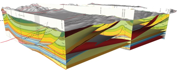
Abstract: The Keweenaw fault is likely the most significant fault associated with the Midcontinent Rift System, with an estimated reverse slip of ~10 km that places Portage Lake Volcanics (~1.1 Ga) over much younger Jacobsville Sandstone (~1.0 Ga). Published bedrock geology maps with cross sections from the 1950s show the fault as a single continuous trace that is locally associated with smaller cross faults and splays. This M.S. thesis presents a structural analysis and interpretation of the Keweenaw fault system between Lake Linden and Mohawk, MI, which includes data collected from well-known localities such as Houghton-Douglass Falls, the St. Louis ravine, the Natural Wall ravine, and the anomalous rhyolite body near Copper City. These data were used to revise existing bedrock geology maps, construct new cross-sections, and analyze fold geometry and fault slip behavior to infer aspects of the tectonic regime that caused the deformation.

New field mapping has refined the trace geometry of the Keweenaw fault (KF) and smaller associated faults by shifting the main fault’s position laterally as much as 150m, revising intersections between several splay faults and the main fault, and suggesting the existence of several footwall splays not previously recognized. Orientation analysis of Jacobsville Sandstone strata in the footwall of the fault system defines fold axes with plunge directions changing from southwest in the south to northeast in the north. The style of folding also changes along the fault from broad syncline-anticline pairs in the southwest to tightly folded anticlines with overturned bedding to the northeast. Fault-slip analyses reveal a bimodal distribution strike-slip and reverse slip along the fault system that collectively define a 1:1 ratio and a nearly north-south maximum tectonic shortening direction of 2°–182°. The NS-trending shortening direction computed from fault-slip analysis creates a paradox yet to be explained. However, fold axis trends in the current area indicate shortening along an ESE-trending line, which is consistent with recent results for the fault system northeast of this study area and with Grenville orogenic compression being the primary cause of slip along the Keweenaw fault system.

Advised by James DeGraff, with Chad Deering, William Rose, and Jeremy Shannon as committee members.

Paola Rivera-González MS in Geology Final Defense

On April 5, 2023, Paola Rivera-González successfully defended her Geology Master of Science degree.

Title: Climate Changes in El Salvador: Impacts of ‘La Canícula’ (“Dog Days of Summer”) on Agricultural Practices and Decision-Making in Rural Communities

Abstract: The Central American Dry Corridor (CADC), a tropical dry forest region, is characterized by distinct rainy and dry seasons that influence the local agricultural calendar and decision-making in rural communities. ‘La canícula’ is a period of decreased precipitation during the rainy season, which typically occurs in July during the corn growing season in El Salvador. The ‘canícula’ is expected to change in intensity and duration in the next decades, which would impact small-scale farmers and their livelihoods. Climate variability and uncertainty has led to crop loss, water scarcity, and food insecurity in rural communities dependent on subsistence farming. Farmers’ experiences with a changing climate led to reformed decision-making and agricultural processes (eg. agricultural calendar, seed type usage, crop rotation) to optimize their harvest and adapt to a variable climate. Studying the local perceptions and adaptation practices of farmers showed how natural hazards related to global climate change impact society, community dynamics in how farmers identify their main challenges, and revealed the ways farmers improve resilience to a changing climate.

Advised by Luke Bowman with committee members Kari Henquinet, John Gierke

Paola Laguna Algeria