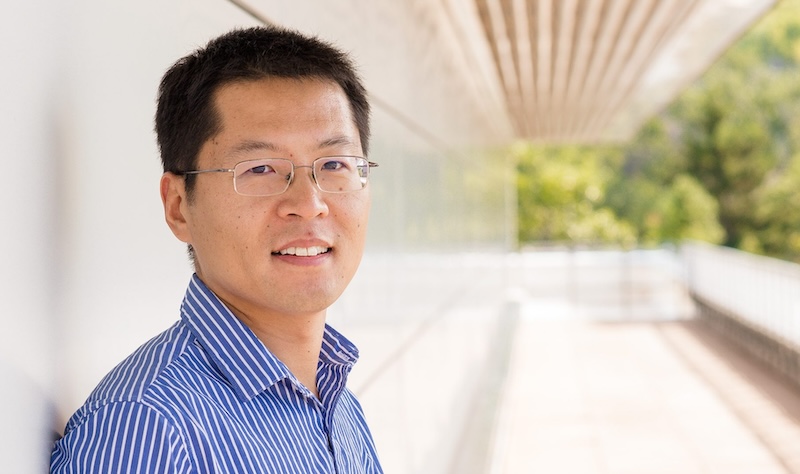
Category: Research

Natalea Cohen MS in Geology Final Defense

On Wednesday, June 14, 2023, Nat Cohen triumphed as she confidently defended her Geology Master of Science degree.

Nat Cohen on Mont Ripley

Title: Rain-induced hazards in remote, low-resource communities: A case study of flash flooding in the Usulután Department, El Salvador

Abstract: Natural hazards like flash floods can cause devastating impacts, so it is important to better understand these events to improve mitigation and emergency preparedness of vulnerable communities. California, El Salvador is a data-poor agricultural community experiencing climate change impacts and associated hazards, including flash flood events. This study uses ArcGIS Pro to map regional flash flood susceptibility and applies the Water Evaluation and Planning system (WEAP) to model sub-daily flash flood events in a California drainage well-known for flash flooding. Natural hazards like flash floods can cause devastating impacts, so it is important to better understand these events to improve mitigation and emergency preparedness of vulnerable communities. California, El Salvador is a data-poor agricultural community experiencing climate change impacts and associated hazards, including flash flood events. This study uses ArcGIS Pro to map regional flash flood susceptibility and applies the Water Evaluation and Planning system (WEAP) to model sub-daily flash flood events in a California drainage well-known for flash flooding.

Co-Advised by Luke Bowman and John Gierke, with Greg Waite as a committee member.

Bill Rose on the Dangers of Global Environmental Manipulation

Distant view of an ash cloud from a volcano.
A huge cloud of volcanic ash and gas rises above Mount Pinatubo, Philippines, on June 12, 1991. USGS fact sheet 113-97.

Professor Emeritus Bill Rose (GMES) was quoted by Medium in a story connecting Mount Pinatubo’s eruption in 1991 to recent geoengineering proposals seeking to replicate the cooling effect that large volcanic eruptions have on global temperatures. Rose has extensively studied the climactic effects of Mount Pinatubo and other volcanic eruptions. The cooling effect is likely due to liquid sulfate aerosol, which could potentially be introduced artificially.

According to Bill Rose, this would put scientists and politicians into a dangerous system of global environmental management where essentially another form of pollution is pumped into the atmosphere to offset the impact of the current pollution.

Read more at Medium, by Floyd Whaley.

GMES Researchers on Infrasound Detection of Approaching Lahars

The National Science Foundation mentioned Michigan Tech in a story about a study showing that infrasound remote sensing technology is an effective way to monitor catastrophic volcanic mudflows. Rudiger Escobar Wolf and Greg Waite (GMES) and Ph.D. student Gustavo Bejar Lopez (geology) are co-authors of the study, which was published in Nature Scientific Reports. NSF’s story was picked up by EIN Presswire.

The study is a collaborative effort by scientists at Boise State University, the Instituto Nacional de Sismología, Vulcanología, Meteorología e Hidrología in Guatemala, and Michigan Technological University, and is funded by the U.S. National Science Foundation.

Johnson, J.B., Roca, A., Pineda, A. et al. Infrasound detection of approaching lahars. Sci Rep 13, 6476 (2023). https://doi.org/10.1038/s41598-023-32109-2

Sets of waveforms over time with graphs of lag times and location precision. Descriptions are in the caption and full article.
Cross correlation analysis from station IO is used to detect sound originating from the Ceniza drainage. Read the full caption online. Scientific Reports articles are published OA under a CC BY license (Creative Commons Attribution 4.0 International license). Read the full article.

Dr. Radwin Askari Receives National Science Foundation CAREER Award

Radwin Askari’s work as a researcher and educator has been recognized with CAREER Awards from the National Science Foundation.

GMES Associate Professor Radwin Askari, a geophysicist who studies cavitation in volcanoes’ fluid-filled magmatic cracks, has earned a National Science Foundation (NSF) CAREER Award.

The awards recognize Askari, an associate professor of geological and mining engineering and sciences, as an early-career faculty who demonstrates the potential to serve as academic role model in research and education, and to lead advances in the mission of his department or organization. The five-year grant will support both research work and education outreach. 

Askari’s award will enhance both research capabilities and educational opportunities in the Physical Modeling Laboratory.

Understanding Volcanoes Through Integrated Physical Modeling  

Askari will receive more than $668,000 to continue research in the Physical Modeling Laboratory (PML), which he founded in the Department of Geological and Mining Engineering and Sciences (GMES). For his CAREER project, he’ll develop two analog apparatuses to investigate the cavitation mechanism in fluid-filled magmatic cracks and the developments of sub-cracks and seismic signals that result. Askari said it is crucial to understand both the cavitation mechanism and the dynamics of a volcano’s magmatic crack growth in order to estimate the scale of magma transport. 

“The results from this research can improve the forecast of volcanic eruptions, which in turn can help to mitigate their consequent hazards.”

Radwin Askari

As a result, Askari will be able to assess other complex scenarios in fracture evolution and their corresponding seismicity, a major step toward his ultimate research goals in the field. He also plans to purchase new lab equipment, including a high-speed imaging system, to substantially enhance the PML’s experimental capacities. Other disciplines across campus, including biomechanics, aerodynamics and fluid dynamics, will also be able to use these advanced tools for future multidisciplinary research collaborations. 

Askari plans to promote earth science literacy for students, educators and the public by producing several educational videos and a virtual PML lab tour. He will also offer summer research internships to students from traditionally underserved populations. 

Askari said he’s grateful to GMES Chair Aleksey Smirnov, along with Assistant Vice President for Research Development Peter Larsen and colleagues in Tech’s Sponsored Programs Office, for their support and guidance. He also thanked retired GMES staff member Carol Asiala, an assistant research scientist and engineer, for her assistance with the nontechnical parts of his award proposal.

Learn more about the Physical Modeling Laboratory.

GMES People Attend the Annual Meeting of ILSG in 2023

Eau Claire picture of the waterfront and city buildings.
Eau Claire, Wisconsin, by Itrytohelp32. This file is licensed under the Creative Commons Attribution-Share Alike 4.0 International license.

Michigan Tech was well represented at the 69th annual meeting for the Institute on Lake Superior Geology (ILSG), held in Eau Claire, Wisconsin, from April 23-26.

Research Professor Jim DeGraff and Professor Emeritus Bill Rose (GMES) presented a poster titled “Digital Image Capture and Database Compilation of Historical Mining Data from the Keweenaw Copper District, Michigan: A Progress Update.”

Graduate student Katherine Langfield (geology) delivered an oral presentation titled “Slip Kinematics of the Keweenaw and Hancock Faults within the Midcontinent Rift System, Upper Peninsula of Michigan.”

Graduate student Daniel Lizzadro-McPherson (geology) delivered an oral presentation titled “Structural Analysis and Slip Kinematics of the Keweenaw Fault System between Béte Grise Bay and Gratiot Lake, Keweenaw County, Michigan.”

Rose also delivered an oral presentation titled “New Work Developing Geoheritage Awareness.”

Geosciences Research Scientist Erika Vye (GLRC/GMES) delivered an oral presentation titled “Geoheritage as an Educational Tool to Explore Relationships with Land and Water in the Keweenaw.”

Professor Emeritus Ted Bornhorst (GMES) presented Peter Hollings, professor at Lakehead University in Thunder Bay, Ontario, with the prestigious ILSG Goldich Medal recognizing outstanding contributions to the understanding of Lake Superior geology. He also attended the ILSG Board of Directors meeting; the board approved the 70th annual meeting to be held in Houghton in 2024, which will be chaired by Bornhorst.

The ILSG is a nonprofit professional society that provides a forum for promoting better understanding of the geology of the Lake Superior region. The major activity of the institute is an annual meeting with geological field trips and technical presentations.

Gierke and Bowman on Building Rainwater Collection Systems

Group of locals and two researchers standing outside
Fundación Cartagena Nuevo Amanecer project partners celebrating the completion of another phase of their demonstrative community garden in Magangue, Colombia. Image courtesy of Damaris Guerra.
Man standing near a tank holding a sticker with  mining picks and a Husky illustration.
Foundation’s lead technician Jesus Fandiño with a GMES sticker to be placed on the main rainwater catchment/irrigation supply tank.

John Gierke and Luke Bowman supported Fundación Cartagena Nuevo Amanecer, with Dr. Gierke serving as Small-Scale Irrigation Systems Expert and Dr. Bowman serving as Water Capture (Hydrology) Specialist.

The two assisted the Fundación in the design of a small-scale water catchment and irrigation system for FCNA’s school garden beds as well as local backyard gardens.

In addition to designing and building functional systems during 10 days of work, Gierke and Bowman provided community partners with user-friendly, Spanish-language, spreadsheet tools to explore design considerations for sizing, purchasing components, and building new systems.

Read more at Partners of the Americas Economic Development & Health, by Farmer.to.Farmer.POA.

Simon Carn on the Shiveluch Volcanic Eruption

Satellite view of the peninsula with orange coloring.
Kamchatka Peninsula with Shiveluch in the upper, right quadrant. Image taken on April 11, 2023, by NASA Earth Observatory.

Simon Carn was quoted by the Washington Post in a story about the eruption of Russia’s Shiveluch volcano, located on the Kamchatka Peninsula in Russia’s far east. The story was picked up by MSN and the Benzie County Record Patriot.

The incident “looks like the largest Shiveluch eruption of the satellite era,” Michigan Technological University volcanologist Simon Carn said on Twitter.

Carn is a professor in the Department of Geological and Mining Engineering and Sciences with a PhD in Volcanology from Cambridge University. His current research focus is the application of remote sensing data to studies of volcanic degassing, volcanic eruption clouds, and anthropogenic pollution.

A Fresh Perspective: GMES Freshman Shines in Hydrological Research

Meet Natalie Sorensen, the exceptional first-year student at the Department of Geological and Mining Engineering and Sciences (GMES) who has defied the odds and conducted scientific research during her freshman year. Natalie’s project focused on helping farmers adjust their farming practices based on water availability, which is dictated naturally by climate and enhanced anthropogenically. She worked closely with Dr. John Gierke to test the Mark 2 soil moisture sensor against independent measurements of meteorological parameters and soil moisture in a local agricultural setting.

Student standing in the field with two apparatuses.
The HOBO station is on the left, and Arable Mark 2 is on the right.

Natalie’s project was a rare feat for a freshman, as most students don’t join research until their junior or senior years. However, Natalie’s passion and dedication to the field drove her to take on this challenge early in her college career. Natalie compared data from an Arable Mark 2 weather station to data from a HOBO RX3000 weather station, which is commonly used in climate-monitoring research. To independently test the soil moisture sensors on both weather stations, she also took soil core samples to measure soil moisture using gravimetric analysis. While the results of Natalie’ study are still being analyzed, the preliminary data seem promising and compatible with the natural variability of soil properties in glacial settings.

Student in the field taking core samples near an instrument.
Natalie takes core samples for gravimetric analyses.

Natalie’s work was supported by the URIP program and Dr. Gierke’s Institutional Research and Development (IRAD) for matching funds. In addition, in-kind support for the fieldwork was provided by the Gierke Blueberry Farm. Natalie presented a poster of her work at the Undergraduate Research Symposium on March 24, 2023, where she impressed her peers and professors with her research.

Natalie’s story is a testament to the power of hard work, passion, and dedication. She is a shining example of how early exposure to research opportunities can help students achieve their academic and professional goals. We look forward to hearing more about Natalie’s future research endeavors and wish her continued success in her studies within GMES.

Natalie Sorensen standing near her poster on the floor of the symposium.
Natalie at her poster at the Undergraduate Research Symposium.

Poster Extract

Field Testing of Climate and Soil Moisture Monitoring in an Agricultural Setting

Student Presenter: Natalie Sorensen, Geological Engineering
Faculty Advisor: John Gierke, Geological and Mining Engineering and Sciences

Farmers need to adjust their farming practices based on water availability, which is dictated naturally by climate and enhanced anthropogenically.

Data from a Mark 2 was compared to data from a HOBO RX3000 weather station (Onset, Bourne, MA), which is commonly used in climate-monitoring research, on the Gierke Blueberry Farm for the past decade.

I am still processing data to compare the Arable Mark 2 and HOBO measurements of air and soil temperatures and precipitation (along with solar intensity, atmospheric pressure, and relative humidity–the Mark 2 is not equipped to measure wind).

Read more in the URSS Booklet.

Thomas Oommen on the Slow-moving Portuguese Bend Landslide

Land near the shore showing cracks and buckling.
By Pricetveyron – Own work, CC BY-SA 4.0, https://commons.wikimedia.org/w/index.php?curid=47502552

Thomas Oommen (GMES) was quoted by SFGATE and the Seattle Times. Both outlets picked up a March 6, 2023, Los Angeles Times story about the slow-moving Portuguese Bend landslide affecting the city of Rancho Palos Verde in southern California.

Palos Verdes Peninsula has long been prone to landslides, and the most dramatic one is affecting Portuguese Bend, an area named after a Portuguese whaling operation. The geological phenomenon has hit a 240-acre area hard over the last seven decades, causing fissures to open in the earth and homes to strain, buckle and drift, sometimes outright wandering onto adjacent properties.

The land moves sometimes horizontally, sometimes vertically. Sometimes inches, sometimes feet.

Thomas Oommen, professor of geological sciences at Michigan Technological University, said it’s an interesting case study because there are only a few landslides with such significant movement every year. What distinguishes Portuguese Bend is that the slope has not failed catastrophically — yet — and the humans atop are largely staying put, riding the slow-moving land for as long as they can.

Oommen’s research efforts focus on developing improved susceptibility characterization and documentation of geo-hazards, such as earthquakes and landslides.

Read more at the Los Angeles Times, by Jack Flemming.

International Team Analyzes Ice Cores to Calculate Levels of Sulfate Aerosols

An international team which includes Simon Carn analyzed layers of an ice core from central Greenland to calculate levels of sulfate aerosols between the years 1200 and 1850. They discovered that non-erupting volcanoes leak sulfur at up to three times the rate previously believed.

https://doi.org/10.1029/2022GL102061

The discovery impacts efforts to model past, present, and future climate.

“We found that on longer timescales the amount of sulfate aerosols released during passive degassing is much higher than during eruptions,” said first author Ursula Jongebloed, a UW doctoral student in atmospheric sciences. “Passive degassing releases at least 10 times more sulfur into the atmosphere, on decadal timescales, than eruptions, and it could be as much as 30 times more.”

Read more at UW News, by Hannah Hickey.

Related